

Surf Forecasts:

Short Range ForecastLight rain (total 5mm), mostly falling on Mon night. Warm (max 28°C on Mon morning, min 27°C on Mon morning). Mainly fresh winds. | ||||||||||||||||||||||||
Monday 3 | Tuesday 4 | Wednesday 5 | ||||||||||||||||||||||
2 AM | 5 AM | 8 AM | 11 AM | 2 PM | 5 PM | 8 PM | 11 PM | 2 AM | 5 AM | 8 AM | 11 AM | 2 PM | 5 PM | 8 PM | 11 PM | 2 AM | 5 AM | 8 AM | 11 AM | 2 PM | 5 PM | 8 PM | 11 PM | |
Swell Height Map |  | 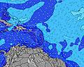 |  |  |  |  |  |  |  | |||||||||||||||
Wave Height (m) Direction Period (s) | E 5 | E 5 | E 6 | ESE 6 | E 6 | E 6 | E 6 | E 6 | E 5 | ENE 6 | ENE 6 | ENE 6 | ENE 4 | ENE 6 | ENE 6 | ENE 6 | E 6 | E 6 | E 6 | E 6 | E 6 | NE 6 | NE 6 | NE 7 |
Wave Graph | ||||||||||||||||||||||||
0 | 0 | 0 | 0 | 60 | 0 | 0 | 0 | 0 | 26 | 27 | 31 | 18 | 34 | 33 | 44 | 49 | 35 | 33 | 35 | 38 | 20 | 20 | 21 | |
Wind (km/h) | ||||||||||||||||||||||||
Wind State on-shore cross-onshore cross-shore cross-offshore off-shore glassy | cross-off | cross-off | cross-off | cross | cross | cross | cross | cross | cross | cross | cross | cross | cross | cross | cross | cross | cross | cross | cross-off | cross-off | cross-off | cross-off | cross | cross |
High Tide | 11:19PM0.42m | 12:03PM0.40m | 11:50PM0.39m | 12:58PM0.42m | 00:24AM0.36m | 1:57PM0.44m | ||||||||||||||||||
Low Tide | 5:41AM0.13m | 5:57PM0.19m | 6:13AM0.10m | 7:02PM0.21m | 6:50AM0.07m | 8:17PM0.22m | ||||||||||||||||||
— | 5:56 | — | — | — | — | — | — | — | 5:56 | — | — | — | — | — | — | — | 5:56 | — | — | — | — | — | — | |
— | — | — | — | — | 6:52 | — | — | — | — | — | — | — | 6:52 | — | — | — | — | — | — | — | 6:51 | — | — | |
mm | 1 | — | — | — | — | — | — | — | — | 1 | 1 | — | — | 1 | — | — | — | 1 | 1 | — | — | — | — | — |
Temp °C | 27 | 27 | 27 | 28 | 28 | 28 | 27 | 27 | 27 | 27 | 27 | 27 | 28 | 28 | 27 | 27 | 27 | 27 | 27 | 27 | 27 | 28 | 27 | 27 |
Feels °C | 27 | 26 | 26 | 28 | 28 | 29 | 27 | 27 | 28 | 28 | 29 | 28 | 30 | 29 | 28 | 27 | 28 | 28 | 28 | 28 | 28 | 29 | 27 | 27 |
Swell 1 Height (m) Direction Period (s) | — | — | — | — | — | — | — | — | ESE 7 | SE 5 | SE 5 | SE 5 | SE 5 | SE 5 | SE 5 | SSE 5 | N 9 | N 9 | N 9 | N 9 | N 9 | NE 6 | NE 6 | NE 7 |
— | — | — | — | — | — | — | — | 5 | 12 | 6 | 7 | 7 | 7 | 6 | 3 | 2 | 2 | 2 | 2 | 2 | 20 | 20 | 21 | |
Swell 2 Height (m) Direction Period (s) | — | — | — | — | — | — | — | — | — | ESE 7 | ESE 6 | — | ESE 7 | ESE 7 | ESE 7 | — | N 9 | ESE 7 | ESE 7 | — | N 12 | N 8 | E 11 | E 10 |
— | — | — | — | — | — | — | — | — | 4 | 3 | — | 4 | 9 | 9 | — | 2 | 5 | 5 | — | 3 | 1 | 2 | 2 | |
Swell 3 Height (m) Direction Period (s) | — | — | — | — | — | — | — | — | — | — | — | — | — | — | — | — | — | N 9 | E 12 | N 9 | E 11 | S 5 | N 11 | N 11 |
— | — | — | — | — | — | — | — | — | — | — | — | — | — | — | — | — | 2 | 3 | 2 | 2 | 1 | 2 | 2 | |
Wind waves Height (m) Direction Period (s) | E 5 | E 5 | E 6 | ESE 6 | E 6 | E 6 | E 6 | E 6 | E 5 | ENE 6 | ENE 6 | ENE 6 | ENE 4 | ENE 6 | ENE 6 | ENE 6 | E 6 | E 6 | E 6 | E 6 | E 6 | ESE 4 | ESE 4 | ESE 4 |
60 | 69 | 71 | 60 | 60 | 58 | 44 | 52 | 31 | 26 | 27 | 31 | 18 | 34 | 33 | 44 | 49 | 35 | 33 | 35 | 38 | 6 | 8 | 7 | |
Nearest Offshore or Glassy | ||||||||||||||||||||||||
Distance (km) | 211 | 146 | 151 | 39 | 39 | 201 | 201 | 39 | 149 | 39 | 151 | 541 | 316 | 201 | 908 | 316 | 6 | 39 | 39 | 39 | 39 | 39 | 39 | 154 |
Best forecast wave conditions in Tortola - BVI | ||||||||||||||||||||||||
Best forecast wave conditions in British Virgin Islands | ||||||||||||||||||||||||
Header Global | ||||||||||||||||||||||||
- Map Icons:
 Break
Break Live Wave Height (m)
 Live Wind Speed (km/h)
 Surf Rating (10 Max)
 Ocean Swells (m)
- Wind Speed (km/h)
Latest Updates


FREE! Surf-Forecast.com widget for your website
The surf report / weather widget below is available to embed on third party websites free of charge and provides a summary of our Trunk Bay - Shark Bay surf forecast. Simply grab the html code snippet that we provide and paste it into your own site. You can choose your preferred language and metric/imperial units for the surf forecast feed to suit users of your site. Click here to get the code.
 Nearest