

Surf Forecasts:

How big are the waves at Naa today (03 Aug):
- Morning surf: Morning surf (03 Aug, local time) - 2ft (0.6m), 12s period with NNW swell.
- Afternoon surf: Afternoon surf (03 Aug, local time) - 2.5ft (0.7m), 11s period with NE swell.
- Evening surf: Evening surf (03 Aug, local time) - 2.5ft (0.7m), 11s period with NE swell.
The current surf forecast for Naa at 5PM is: 0.7m 11s primary swell from a Northeast direction (forecast issued at 11:00am August 03). An open ocean swell of 0.8m 10s is not directed at the surf break. The wind direction is predicted to be cross-shore.
| Time (+12) & Date | Wave Height | Wave Period |
|---|---|---|
| Morning (03 Aug) | 2ft (0.6m) | 12s |
| Afternoon (03 Aug) | 2.5ft (0.7m) | 11s |
| Evening (03 Aug) | 2.5ft (0.7m) | 11s |
Table - waves today at Naa. (Swell directed towards the surf break)
Short Range ForecastLight rain (total 4mm), mostly falling on Wed night. Warm (max 28°C on Mon morning, min 28°C on Mon morning). Wind will be generally light. | |||||||||||||||||||||
Mon 3 | Tuesday 4 | Wednesday 5 | |||||||||||||||||||
9 AM | 12 PM | 3 PM | 6 PM | 9 PM | 12 AM | 3 AM | 6 AM | 9 AM | 12 PM | 3 PM | 6 PM | 9 PM | 12 AM | 3 AM | 6 AM | 9 AM | 12 PM | 3 PM | 6 PM | 9 PM | |
Swell Height Map | 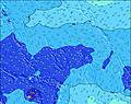 | 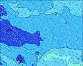 | 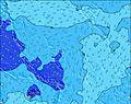 | 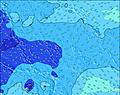 | 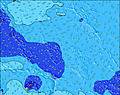 | 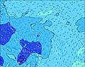 | 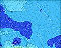 | 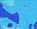 | |||||||||||||
Wave Height (m) Direction Period (s) | NNW 12 | NE 11 | NE 11 | NE 11 | NE 11 | NE 10 | NE 10 | ENE 10 | ENE 10 | ENE 10 | ENE 10 | ENE 10 | SE 8 | NW 12 | NW 12 | NW 12 | NW 12 | NW 12 | ENE 15 | ENE 15 | ENE 15 |
Wave Graph | |||||||||||||||||||||
98 | 119 | 119 | 117 | 115 | 82 | 79 | 64 | 63 | 61 | 61 | 37 | 41 | 69 | 69 | 73 | 73 | 68 | 126 | 128 | 123 | |
Wind (km/h) | |||||||||||||||||||||
Wind State on-shore cross-onshore cross-shore cross-offshore off-shore glassy | cross-on | cross | cross | cross | cross | cross-off | cross-off | cross-off | cross-off | cross-off | cross-off | cross-off | cross-off | cross-off | glassy | cross-off | off | off | cross-off | cross-off | cross-off |
High Tide | 6:51AM1.78m | 7:16PM1.66m | 7:25AM1.66m | 7:55PM1.60m | 8:06AM1.51m | 8:45PM1.52m | |||||||||||||||
Low Tide | 1:05PM0.20m | 1:16AM0.32m | 1:38PM0.28m | 2:00AM0.43m | 2:18PM0.39m | ||||||||||||||||
6:28 | — | — | — | — | — | — | 6:28 | — | — | — | — | — | — | — | 6:28 | — | — | — | — | — | |
— | — | — | 6:39 | — | — | — | — | — | — | — | 6:38 | — | — | — | — | — | — | — | 6:38 | — | |
mm | — | — | — | — | — | — | 1 | 1 | — | — | — | — | — | — | — | — | — | — | — | — | — |
Temp °C | 28 | 28 | 28 | 28 | 28 | 28 | 28 | 28 | 28 | 28 | 28 | 28 | 28 | 28 | 28 | 28 | 28 | 28 | 28 | 28 | 28 |
Feels °C | 31 | 31 | 30 | 30 | 30 | 31 | 32 | 32 | 32 | 30 | 30 | 30 | 31 | 31 | 33 | 32 | 31 | 30 | 30 | 31 | 31 |
Swell 1 Height (m) Direction Period (s) | WNW 8 | WNW 9 | WNW 10 | WNW 10 | WNW 10 | WNW 10 | WNW 10 | WNW 10 | WNW 10 | WNW 10 | WNW 10 | WNW 10 | WNW 10 | WNW 9 | WNW 9 | WNW 9 | WNW 9 | WNW 9 | WNW 9 | WNW 9 | WNW 9 |
62 | 84 | 120 | 120 | 120 | 117 | 120 | 109 | 109 | 105 | 125 | 125 | 125 | 78 | 75 | 73 | 73 | 71 | 73 | 73 | 75 | |
Swell 2 Height (m) Direction Period (s) | NNW 12 | NE 11 | NE 11 | NE 11 | NE 11 | NE 10 | NE 10 | ENE 10 | ENE 10 | ENE 10 | ENE 10 | SE 8 | NE 9 | SE 8 | SE 8 | SE 8 | NE 9 | NE 9 | ENE 15 | ENE 15 | ENE 15 |
98 | 119 | 119 | 117 | 115 | 82 | 79 | 64 | 63 | 61 | 61 | 32 | 41 | 33 | 33 | 24 | 38 | 38 | 126 | 128 | 123 | |
Swell 3 Height (m) Direction Period (s) | NE 8 | NNW 12 | NNW 12 | NW 12 | SE 8 | SE 8 | SE 8 | SE 8 | SE 8 | SE 8 | SE 8 | ENE 10 | SE 8 | NW 12 | NW 12 | NW 12 | NW 12 | NW 12 | NE 9 | NE 9 | SE 8 |
35 | 96 | 94 | 68 | 33 | 33 | 32 | 24 | 31 | 32 | 32 | 37 | 41 | 69 | 69 | 73 | 73 | 68 | 38 | 38 | 31 | |
Wind waves Height (m) Direction Period (s) | — | — | — | — | — | — | — | — | — | ESE 2 | SE 3 | SE 3 | — | — | — | — | — | — | — | — | — |
— | — | — | — | — | — | — | — | — | 1 | 1 | 2 | — | — | — | — | — | — | — | — | — | |
Nearest Offshore or Glassy | |||||||||||||||||||||
Distance (km) | 2320 | 2092 | 2092 | 2320 | 2320 | 0 | 0 | 0 | 0 | 2069 | 2409 | 0 | 0 | 0 | 0 | 0 | 0 | 0 | 0 | 0 | 0 |
Best forecast wave conditions in Gilbert Islands | |||||||||||||||||||||
Best forecast wave conditions in Kiribati | |||||||||||||||||||||
Header Global | |||||||||||||||||||||
- Map Icons:
 Break
Break Live Wave Height (m)
 Live Wind Speed (km/h)
 Surf Rating (10 Max)
 Ocean Swells (m)
- Wind Speed (km/h)
Latest Updates


FREE! Surf-Forecast.com widget for your website
The surf report / weather widget below is available to embed on third party websites free of charge and provides a summary of our Naa surf forecast. Simply grab the html code snippet that we provide and paste it into your own site. You can choose your preferred language and metric/imperial units for the surf forecast feed to suit users of your site. Click here to get the code.
 Nearest