

Surf Forecasts:

How big are the waves at Motels today (02 Aug):
- Afternoon surf: Afternoon surf (02 Aug, local time) - 3.5ft (1.1m), 14s period with SW swell.
- Evening surf: Evening surf (02 Aug, local time) - 3.5ft (1.1m), 16s period with SW swell.
The current surf forecast for Motels at 12AM is: 1.1m 16s primary swell from a Southwest direction and 0.8m 12s secondary swell from a Southeast direction (forecast issued at 06:00pm August 01). An open ocean swell of 0.8m 7s is not directed at the surf break. The wind direction is predicted to be cross-shore.
| Time (+13) & Date | Wave Height | Wave Period |
|---|---|---|
| Morning (02 Aug) | - | - |
| Afternoon (02 Aug) | 3.5ft (1.1m) | 14s |
| Evening (02 Aug) | 3.5ft (1.1m) | 16s |
Table - waves today at Motels. (Swell directed towards the surf break)
Short Range ForecastLight rain (total 2mm), mostly falling on Sun morning. Warm (max 23°C on Sun morning, min 19°C on Mon night). Wind will be generally light. | |||||||||||||||||||
Sat 1 | Sunday 2 | Monday 3 | |||||||||||||||||
4 PM | 7 PM | 10 PM | 1 AM | 4 AM | 7 AM | 10 AM | 1 PM | 4 PM | 7 PM | 10 PM | 1 AM | 4 AM | 7 AM | 10 AM | 1 PM | 4 PM | 7 PM | 10 PM | |
Swell Height Map | 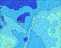 | 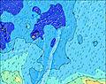 | 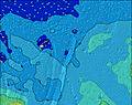 | 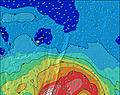 | 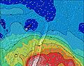 | 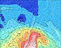 | 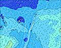 | ||||||||||||
Wave Height (m) Direction Period (s) | SW 14 | SW 15 | SW 16 | SW 16 | SW 16 | SW 15 | SW 15 | SW 15 | SW 15 | SW 15 | SW 14 | SW 14 | SW 14 | SW 13 | SW 13 | SW 13 | SW 13 | SW 13 | SW 13 |
Wave Graph | |||||||||||||||||||
447 | 492 | 546 | 553 | 539 | 421 | 415 | 479 | 485 | 472 | 590 | 650 | 706 | 704 | 618 | 663 | 732 | 814 | 865 | |
Wind (km/h) | |||||||||||||||||||
Wind State on-shore cross-onshore cross-shore cross-offshore off-shore glassy | cross-off | cross-off | cross-off | cross | cross | cross-on | cross-on | on | cross-on | cross | cross | cross | cross | cross | cross-off | cross-off | cross-off | cross-off | cross-off |
High Tide | 9:52PM1.23m | 9:55AM1.25m | 10:30PM1.25m | 10:38AM1.23m | |||||||||||||||
Low Tide | 3:50AM0.35m | 4:11PM0.23m | 4:33AM0.33m | 4:49PM0.25m | |||||||||||||||
— | — | — | — | — | 7:11 | — | — | — | — | — | — | — | 7:11 | — | — | — | — | — | |
6:22 | — | — | — | — | — | — | — | 6:22 | — | — | — | — | — | — | — | 6:22 | — | — | |
mm | — | — | — | — | — | — | 1 | — | — | — | 1 | — | — | — | — | — | — | — | — |
Temp °C | 22 | 22 | 22 | 22 | 22 | 22 | 23 | 23 | 23 | 22 | 21 | 21 | 21 | 21 | 20 | 20 | 20 | 20 | 20 |
Feels °C | 20 | 20 | 19 | 19 | 20 | 21 | 22 | 23 | 23 | 22 | 21 | 21 | 20 | 19 | 18 | 17 | 16 | 16 | 16 |
Swell 1 Height (m) Direction Period (s) | SW 14 | SW 15 | SW 16 | SW 16 | SW 16 | SW 15 | SW 15 | SW 15 | SW 15 | SW 15 | SW 14 | SW 14 | SW 14 | SW 13 | SW 13 | SW 13 | SW 13 | SW 13 | SW 13 |
447 | 492 | 546 | 553 | 539 | 421 | 415 | 479 | 485 | 472 | 590 | 650 | 706 | 704 | 618 | 663 | 732 | 814 | 865 | |
Swell 2 Height (m) Direction Period (s) | SE 12 | SE 12 | SE 12 | SE 12 | SSE 12 | SE 12 | SE 12 | ENE 7 | ENE 7 | ENE 7 | ENE 7 | ENE 7 | ENE 6 | E 6 | ENE 6 | ENE 6 | ENE 10 | E 7 | E 7 |
142 | 144 | 169 | 144 | 177 | 142 | 110 | 70 | 64 | 64 | 64 | 62 | 55 | 39 | 31 | 23 | 77 | 24 | 26 | |
Swell 3 Height (m) Direction Period (s) | ENE 6 | S 8 | NE 13 | NE 12 | E 7 | E 7 | NE 12 | SE 12 | SSE 12 | SE 11 | SSE 11 | SSE 11 | SSE 11 | SSE 11 | SE 11 | SE 12 | SE 12 | SW 7 | SSW 16 |
25 | 20 | 43 | 39 | 24 | 34 | 37 | 137 | 88 | 104 | 85 | 85 | 85 | 73 | 64 | 72 | 51 | 14 | 87 | |
Wind waves Height (m) Direction Period (s) | — | ENE 7 | ENE 7 | ENE 7 | NE 4 | NE 4 | ENE 7 | N 4 | NE 12 | — | — | — | — | — | SSW 4 | SSW 4 | SSW 5 | SSW 6 | SW 6 |
— | 34 | 50 | 64 | 17 | 16 | 88 | 7 | 68 | — | — | — | — | — | 8 | 25 | 44 | 65 | 97 | |
Nearest Offshore or Glassy | |||||||||||||||||||
Distance (km) | 0 | 287 | 287 | 286 | 286 | 286 | 286 | 286 | 286 | 4 | 4 | 4 | 286 | 286 | 286 | 803 | 875 | 875 | 875 |
Best forecast wave conditions in Tonga - Tongatapu | |||||||||||||||||||
Best forecast wave conditions in Tonga | |||||||||||||||||||
Header Global | |||||||||||||||||||
- Map Icons:
 Break
Break Live Wave Height (m)
 Live Wind Speed (km/h)
 Surf Rating (10 Max)
 Ocean Swells (m)
- Wind Speed (km/h)
Latest Updates


FREE! Surf-Forecast.com widget for your website
The surf report / weather widget below is available to embed on third party websites free of charge and provides a summary of our Motels surf forecast. Simply grab the html code snippet that we provide and paste it into your own site. You can choose your preferred language and metric/imperial units for the surf forecast feed to suit users of your site. Click here to get the code.
 Nearest