

Surf Forecasts:

How big are the waves at Magoos today (04 Aug):
- Morning surf: Morning surf (04 Aug, local time) - 4.5ft (1.3m), 14s period with NNE swell.
- Afternoon surf: Afternoon surf (04 Aug, local time) - 4.5ft (1.4m), 13s period with NNE swell.
- Evening surf: Evening surf (04 Aug, local time) - 4.5ft (1.4m), 13s period with N swell.
The current surf forecast for Magoos at 2AM is: 1.2m 14s primary swell from a Northeast direction (forecast issued at 09:00pm August 03). An open ocean swell of 0.2m 9s is not directed at the surf break, a second open ocean swell of 2.1m 8s is not directed at the surf break. The wind direction is predicted to be cross-onshore.
| Time (ChST) & Date | Wave Height | Wave Period |
|---|---|---|
| Morning (04 Aug) | 4.5ft (1.3m) | 14s |
| Afternoon (04 Aug) | 4.5ft (1.4m) | 13s |
| Evening (04 Aug) | 4.5ft (1.4m) | 13s |
Table - waves today at Magoos. (Swell directed towards the surf break)
Short Range ForecastHeavy rain (total 49mm), heaviest during Thu afternoon. Warm (max 29°C on Wed morning, min 27°C on Tue afternoon). Mainly fresh winds. | ||||||||||||||||||
Mon 3 | Tuesday 4 | Wednesday 5 | ||||||||||||||||
7 PM | 10 PM | 1 AM | 4 AM | 7 AM | 10 AM | 1 PM | 4 PM | 7 PM | 10 PM | 1 AM | 4 AM | 7 AM | 10 AM | 1 PM | 4 PM | 7 PM | 10 PM | |
Swell Height Map | 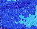 | 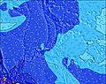 | 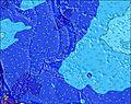 | 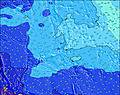 | 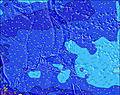 | 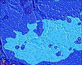 | 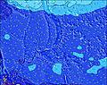 | |||||||||||
Wave Height (m) Direction Period (s) | NE 14 | NE 14 | NE 14 | NNE 14 | NNE 14 | NNE 14 | NNE 13 | NNE 13 | NNE 13 | N 13 | N 13 | N 13 | N 13 | N 13 | N 13 | N 13 | NNW 13 | NNW 13 |
Wave Graph | ||||||||||||||||||
492 | 485 | 581 | 586 | 569 | 631 | 683 | 632 | 599 | 663 | 643 | 643 | 620 | 610 | 737 | 759 | 679 | 679 | |
Wind (km/h) | ||||||||||||||||||
Wind State on-shore cross-onshore cross-shore cross-offshore off-shore glassy | cross-on | cross-on | cross-on | cross-on | cross-on | cross-on | cross-on | cross | cross-on | cross | cross | cross | cross-on | cross-on | cross-on | cross-on | cross-on | cross-on |
High Tide | 11:05PM0.78m | 11:13AM0.66m | 11:33PM0.78m | 12:30PM0.64m | ||||||||||||||
Low Tide | 4:35PM0.20m | 5:30AM0.29m | 5:15PM0.28m | 6:21AM0.22m | 6:00PM0.38m | |||||||||||||
— | — | — | 6:05 | — | — | — | — | — | — | — | 6:05 | — | — | — | — | — | — | |
— | — | — | — | — | — | — | 6:47 | — | — | — | — | — | — | — | 6:46 | — | — | |
mm | 3 | 1 | 1 | 2 | 1 | 3 | 4 | 3 | 2 | — | — | 2 | 2 | 2 | 2 | 2 | 1 | 2 |
Temp °C | 28 | 28 | 28 | 28 | 28 | 28 | 28 | 28 | 27 | 27 | 28 | 28 | 28 | 29 | 29 | 29 | 28 | 28 |
Feels °C | 28 | 28 | 28 | 28 | 28 | 28 | 27 | 27 | 26 | 26 | 28 | 28 | 28 | 29 | 29 | 29 | 29 | 29 |
Swell 1 Height (m) Direction Period (s) | NE 14 | NE 14 | NE 14 | NNE 14 | NNE 14 | NNE 14 | NNE 13 | NNE 13 | NNE 13 | N 13 | N 13 | N 13 | N 13 | N 13 | N 13 | N 13 | NNW 13 | NNW 13 |
492 | 485 | 581 | 586 | 569 | 631 | 683 | 632 | 599 | 663 | 643 | 643 | 620 | 610 | 737 | 759 | 679 | 679 | |
Swell 2 Height (m) Direction Period (s) | ENE 14 | ENE 14 | SSE 9 | SSE 9 | SE 9 | SE 8 | SE 8 | SE 8 | SE 8 | SE 8 | SE 8 | SE 8 | ENE 13 | SE 8 | SE 8 | SSE 8 | NE 12 | NE 12 |
19 | 19 | 8 | 8 | 12 | 18 | 18 | 18 | 11 | 18 | 17 | 17 | 33 | 18 | 17 | 27 | 35 | 35 | |
Swell 3 Height (m) Direction Period (s) | SSE 9 | SSE 9 | ENE 14 | ENE 14 | ENE 14 | ENE 14 | ENE 14 | ENE 13 | ENE 13 | ENE 13 | ENE 13 | ENE 13 | S 9 | NE 13 | NE 12 | NE 12 | SE 12 | ESE 12 |
7 | 8 | 19 | 18 | 18 | 18 | 18 | 17 | 17 | 34 | 33 | 33 | 6 | 41 | 36 | 35 | 22 | 13 | |
Wind waves Height (m) Direction Period (s) | WSW 8 | WSW 8 | WSW 8 | WSW 8 | WSW 8 | WSW 8 | WSW 8 | WSW 8 | WSW 8 | WSW 8 | WSW 8 | WSW 8 | WSW 8 | WSW 8 | WSW 8 | WSW 8 | WSW 8 | WSW 8 |
525 | 554 | 507 | 494 | 469 | 531 | 576 | 644 | 674 | 634 | 650 | 705 | 650 | 666 | 666 | 650 | 646 | 646 | |
Nearest Offshore or Glassy | ||||||||||||||||||
Distance (km) | 1862 | 1856 | 1836 | 1833 | 1856 | 1833 | 1909 | 1909 | 1856 | 1833 | 1833 | 1833 | 1833 | 1833 | 1862 | 1862 | 1836 | 1833 |
Best forecast wave conditions in Guam | ||||||||||||||||||
Best forecast wave conditions in Guam | ||||||||||||||||||
Header Global | ||||||||||||||||||
- Map Icons:
 Break
Break Live Wave Height (m)
 Live Wind Speed (km/h)
 Surf Rating (10 Max)
 Ocean Swells (m)
- Wind Speed (km/h)
Latest Updates


FREE! Surf-Forecast.com widget for your website
The surf report / weather widget below is available to embed on third party websites free of charge and provides a summary of our Magoos surf forecast. Simply grab the html code snippet that we provide and paste it into your own site. You can choose your preferred language and metric/imperial units for the surf forecast feed to suit users of your site. Click here to get the code.
 Nearest