

Surf Forecasts:

How big are the waves at Llorente today (03 Aug):
- Morning surf: Morning surf (03 Aug, local time) - 2.5ft (0.8m), 15s period with ENE swell.
- Afternoon surf: Afternoon surf (03 Aug, local time) - 2.5ft (0.8m), 14s period with ENE swell.
- Evening surf: Evening surf (03 Aug, local time) - 3.5ft (1.0m), 16s period with ENE swell.
The current surf forecast for Llorente at 9PM is: 1.0m 16s primary swell from a East-northeast direction (forecast issued at 01:00pm August 03). An open ocean swell of 0.6m 7s is not directed at the surf break, a second open ocean swell of 1.2m 7s is not directed at the surf break. The wind direction is predicted to be offshore and the swell rating is 2.
| Time (PST) & Date | Wave Height | Wave Period |
|---|---|---|
| Morning (03 Aug) | 2.5ft (0.8m) | 15s |
| Afternoon (03 Aug) | 2.5ft (0.8m) | 14s |
| Evening (03 Aug) | 3.5ft (1.0m) | 16s |
Table - waves today at Llorente. (Swell directed towards the surf break)
Short Range ForecastLight rain (total 5mm), mostly falling on Mon afternoon. Warm (max 33°C on Tue afternoon, min 26°C on Mon night). Wind will be generally light. | |||||||||||||||||||||
Mon 3 | Tuesday 4 | Wednesday 5 | |||||||||||||||||||
11 AM | 2 PM | 5 PM | 8 PM | 11 PM | 2 AM | 5 AM | 8 AM | 11 AM | 2 PM | 5 PM | 8 PM | 11 PM | 2 AM | 5 AM | 8 AM | 11 AM | 2 PM | 5 PM | 8 PM | 11 PM | |
Swell Height Map | 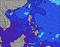 | 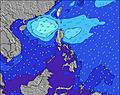 | 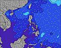 | 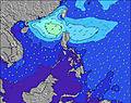 | 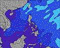 | 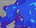 | 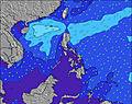 | 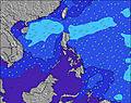 | |||||||||||||
Wave Height (m) Direction Period (s) | ENE 15 | ENE 14 | ENE 14 | ENE 16 | ENE 16 | ENE 16 | ENE 16 | ENE 16 | ENE 16 | ENE 16 | ENE 15 | ENE 15 | ENE 18 | ENE 17 | ENE 17 | ENE 16 | ENE 16 | ENE 16 | ENE 16 | NE 17 | NE 17 |
Wave Graph | |||||||||||||||||||||
284 | 280 | 280 | 547 | 669 | 714 | 803 | 929 | 793 | 806 | 630 | 681 | 1645 | 1254 | 1599 | 881 | 1633 | 859 | 1425 | 1638 | 1717 | |
Wind (km/h) | |||||||||||||||||||||
Wind State on-shore cross-onshore cross-shore cross-offshore off-shore glassy | cross | off | off | off | off | off | off | off | cross-off | cross-off | off | off | off | off | off | off | cross-off | off | off | off | off |
High Tide | 8:12AM1.73m | 8:42PM1.77m | 8:55AM1.62m | 9:15PM1.75m | 9:46AM1.50m | 9:54PM1.72m | |||||||||||||||
Low Tide | 2:24PM0.38m | 2:53AM0.49m | 2:57PM0.51m | 3:40AM0.49m | 3:35PM0.66m | ||||||||||||||||
— | — | — | — | — | — | 5:24 | — | — | — | — | — | — | — | 5:26 | — | — | — | — | — | — | |
— | — | 6:01 | — | — | — | — | — | — | — | 6:00 | — | — | — | — | — | — | — | 6:00 | — | — | |
mm | — | 1 | 1 | 1 | 1 | 1 | — | — | — | — | — | — | — | — | — | — | — | — | — | — | — |
Temp °C | 31 | 31 | 30 | 27 | 26 | 26 | 26 | 28 | 32 | 33 | 31 | 28 | 27 | 26 | 26 | 29 | 32 | 33 | 31 | 28 | 27 |
Feels °C | 34 | 34 | 34 | 31 | 30 | 30 | 30 | 31 | 35 | 35 | 34 | 31 | 31 | 29 | 29 | 32 | 34 | 35 | 34 | 31 | 30 |
Swell 1 Height (m) Direction Period (s) | ENE 15 | ENE 14 | ENE 14 | ENE 16 | ENE 16 | ENE 16 | ENE 16 | ENE 16 | ENE 16 | ENE 16 | ENE 15 | ENE 15 | ENE 18 | ENE 17 | ENE 17 | ENE 16 | ENE 16 | ENE 16 | ENE 16 | NE 17 | NE 17 |
284 | 280 | 280 | 547 | 669 | 714 | 803 | 929 | 793 | 806 | 604 | 596 | 1645 | 1254 | 1599 | 881 | 1633 | 859 | 1425 | 1638 | 1717 | |
Swell 2 Height (m) Direction Period (s) | E 18 | ENE 18 | ENE 18 | SSE 7 | SSE 7 | SSE 7 | SSE 8 | SSE 8 | ENE 20 | ENE 20 | ENE 18 | ENE 18 | SSE 7 | NE 21 | SSE 7 | NE 18 | S 8 | NE 18 | S 7 | ESE 9 | ESE 9 |
167 | 182 | 251 | 34 | 35 | 30 | 32 | 41 | 360 | 349 | 630 | 681 | 19 | 348 | 16 | 752 | 31 | 642 | 28 | 8 | 8 | |
Swell 3 Height (m) Direction Period (s) | SSE 7 | NNE 9 | SSE 7 | ESE 9 | ESE 9 | ESE 9 | ENE 22 | NE 22 | SSE 8 | ESE 9 | ESE 9 | SSE 7 | ESE 10 | SSE 7 | ESE 10 | S 7 | ESE 10 | SSE 8 | ESE 9 | ESE 9 | ESE 9 |
20 | 8 | 30 | 8 | 9 | 9 | 91 | 118 | 45 | 8 | 8 | 29 | 9 | 16 | 9 | 28 | 9 | 33 | 9 | 8 | 8 | |
Wind waves Height (m) Direction Period (s) | — | SSE 7 | S 7 | S 7 | — | — | WSW 3 | SW 4 | S 8 | SSE 8 | SSE 8 | S 7 | — | S 7 | S 7 | S 7 | S 8 | S 8 | S 7 | S 7 | S 7 |
— | 31 | 131 | 150 | — | — | 3 | 6 | 169 | 47 | 44 | 127 | — | 68 | 82 | 107 | 137 | 138 | 130 | 39 | 38 | |
Nearest Offshore or Glassy | |||||||||||||||||||||
Distance (km) | 58 | 0 | 0 | 0 | 0 | 0 | 0 | 0 | 0 | 20 | 0 | 0 | 0 | 0 | 0 | 0 | 0 | 0 | 0 | 0 | 0 |
Best forecast wave conditions in Samar | |||||||||||||||||||||
Best forecast wave conditions in Philippines | |||||||||||||||||||||
Header Global | |||||||||||||||||||||
- Map Icons:
 Break
Break Live Wave Height (m)
 Live Wind Speed (km/h)
 Surf Rating (10 Max)
 Ocean Swells (m)
- Wind Speed (km/h)
Latest Updates


FREE! Surf-Forecast.com widget for your website
The surf report / weather widget below is available to embed on third party websites free of charge and provides a summary of our Llorente surf forecast. Simply grab the html code snippet that we provide and paste it into your own site. You can choose your preferred language and metric/imperial units for the surf forecast feed to suit users of your site. Click here to get the code.
 Nearest