

Surf Forecasts:

How big are the waves at Fagaalu today (31 Jul):
- Afternoon surf: Afternoon surf (31 Jul, local time) - 5ft (1.5m), 7s period with E swell.
- Evening surf: Evening surf (31 Jul, local time) - 3ft (0.9m), 12s period with SSE swell.
The current surf forecast for Fagaalu at 10PM is: 0.9m 12s primary swell from a South-southeast direction and 0.7m 10s secondary swell from a South direction, 1.4m 7s secondary swell from a East direction (forecast issued at 06:00pm July 31). The wind direction is predicted to be cross-onshore.
| Time (SST) & Date | Wave Height | Wave Period |
|---|---|---|
| Morning (31 Jul) | - | - |
| Afternoon (31 Jul) | 5ft (1.5m) | 7s |
| Evening (31 Jul) | 3ft (0.9m) | 12s |
Table - waves today at Fagaalu. (Swell directed towards the surf break)
Short Range ForecastMostly dry. Warm (max 26°C on Sat morning, min 25°C on Fri afternoon). Wind will be generally light. | |||||||||||||||||||
Fri 31 | Saturday 1 | Sunday 2 | |||||||||||||||||
4 PM | 7 PM | 10 PM | 1 AM | 4 AM | 7 AM | 10 AM | 1 PM | 4 PM | 7 PM | 10 PM | 1 AM | 4 AM | 7 AM | 10 AM | 1 PM | 4 PM | 7 PM | 10 PM | |
Swell Height Map |  |  |  | 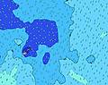 | 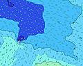 | 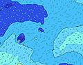 | 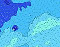 | ||||||||||||
Wave Height (m) Direction Period (s) | E 7 | E 7 | SSE 12 | SSE 12 | SSE 12 | SSE 12 | SSE 12 | SSE 12 | SSE 12 | SSE 12 | SSE 12 | SSE 12 | SSE 11 | SSE 11 | SSE 11 | SSE 11 | SSE 11 | SW 14 | SW 14 |
Wave Graph | |||||||||||||||||||
226 | 200 | 230 | 274 | 387 | 412 | 477 | 508 | 508 | 436 | 429 | 414 | 341 | 335 | 335 | 335 | 261 | 256 | 256 | |
Wind (km/h) | |||||||||||||||||||
Wind State on-shore cross-onshore cross-shore cross-offshore off-shore glassy | cross-on | cross-on | cross-on | cross-on | cross-on | cross-on | cross-on | on | on | on | cross-on | cross-on | cross-on | cross-on | cross-on | cross-on | cross-on | cross-on | cross-on |
High Tide | 8:44PM0.73m | 8:57AM0.81m | 9:26PM0.74m | 9:41AM0.78m | |||||||||||||||
Low Tide | 2:33PM0.05m | 2:41AM0.08m | 3:12PM0.06m | 3:27AM0.10m | 3:54PM0.08m | ||||||||||||||
— | — | — | — | 6:43 | — | — | — | — | — | — | — | 6:43 | — | — | — | — | — | — | |
6:13 | — | — | — | — | — | — | — | 6:13 | — | — | — | — | — | — | — | 6:14 | — | — | |
mm | — | — | — | — | — | — | — | — | — | — | — | — | — | — | — | — | — | — | — |
Temp °C | 25 | 25 | 25 | 25 | 25 | 25 | 26 | 26 | 26 | 26 | 26 | 26 | 25 | 26 | 26 | 26 | 26 | 26 | 26 |
Feels °C | 23 | 23 | 24 | 25 | 25 | 25 | 27 | 27 | 27 | 27 | 27 | 28 | 27 | 27 | 28 | 28 | 28 | 28 | 29 |
Swell 1 Height (m) Direction Period (s) | S 10 | S 10 | SSE 12 | SSE 12 | SSE 12 | SSE 12 | SSE 12 | SSE 12 | SSE 12 | SSE 12 | SSE 12 | SSE 12 | SSE 11 | SSE 11 | SSE 11 | SSE 11 | SSE 11 | SSE 11 | SSE 11 |
158 | 125 | 230 | 274 | 387 | 412 | 477 | 508 | 508 | 436 | 429 | 414 | 341 | 335 | 335 | 335 | 261 | 256 | 256 | |
Swell 2 Height (m) Direction Period (s) | SSE 12 | SSE 12 | S 10 | S 10 | SW 15 | SW 17 | SW 14 | SW 14 | E 8 | SW 16 | E 8 | E 8 | E 8 | E 8 | E 8 | E 8 | E 8 | E 8 | E 8 |
175 | 169 | 92 | 92 | 141 | 183 | 93 | 164 | 127 | 239 | 131 | 149 | 149 | 121 | 146 | 120 | 117 | 98 | 98 | |
Swell 3 Height (m) Direction Period (s) | NE 12 | NE 12 | SW 15 | SW 15 | S 10 | SSW 10 | NE 11 | NE 10 | SW 15 | NE 10 | SW 16 | SW 16 | SW 15 | SW 15 | SW 15 | SW 15 | SW 14 | SW 14 | SW 14 |
69 | 47 | 109 | 141 | 48 | 31 | 42 | 50 | 229 | 25 | 242 | 193 | 178 | 176 | 215 | 215 | 203 | 248 | 248 | |
Wind waves Height (m) Direction Period (s) | E 7 | E 7 | E 7 | E 7 | E 8 | E 8 | E 8 | E 8 | — | E 8 | — | — | — | — | — | — | — | — | — |
226 | 200 | 198 | 173 | 187 | 176 | 176 | 149 | — | 127 | — | — | — | — | — | — | — | — | — | |
Nearest Offshore or Glassy | |||||||||||||||||||
Distance (km) | 897 | 613 | 613 | 13 | 13 | 13 | 13 | 13 | 182 | 17 | 17 | 182 | 613 | 613 | 613 | 13 | 13 | 2 | 2 |
Best forecast wave conditions in American-Samoa - Tutuila | |||||||||||||||||||
Best forecast wave conditions in American Samoa | |||||||||||||||||||
Header Global | |||||||||||||||||||
- Map Icons:
 Break
Break Live Wave Height (m)
 Live Wind Speed (km/h)
 Surf Rating (10 Max)
 Ocean Swells (m)
- Wind Speed (km/h)
Latest Updates


FREE! Surf-Forecast.com widget for your website
The surf report / weather widget below is available to embed on third party websites free of charge and provides a summary of our Fagaalu surf forecast. Simply grab the html code snippet that we provide and paste it into your own site. You can choose your preferred language and metric/imperial units for the surf forecast feed to suit users of your site. Click here to get the code.
 Nearest