

Surf Forecasts:

How big are the waves at Espigon today (06 Jul):
- Morning surf: Morning surf (06 Jul, local time) - 1.5ft (0.5m), 10s period with E swell.
- Afternoon surf: Afternoon surf (06 Jul, local time) - 2ft (0.6m), 10s period with E swell.
- Evening surf: Evening surf (06 Jul, local time) - 2ft (0.6m), 10s period with E swell.
The current surf forecast for Espigon at 4PM is: 0.6m 10s primary swell from a East direction and 0.4m 10s secondary swell from a South direction (forecast issued at 08:00am July 06). An open ocean swell of 0.3m 3s is not directed at the surf break. The wind direction is predicted to be offshore.
| Time (-03) & Date | Wave Height | Wave Period |
|---|---|---|
| Morning (06 Jul) | 1.5ft (0.5m) | 10s |
| Afternoon (06 Jul) | 2ft (0.6m) | 10s |
| Evening (06 Jul) | 2ft (0.6m) | 10s |
Table - waves today at Espigon. (Swell directed towards the surf break)
Updates in hr min s Forecast update imminent
Short Range ForecastLight rain (total 6mm), mostly falling on Wed night. Very mild (max 17°C on Tue afternoon, min 5°C on Mon morning). Mainly strong winds. | ||||||||||||||||||||||||
Monday 6 | Tuesday 7 | Wednesday 8 | Thu 9 | |||||||||||||||||||||
6 AM | 9 AM | 12 PM | 3 PM | 6 PM | 9 PM | 12 AM | 3 AM | 6 AM | 9 AM | 12 PM | 3 PM | 6 PM | 9 PM | 12 AM | 3 AM | 6 AM | 9 AM | 12 PM | 3 PM | 6 PM | 9 PM | 12 AM | 3 AM | |
Swell Height Map |  | 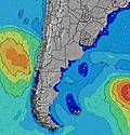 |  | 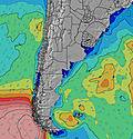 | 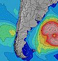 |  | 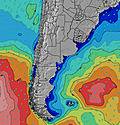 | 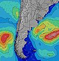 | 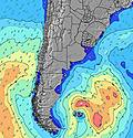 | |||||||||||||||
Wave Height (m) Direction Period (s) | E 10 | E 10 | E 10 | E 10 | E 10 | E 10 | E 10 | E 9 | E 9 | E 9 | ESE 9 | ESE 9 | E 9 | ESE 10 | ESE 10 | ESE 10 | ESE 10 | ESE 9 | ESE 10 | ESE 10 | ESE 9 | SE 9 | ESE 10 | SSE 7 |
Wave Graph | ||||||||||||||||||||||||
47 | 49 | 49 | 70 | 68 | 67 | 47 | 45 | 43 | 43 | 28 | 28 | 26 | 82 | 131 | 125 | 123 | 118 | 159 | 163 | 126 | 251 | 99 | 483 | |
Wind (km/h) | ||||||||||||||||||||||||
Wind State on-shore cross-onshore cross-shore cross-offshore off-shore glassy | off | off | cross-off | off | cross-off | cross-off | cross-off | cross-off | off | off | off | cross-off | cross-off | cross | cross | cross-on | cross-on | cross-on | on | cross-on | cross-on | cross-on | cross-on | cross-on |
High Tide | 4:30AM3.24m | 4:32PM3.26m | 5:11AM3.30m | 5:19PM3.20m | 5:55AM3.37m | 6:11PM3.16m | ||||||||||||||||||
Low Tide | 10:45AM1.09m | 11:04PM0.69m | 11:31AM1.03m | 11:44PM0.74m | 12:20PM0.95m | 00:28AM0.79m | ||||||||||||||||||
8:37 | — | — | — | — | — | — | — | 8:37 | — | — | — | — | — | — | — | 8:36 | — | — | — | — | — | — | 8:36 | |
— | — | — | 5:55 | — | — | — | — | — | — | — | 5:57 | — | — | — | — | — | — | — | 5:57 | — | — | — | 5:58 | |
mm | — | — | — | — | — | — | — | — | — | — | — | — | — | — | — | — | — | 1 | 1 | — | — | — | — | 1 |
Temp °C | 5 | 5 | 6 | 9 | 10 | 8 | 7 | 7 | 8 | 10 | 14 | 17 | 15 | 13 | 13 | 12 | 12 | 10 | 9 | 10 | 10 | 10 | 9 | 9 |
Feels °C | 1 | 1 | 1 | 3 | 4 | 1 | -1 | -1 | 0 | 2 | 7 | 8 | 11 | 10 | 10 | 9 | 9 | 7 | 5 | 6 | 6 | 5 | 3 | 3 |
Swell 1 Height (m) Direction Period (s) | E 10 | E 10 | E 10 | E 10 | E 10 | E 10 | E 10 | E 9 | E 9 | E 9 | ESE 9 | ESE 9 | E 9 | W 5 | ESE 10 | ESE 10 | ESE 10 | ESE 9 | ESE 10 | ESE 10 | ESE 9 | ESE 10 | ESE 10 | ESE 9 |
47 | 49 | 49 | 70 | 68 | 67 | 47 | 45 | 43 | 43 | 28 | 28 | 26 | 43 | 131 | 125 | 123 | 118 | 159 | 163 | 126 | 150 | 94 | 118 | |
Swell 2 Height (m) Direction Period (s) | S 11 | S 11 | S 11 | S 10 | S 10 | S 8 | S 9 | S 9 | S 9 | S 8 | S 8 | S 8 | ESE 11 | ESE 10 | W 5 | W 5 | WSW 5 | W 4 | SW 3 | SW 3 | SSW 3 | — | — | — |
36 | 36 | 35 | 30 | 29 | 5 | 15 | 14 | 13 | 6 | 5 | 5 | 12 | 82 | 19 | 8 | 4 | 1 | 2 | 2 | 1 | — | — | — | |
Swell 3 Height (m) Direction Period (s) | S 18 | S 17 | S 16 | S 18 | S 18 | S 10 | S 17 | S 16 | ENE 4 | NE 4 | NE 4 | NE 4 | S 8 | S 8 | S 8 | S 7 | S 12 | S 12 | S 16 | S 16 | S 12 | — | — | — |
6 | 6 | 5 | 6 | 6 | 7 | 5 | 5 | 2 | 1 | 1 | 1 | 5 | 5 | 1 | 1 | 3 | 3 | 5 | 5 | 3 | — | — | — | |
Wind waves Height (m) Direction Period (s) | — | — | NW 2 | NW 2 | NW 3 | NNW 3 | NNW 3 | NNW 4 | NW 4 | WNW 4 | WNW 5 | W 5 | W 6 | — | — | — | — | SSW 2 | — | — | SSW 3 | SE 9 | SSE 5 | SSE 7 |
— | — | 1 | 1 | 1 | 4 | 9 | 15 | 16 | 19 | 53 | 75 | 101 | — | — | — | — | 1 | — | — | 4 | 251 | 99 | 483 | |
Nearest Offshore or Glassy | ||||||||||||||||||||||||
Distance (km) | 0 | 0 | 0 | 0 | 18 | 738 | 295 | 295 | 295 | 295 | 295 | 439 | 398 | 18 | 18 | 398 | 533 | 533 | 439 | 439 | 439 | 468 | 439 | 439 |
Best forecast wave conditions in Provincia Río Negro | ||||||||||||||||||||||||
Best forecast wave conditions in Argentina | ||||||||||||||||||||||||
Header Global | ||||||||||||||||||||||||
- Map Icons:
 Break
Break Live Wave Height (m)
 Live Wind Speed (km/h)
 Surf Rating (10 Max)
 Ocean Swells (m)
- Wind Speed (km/h)


FREE! Surf-Forecast.com widget for your website
The surf report / weather widget below is available to embed on third party websites free of charge and provides a summary of our Espigon surf forecast. Simply grab the html code snippet that we provide and paste it into your own site. You can choose your preferred language and metric/imperial units for the surf forecast feed to suit users of your site. Click here to get the code.
 Nearest