

Surf Forecasts:

| Time (CST) & Date | Wave Height | Wave Period |
|---|---|---|
| Morning (02 Jul) | 1ft (0.3m) | 5s |
| Afternoon (02 Jul) | 0.5ft (0.2m) | 5s |
| Evening (02 Jul) | - | - |
Table - waves today at Dadonghai. (Swell directed towards the surf break)
Updates in hr min s Forecast update imminent
Short Range ForecastHeavy rain (total 89mm), heaviest during Sat afternoon. Warm (max 31°C on Thu afternoon, min 26°C on Thu night). Winds increasing (calm on Fri afternoon, fresh winds from the WSW by Sat morning). | ||||||||||||||||||||||||
Thu 2 | Friday 3 | Saturday 4 | Sun 5 | |||||||||||||||||||||
11 AM | 2 PM | 5 PM | 8 PM | 11 PM | 2 AM | 5 AM | 8 AM | 11 AM | 2 PM | 5 PM | 8 PM | 11 PM | 2 AM | 5 AM | 8 AM | 11 AM | 2 PM | 5 PM | 8 PM | 11 PM | 2 AM | 5 AM | 8 AM | |
Swell Height Map | 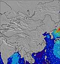 | 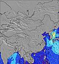 | 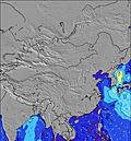 | 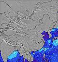 | 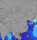 | 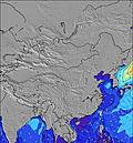 | 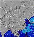 | 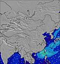 |  | |||||||||||||||
Wave Height (m) Direction Period (s) | SSE 5 | SSE 5 | SSE 5 | ENE 9 | SSE 5 | S 8 | S 8 | S 8 | S 8 | S 8 | SSE 8 | SSE 9 | SSE 9 | SSE 8 | SSE 8 | SSE 8 | SSE 8 | SSE 8 | SSE 9 | SSE 9 | SSE 8 | SSE 8 | SSE 8 | SSE 8 |
Wave Graph | ||||||||||||||||||||||||
6 | 3 | 3 | 0 | 3 | 5 | 5 | 12 | 12 | 12 | 24 | 88 | 137 | 164 | 172 | 212 | 191 | 196 | 301 | 288 | 256 | 238 | 159 | 143 | |
Wind (km/h) | ||||||||||||||||||||||||
Wind State on-shore cross-onshore cross-shore cross-offshore off-shore glassy | cross-on | cross | cross-on | cross | cross-off | cross-off | cross-off | cross-off | cross-on | glassy | cross-on | cross-on | cross | cross | cross | cross | cross | cross | cross-on | cross-on | cross | cross-on | cross-on | cross-on |
High Tide | 11:46AM1.58m | 12:25PM1.54m | 1:01PM1.48m | 4:52AM0.71m | ||||||||||||||||||||
Low Tide | 8:24PM0.14m | 8:54PM0.17m | 9:18PM0.22m | 5:17AM0.71m | ||||||||||||||||||||
— | — | — | — | — | — | 6:09 | — | — | — | — | — | — | — | 6:09 | — | — | — | — | — | — | — | 6:09 | — | |
— | — | 7:21 | — | — | — | — | — | — | — | 7:22 | — | — | — | — | — | — | — | 7:22 | — | — | — | — | 7:22 | |
mm | — | 1 | 1 | 1 | 1 | — | — | — | — | 2 | 1 | 1 | 1 | 4 | 3 | 6 | 9 | 12 | 12 | 8 | 6 | 6 | 5 | 5 |
Temp °C | 32 | 29 | 31 | 29 | 28 | 27 | 26 | 28 | 31 | 28 | 29 | 28 | 28 | 27 | 27 | 27 | 27 | 26 | 27 | 27 | 26 | 26 | 26 | 27 |
Feels °C | 36 | 34 | 35 | 34 | 32 | 31 | 30 | 33 | 35 | 34 | 34 | 33 | 33 | 31 | 31 | 28 | 28 | 27 | 29 | 31 | 30 | 31 | 29 | 30 |
Swell 1 Height (m) Direction Period (s) | SSE 5 | SSE 5 | ENE 9 | ENE 9 | E 8 | WNW 4 | S 8 | E 9 | E 8 | E 9 | E 9 | E 10 | E 9 | E 9 | SSE 8 | SSE 8 | SSE 8 | SSE 8 | SSE 9 | SSE 9 | W 5 | SSE 8 | SSE 8 | SSE 8 |
6 | 3 | 17 | 26 | 36 | 3 | 5 | 290 | 283 | 351 | 501 | 513 | 375 | 225 | 172 | 212 | 191 | 196 | 301 | 288 | 20 | 238 | 159 | 143 | |
Swell 2 Height (m) Direction Period (s) | E 4 | E 4 | SSE 5 | WNW 4 | WNW 4 | S 8 | WNW 4 | S 8 | S 8 | S 8 | SSE 8 | SSE 9 | SSE 9 | SSE 8 | E 8 | ESE 8 | E 8 | ESE 8 | W 6 | WSW 6 | ESE 7 | W 5 | ESE 6 | ESE 6 |
1 | 1 | 3 | 2 | 5 | 5 | 1 | 12 | 12 | 12 | 24 | 88 | 137 | 164 | 88 | 22 | 20 | 11 | 130 | 54 | 16 | 12 | 23 | 14 | |
Swell 3 Height (m) Direction Period (s) | E 8 | E 7 | E 4 | E 4 | SSE 5 | S 8 | W 4 | WNW 4 | — | — | — | — | — | — | ENE 8 | ENE 8 | ESE 7 | ENE 7 | ESE 7 | ESE 7 | E 9 | ESE 7 | WSW 4 | WSW 4 |
5 | 1 | 1 | 3 | 3 | 5 | 1 | 1 | — | — | — | — | — | — | 37 | 20 | 5 | 11 | 17 | 16 | 6 | 15 | 7 | 3 | |
Wind waves Height (m) Direction Period (s) | ENE 3 | NE 3 | — | — | ENE 5 | ENE 8 | ENE 8 | — | — | WSW 4 | WSW 4 | WSW 6 | WSW 5 | WSW 5 | WSW 6 | WSW 6 | WSW 6 | WSW 6 | W 6 | — | SSE 8 | — | W 4 | W 4 |
2 | 3 | — | — | 7 | 119 | 246 | — | — | 2 | 4 | 24 | 48 | 113 | 247 | 255 | 312 | 320 | 182 | — | 256 | — | 4 | 3 | |
Nearest Offshore or Glassy | ||||||||||||||||||||||||
Distance (km) | 1150 | 1152 | 1152 | 1017 | 930 | 1017 | 87 | 87 | 264 | 14 | 51 | 87 | 14 | 264 | 264 | 264 | 264 | 1152 | 1313 | 1150 | 267 | 1150 | 1155 | 1150 |
Best forecast wave conditions in Hainan | ||||||||||||||||||||||||
Best forecast wave conditions in China | ||||||||||||||||||||||||
Header Global | ||||||||||||||||||||||||
- Map Icons:
 Break
Break Live Wave Height (m)
 Live Wind Speed (km/h)
 Surf Rating (10 Max)
 Ocean Swells (m)
- Wind Speed (km/h)


FREE! Surf-Forecast.com widget for your website
The surf report / weather widget below is available to embed on third party websites free of charge and provides a summary of our Dadonghai surf forecast. Simply grab the html code snippet that we provide and paste it into your own site. You can choose your preferred language and metric/imperial units for the surf forecast feed to suit users of your site. Click here to get the code.
 Nearest