

Surf Forecasts:

How big are the waves at Cloud 9 today (03 Aug):
- Morning surf: Morning surf (03 Aug, local time) - 2.5ft (0.7m), 15s period with ENE swell.
- Afternoon surf: Afternoon surf (03 Aug, local time) - 1.5ft (0.5m), 18s period with ENE swell.
- Evening surf: Evening surf (03 Aug, local time) - 3ft (0.9m), 16s period with ENE swell.
The current surf forecast for Cloud 9 at 7AM is: 0.7m 15s primary swell from a East-northeast direction (forecast issued at 01:00am August 03). An open ocean swell of 0.9m 7s is not directed at the surf break. The wind direction is predicted to be cross-offshore and the swell rating is 2.
| Time (PST) & Date | Wave Height | Wave Period |
|---|---|---|
| Morning (03 Aug) | 2.5ft (0.7m) | 15s |
| Afternoon (03 Aug) | 1.5ft (0.5m) | 18s |
| Evening (03 Aug) | 3ft (0.9m) | 16s |
Table - waves today at Cloud 9. (Swell directed towards the surf break)
Short Range ForecastMostly dry. Warm (max 31°C on Wed afternoon, min 27°C on Tue night). Wind will be generally light. | ||||||||||||||||||||||||
Monday 3 | Tuesday 4 | Wednesday 5 | ||||||||||||||||||||||
2 AM | 5 AM | 8 AM | 11 AM | 2 PM | 5 PM | 8 PM | 11 PM | 2 AM | 5 AM | 8 AM | 11 AM | 2 PM | 5 PM | 8 PM | 11 PM | 2 AM | 5 AM | 8 AM | 11 AM | 2 PM | 5 PM | 8 PM | 11 PM | |
Swell Height Map | 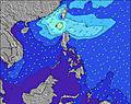 | 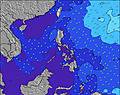 | 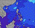 | 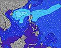 | 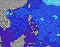 | 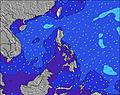 | 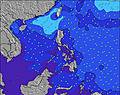 | 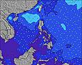 | 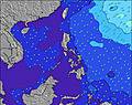 | |||||||||||||||
Wave Height (m) Direction Period (s) | E 14 | ENE 15 | ENE 15 | ENE 14 | ENE 18 | ENE 17 | ENE 16 | ENE 16 | ENE 16 | ENE 16 | ENE 16 | ENE 15 | ENE 15 | ENE 18 | ENE 18 | ENE 17 | ENE 16 | ENE 16 | NE 19 | NE 18 | NE 17 | NE 16 | NE 21 | NE 16 |
Wave Graph | ||||||||||||||||||||||||
153 | 172 | 246 | 163 | 176 | 528 | 457 | 452 | 582 | 546 | 546 | 539 | 512 | 1131 | 1093 | 1235 | 915 | 904 | 693 | 649 | 1484 | 1097 | 831 | 940 | |
Wind (km/h) | ||||||||||||||||||||||||
Wind State on-shore cross-onshore cross-shore cross-offshore off-shore glassy | off | cross-off | off | cross-off | glassy | glassy | glassy | cross-off | cross-off | off | off | off | cross-off | cross-off | glassy | cross-off | off | off | off | off | cross-off | cross-off | off | cross-off |
High Tide | 8:13AM1.76m | 8:42PM1.80m | 8:55AM1.65m | 9:15PM1.79m | 9:46AM1.52m | 9:54PM1.75m | ||||||||||||||||||
Low Tide | 2:14AM0.52m | 2:25PM0.39m | 2:54AM0.50m | 2:57PM0.52m | 3:41AM0.50m | 3:34PM0.67m | ||||||||||||||||||
— | 5:24 | — | — | — | — | — | — | — | 5:24 | — | — | — | — | — | — | — | 5:24 | — | — | — | — | — | — | |
— | — | — | — | — | 5:57 | — | — | — | — | — | — | — | 5:57 | — | — | — | — | — | — | — | 5:57 | — | — | |
mm | — | — | — | — | — | — | — | — | — | — | — | — | — | — | — | — | — | — | — | — | — | — | — | — |
Temp °C | 28 | 27 | 28 | 29 | 30 | 29 | 29 | 28 | 28 | 28 | 28 | 29 | 30 | 30 | 29 | 29 | 28 | 27 | 28 | 29 | 31 | 30 | 29 | 29 |
Feels °C | 32 | 31 | 32 | 32 | 34 | 33 | 34 | 32 | 32 | 31 | 31 | 32 | 33 | 33 | 34 | 33 | 32 | 30 | 31 | 32 | 33 | 31 | 31 | 33 |
Swell 1 Height (m) Direction Period (s) | SSE 7 | SSE 7 | SSE 7 | SSE 7 | SSE 7 | ENE 17 | ENE 16 | ENE 16 | SSE 8 | SSE 8 | ENE 16 | ENE 15 | ENE 15 | ENE 18 | ENE 18 | ENE 17 | ENE 16 | ENE 16 | ENE 15 | ENE 15 | NE 17 | NE 16 | NE 16 | NE 16 |
64 | 93 | 93 | 66 | 64 | 528 | 457 | 452 | 145 | 145 | 546 | 539 | 512 | 1131 | 1093 | 1235 | 915 | 904 | 581 | 559 | 1484 | 1097 | 729 | 940 | |
Swell 2 Height (m) Direction Period (s) | E 14 | ENE 15 | ENE 15 | ENE 14 | ENE 14 | SSE 7 | SSE 7 | SSE 8 | ENE 16 | ENE 16 | SSE 8 | SSE 7 | SSE 7 | SSE 7 | SSE 7 | SSE 7 | SSE 8 | SSE 8 | NE 19 | NE 18 | SSE 7 | SSE 7 | NE 21 | NE 20 |
153 | 172 | 246 | 163 | 160 | 64 | 68 | 101 | 582 | 546 | 107 | 70 | 70 | 46 | 44 | 47 | 72 | 107 | 693 | 649 | 61 | 61 | 831 | 792 | |
Swell 3 Height (m) Direction Period (s) | ENE 18 | ENE 19 | ESE 9 | ENE 18 | ENE 18 | ESE 9 | ESE 9 | ESE 8 | ESE 9 | NE 22 | ENE 21 | ENE 20 | ENE 20 | ESE 9 | ESE 10 | ESE 10 | NE 21 | NE 20 | SSE 8 | SSE 7 | ESE 9 | NE 21 | SSE 7 | SSE 7 |
64 | 70 | 8 | 127 | 176 | 8 | 8 | 7 | 7 | 118 | 251 | 353 | 342 | 8 | 9 | 9 | 433 | 478 | 88 | 70 | 16 | 436 | 47 | 47 | |
Wind waves Height (m) Direction Period (s) | — | — | — | — | — | — | — | — | — | — | — | — | — | — | — | — | — | — | — | — | — | — | — | — |
— | — | — | — | — | — | — | — | — | — | — | — | — | — | — | — | — | — | — | — | — | — | — | — | |
Nearest Offshore or Glassy | ||||||||||||||||||||||||
Distance (km) | 0 | 0 | 0 | 0 | 0 | 0 | 0 | 0 | 0 | 0 | 0 | 0 | 0 | 0 | 0 | 0 | 0 | 0 | 0 | 0 | 3 | 1 | 0 | 0 |
Best forecast wave conditions in Siargao Islands | ||||||||||||||||||||||||
Best forecast wave conditions in Philippines | ||||||||||||||||||||||||
Header Global | ||||||||||||||||||||||||
- Map Icons:
 Break
Break Live Wave Height (m)
 Live Wind Speed (km/h)
 Surf Rating (10 Max)
 Ocean Swells (m)
- Wind Speed (km/h)
Latest Updates


FREE! Surf-Forecast.com widget for your website
The surf report / weather widget below is available to embed on third party websites free of charge and provides a summary of our Cloud 9 surf forecast. Simply grab the html code snippet that we provide and paste it into your own site. You can choose your preferred language and metric/imperial units for the surf forecast feed to suit users of your site. Click here to get the code.
 Nearest