

Surf Forecasts:

How big are the waves at Barrancon today (02 Aug):
- Morning surf: Morning surf (02 Aug, local time) - 3.5ft (1.0m), 10s period with SW swell.
- Afternoon surf: Afternoon surf (02 Aug, local time) - 5ft (1.5m), 12s period with SW swell.
- Evening surf: Evening surf (02 Aug, local time) - 5ft (1.5m), 11s period with SW swell.
The current surf forecast for Barrancon at 6PM is: 1.3m 10s primary swell from a Southwest direction and 0.7m 13s secondary swell from a West-southwest direction (forecast issued at 01:00pm August 02). The wind direction is predicted to be cross-shore.
| Time (-04) & Date | Wave Height | Wave Period |
|---|---|---|
| Morning (02 Aug) | 3.5ft (1.0m) | 10s |
| Afternoon (02 Aug) | 5ft (1.5m) | 12s |
| Evening (02 Aug) | 5ft (1.5m) | 11s |
Table - waves today at Barrancon. (Swell directed towards the surf break)
Short Range ForecastMostly dry. Warm (max 22°C on Sun afternoon, min 19°C on Sun night). Wind will be generally light. | |||||||||||||||||||||
Sun 2 | Monday 3 | Tuesday 4 | |||||||||||||||||||
11 AM | 2 PM | 5 PM | 8 PM | 11 PM | 2 AM | 5 AM | 8 AM | 11 AM | 2 PM | 5 PM | 8 PM | 11 PM | 2 AM | 5 AM | 8 AM | 11 AM | 2 PM | 5 PM | 8 PM | 11 PM | |
Swell Height Map |  |  | 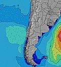 | 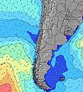 |  |  | 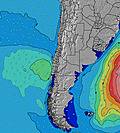 | 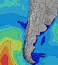 | |||||||||||||
Wave Height (m) Direction Period (s) | SW 10 | SW 12 | SW 10 | SW 11 | SW 10 | SW 10 | SW 12 | SSW 12 | SW 13 | SW 13 | SW 12 | SW 12 | SW 12 | SW 12 | SW 12 | SW 12 | SW 12 | SW 12 | SW 12 | SW 12 | SW 12 |
Wave Graph | |||||||||||||||||||||
211 | 593 | 296 | 524 | 315 | 348 | 303 | 161 | 330 | 512 | 634 | 773 | 1065 | 1048 | 1031 | 944 | 944 | 944 | 944 | 944 | 1031 | |
Wind (km/h) | |||||||||||||||||||||
Wind State on-shore cross-onshore cross-shore cross-offshore off-shore glassy | cross | cross-on | cross | cross-on | cross-on | glassy | cross-on | cross | glassy | glassy | glassy | glassy | glassy | glassy | glassy | glassy | glassy | glassy | glassy | glassy | glassy |
High Tide | 11:33AM1.06m | 00:13AM0.81m | 12:06PM0.98m | 00:55AM0.84m | 12:43PM0.88m | ||||||||||||||||
Low Tide | 6:08PM0.11m | 5:51AM0.25m | 6:36PM0.13m | 6:41AM0.30m | 7:08PM0.15m | ||||||||||||||||
— | — | — | — | — | — | 7:11 | — | — | — | — | — | — | — | 7:11 | — | — | — | — | — | — | |
— | — | 6:21 | — | — | — | — | — | — | — | 6:21 | — | — | — | — | — | — | — | 6:22 | — | — | |
mm | — | — | — | — | — | — | — | — | — | — | — | — | — | — | — | — | — | — | — | — | — |
Temp °C | 21 | 22 | 21 | 20 | 20 | 20 | 19 | 20 | 22 | 22 | 21 | 20 | 19 | 19 | 19 | 19 | 21 | 22 | 20 | 19 | 20 |
Feels °C | 20 | 22 | 20 | 19 | 20 | 20 | 18 | 20 | 23 | 23 | 22 | 21 | 19 | 19 | 19 | 19 | 21 | 23 | 21 | 20 | 21 |
Swell 1 Height (m) Direction Period (s) | SW 11 | SW 12 | SW 10 | SW 11 | SW 10 | SW 10 | SW 7 | SW 8 | SW 7 | SW 13 | SW 12 | SW 12 | SW 12 | SW 12 | SW 12 | SW 12 | SW 12 | SW 12 | SW 12 | SW 12 | SW 12 |
110 | 593 | 296 | 524 | 315 | 348 | 115 | 160 | 105 | 512 | 634 | 773 | 1065 | 1048 | 1031 | 944 | 944 | 944 | 944 | 944 | 1031 | |
Swell 2 Height (m) Direction Period (s) | WSW 14 | WSW 14 | WSW 13 | WSW 13 | SSW 12 | SSW 12 | SW 12 | SSW 12 | SW 13 | SW 7 | SW 7 | SW 7 | NW 13 | NW 12 | NW 12 | NW 11 | NW 11 | NW 12 | SW 20 | SW 21 | SSW 21 |
133 | 107 | 154 | 118 | 172 | 172 | 303 | 161 | 330 | 102 | 121 | 86 | 6 | 6 | 5 | 5 | 5 | 5 | 16 | 17 | 42 | |
Swell 3 Height (m) Direction Period (s) | SSW 14 | WSW 10 | SSW 13 | W 12 | WSW 13 | WSW 13 | WSW 13 | SW 14 | SSW 12 | SSW 12 | SSW 12 | NW 12 | — | — | — | — | — | SW 20 | NW 12 | NW 12 | NW 11 |
73 | 10 | 147 | 3 | 154 | 116 | 116 | 116 | 123 | 56 | 60 | 6 | — | — | — | — | — | 16 | 6 | 5 | 5 | |
Wind waves Height (m) Direction Period (s) | SW 10 | — | — | — | — | — | — | — | — | — | — | — | — | — | — | — | — | — | — | — | — |
211 | — | — | — | — | — | — | — | — | — | — | — | — | — | — | — | — | — | — | — | — | |
Nearest Offshore or Glassy | |||||||||||||||||||||
Distance (km) | 179 | 179 | 95 | 172 | 45 | 0 | 45 | 45 | 0 | 0 | 0 | 0 | 0 | 0 | 0 | 0 | 0 | 0 | 0 | 0 | 0 |
Best forecast wave conditions in Tarapaca | |||||||||||||||||||||
Best forecast wave conditions in Chile | |||||||||||||||||||||
Header Global | |||||||||||||||||||||
- Map Icons:
 Break
Break Live Wave Height (m)
 Live Wind Speed (km/h)
 Surf Rating (10 Max)
 Ocean Swells (m)
- Wind Speed (km/h)
Latest Updates


FREE! Surf-Forecast.com widget for your website
The surf report / weather widget below is available to embed on third party websites free of charge and provides a summary of our Barrancon surf forecast. Simply grab the html code snippet that we provide and paste it into your own site. You can choose your preferred language and metric/imperial units for the surf forecast feed to suit users of your site. Click here to get the code.
 Nearest