

Surf Forecasts:

How big are the waves at Airports today (03 Aug):
- Morning surf: Morning surf (03 Aug, local time) - 4ft (1.2m), 16s period with SSW swell.
- Afternoon surf: Afternoon surf (03 Aug, local time) - 4ft (1.2m), 16s period with SSW swell.
- Evening surf: Evening surf (03 Aug, local time) - 4ft (1.2m), 16s period with SSW swell.
The current surf forecast for Airports at 12AM is: 0.9m 16s primary swell from a South-southwest direction and 1.2m 9s secondary swell from a South-southeast direction, 1.0m 10s secondary swell from a Northwest direction (forecast issued at 04:00pm August 02). The wind direction is predicted to be cross-onshore.
| Time (+05) & Date | Wave Height | Wave Period |
|---|---|---|
| Morning (03 Aug) | 4ft (1.2m) | 16s |
| Afternoon (03 Aug) | 4ft (1.2m) | 16s |
| Evening (03 Aug) | 4ft (1.2m) | 16s |
Table - waves today at Airports. (Swell directed towards the surf break)
Short Range ForecastModerate rain (total 10mm), heaviest on Mon afternoon. Warm (max 28°C on Sun afternoon, min 27°C on Sun night). Wind will be generally light. | ||||||||||||||||||||
Sun 2 | Monday 3 | Tuesday 4 | ||||||||||||||||||
2 PM | 5 PM | 8 PM | 11 PM | 2 AM | 5 AM | 8 AM | 11 AM | 2 PM | 5 PM | 8 PM | 11 PM | 2 AM | 5 AM | 8 AM | 11 AM | 2 PM | 5 PM | 8 PM | 11 PM | |
Swell Height Map |  | 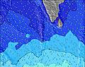 | 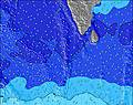 | 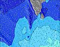 | 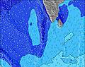 | 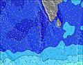 | 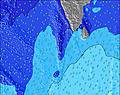 | 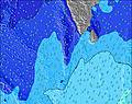 | ||||||||||||
Wave Height (m) Direction Period (s) | SSW 13 | NW 11 | SSW 16 | SSW 16 | SSW 16 | SSW 16 | SSW 16 | SSW 16 | SSW 16 | SSW 16 | SSW 16 | SSW 16 | SSW 15 | SSW 15 | SSW 15 | SSW 15 | SSW 15 | SSW 15 | SSW 21 | SSW 15 |
Wave Graph | ||||||||||||||||||||
273 | 254 | 620 | 387 | 481 | 724 | 742 | 779 | 761 | 733 | 724 | 706 | 670 | 653 | 644 | 405 | 405 | 485 | 625 | 537 | |
Wind (km/h) | ||||||||||||||||||||
Wind State on-shore cross-onshore cross-shore cross-offshore off-shore glassy | cross-on | cross-on | cross-on | cross-on | cross-on | on | on | on | on | on | on | on | on | on | on | on | on | on | on | on |
High Tide | 3:26PM1.03m | 3:47AM0.89m | 3:47PM0.99m | 4:26AM0.87m | 4:09PM0.93m | |||||||||||||||
Low Tide | 9:43PM0.19m | 9:35AM0.26m | 10:11PM0.17m | 10:08AM0.34m | 10:43PM0.16m | |||||||||||||||
— | — | — | — | — | 6:09 | — | — | — | — | — | — | — | 6:09 | — | — | — | — | — | — | |
— | 6:17 | — | — | — | — | — | — | — | 6:17 | — | — | — | — | — | — | — | 6:17 | — | — | |
mm | — | — | — | — | 1 | — | — | 1 | 1 | 2 | 2 | 1 | — | — | — | — | — | — | — | — |
Temp °C | 28 | 28 | 28 | 28 | 27 | 27 | 27 | 27 | 27 | 27 | 27 | 27 | 27 | 27 | 27 | 27 | 28 | 28 | 28 | 28 |
Feels °C | 30 | 30 | 31 | 30 | 30 | 30 | 30 | 30 | 30 | 30 | 30 | 30 | 30 | 30 | 31 | 30 | 31 | 30 | 31 | 32 |
Swell 1 Height (m) Direction Period (s) | SSE 9 | SSE 9 | SSW 16 | SSE 9 | SSE 9 | SSW 16 | SSW 16 | SSW 16 | SSW 16 | SSW 16 | SSW 16 | SSW 16 | SSW 15 | SSW 15 | SSW 15 | SSW 15 | SSW 15 | SSW 15 | SSW 14 | SSW 15 |
207 | 207 | 620 | 202 | 197 | 724 | 742 | 779 | 761 | 733 | 724 | 706 | 670 | 653 | 644 | 405 | 405 | 485 | 325 | 537 | |
Swell 2 Height (m) Direction Period (s) | NW 11 | NW 11 | SSE 9 | NW 10 | SSW 16 | SSE 8 | SSE 8 | SSE 8 | SSE 8 | SSE 8 | SSE 8 | SSE 8 | S 8 | S 8 | NW 8 | S 8 | S 8 | S 9 | SSW 21 | S 9 |
229 | 254 | 202 | 200 | 481 | 188 | 173 | 169 | 153 | 153 | 125 | 125 | 76 | 74 | 62 | 57 | 74 | 76 | 625 | 162 | |
Swell 3 Height (m) Direction Period (s) | SSW 13 | SSW 13 | NW 10 | SSW 16 | NW 10 | NW 10 | NW 9 | NW 9 | NW 9 | NW 9 | NW 8 | NW 8 | NW 8 | NW 8 | S 8 | NW 8 | NW 8 | NW 8 | S 9 | S 20 |
273 | 249 | 216 | 387 | 192 | 137 | 125 | 118 | 112 | 107 | 102 | 100 | 80 | 65 | 55 | 62 | 62 | 48 | 99 | 377 | |
Wind waves Height (m) Direction Period (s) | — | — | — | — | — | — | — | — | — | — | — | — | — | — | — | — | — | — | — | — |
— | — | — | — | — | — | — | — | — | — | — | — | — | — | — | — | — | — | — | — | |
Nearest Offshore or Glassy | ||||||||||||||||||||
Distance (km) | 157 | 157 | 157 | 157 | 157 | 57 | 157 | 57 | 57 | 57 | 57 | 57 | 57 | 57 | 57 | 57 | 57 | 57 | 57 | 57 |
Best forecast wave conditions in Huvadhoo Atoll | ||||||||||||||||||||
Best forecast wave conditions in Maldives | ||||||||||||||||||||
Header Global | ||||||||||||||||||||
- Map Icons:
 Break
Break Live Wave Height (m)
 Live Wind Speed (km/h)
 Surf Rating (10 Max)
 Ocean Swells (m)
- Wind Speed (km/h)
Latest Updates


FREE! Surf-Forecast.com widget for your website
The surf report / weather widget below is available to embed on third party websites free of charge and provides a summary of our Airports surf forecast. Simply grab the html code snippet that we provide and paste it into your own site. You can choose your preferred language and metric/imperial units for the surf forecast feed to suit users of your site. Click here to get the code.
 Nearest