

Washington State Surf
Detailed Washington State surf forecast maps and the latest eyeball surf report from local surfers in the region. Near-shore swell is shown on the map together with the surf forecast rating for spots in Washington State. Find the best places to surf in offshore conditions by selecting the wind option on the forecast map. Windsurfers and kite surfers can also use this option to find more favorable cross-shore conditions in Washington State. Our local Wavefinder indicates where some of the best conditions are likely to be found in Washington State over the next 7 days. Surf photos from Washington State and reviews of the best spots and surfing conditions have been provided by local surfers.
Washington State Surf Forecast
Washington State Surf Forecast map for predicting the best wave and wind conditions across the region. For surfers, the map shows the most powerful swell tracking across near-shore open water and not the peak waves experienced by boats out at sea. Move your mouse over the ocean swell symbols or the surf breaks on the coastline to see a more detailed surf forecast including wave period and wind conditions. The forecast updates every 6 hours and most live weather reports update every hour. You can animate the Washington State Surf map or show live wind and wave conditions as reported from wavebuoys and local weather stations. Surf breaks shown along the Washington State coastline are also listed below.
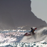
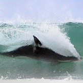
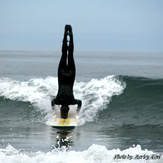
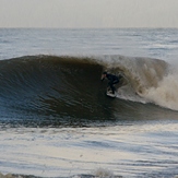
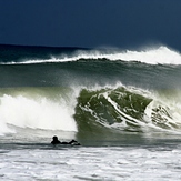
Washington State Photos
Washington State Wavefinder
| Sat | Sunday 28 | Monday 29 | Tuesday 30 | Wednesday 01 | Thursday 02 | Fri | ||||||||||||
Night | AM | PM | Night | AM | PM | Night | AM | PM | Night | AM | PM | Night | AM | PM | Night | AM | PM | |
Best forecast wave conditions in Washington State |  |  | | |  | |  | |  | |  |  |  | | |  | | |
| Rating | ||||||||||||||||||
Wave Height (m) & direction (?) | 1.8 WSW | 2.1 W | 2.0 W | 1.7 W | 2.2 W | 1.6 W | 2.0 W | 3.0 W | 2.5 W | 2.0 WNW | 1.3 W | 1.3 WNW | 0.8 WSW | 1.7 WSW | 1.6 W | 0.8 WSW | 0.5 SW | 0.4 SW |
| Period(s) (?) | 8 | 12 | 11 | 11 | 11 | 11 | 11 | 12 | 11 | 10 | 10 | 9 | 7 | 7 | 7 | 7 | 16 | 16 |
| Energy(?) | 414 | 1186 | 969 | 637 | 1086 | 564 | 1022 | 2115 | 1672 | 778 | 313 | 254 | 51 | 255 | 272 | 69 | 122 | 88 |
| Wind (km/h) | ||||||||||||||||||
| Wind State(?) | cross- off | cross- off | cross- off | cross- off | cross | cross- off | off | cross- off | cross- off | cross- off | cross- off | cross | cross- off | glass | cross- off | glass | cross- off | off |
High Tide / height (m) | 8:08PM 3:37AM | 5:23PM | 4:10AM | 7:18PM | 8:34PM 4:36AM | 5:55AM | 7:09AM | 8:17PM | 7:25AM | 10:21PM | 9:09AM | |||||||
Low Tide / height (m) | 9:42PM | 11:45AM | 10:04PM | 12:37PM | 10:42PM | 10:10PM | 1:36PM | 12:13AM | 1:38AM | 2:54PM | 4:25AM | 3:29PM 10:29AM | ||||||
Summary | rain shwrs | light rain | light rain | rain shwrs | rain shwrs | light rain | rain shwrs | some clouds | some clouds | clear | some clouds | cloudy | heavy rain | rain shwrs | some clouds | some clouds | clear | some clouds |
Rain (mm) | 2 | 2 | 3 | 4 | 1 | 1 | 2 | - | - | - | - | - | 18 | 2 | - | - | - | - |
High °C | 11 | 9 | 8 | 7 | 7 | 9 | 8 | 7 | 10 | 9 | 9 | 9 | 8 | 8 | 10 | 10 | 11 | 14 |
Low °C | 10 | 8 | 8 | 5 | 6 | 9 | 6 | 5 | 8 | 9 | 8 | 9 | 6 | 8 | 10 | 6 | 6 | 14 |
Chill °C (?) | 8 | 6 | 5 | 4 | 5 | 7 | 6 | 5 | 7 | 6 | 7 | 7 | 8 | 7 | 8 | 10 | 10 | 13 |
Sunrise | - | 6:00 | - | - | 6:01 | - | - | 6:00 | - | - | 5:58 | - | - | 5:56 | - | - | 5:56 | - |
Sunset | - | - | 8:27 | - | - | 8:28 | - | - | 8:24 | - | - | 8:27 | - | - | 8:30 | - | - | 8:37 |
| Swell1 (m) & direction | 1.5 W | 2.1 W | 2.0 W | 1.7 W | 2.2 W | 1.6 W | 2.0 W | 3.0 W | 2.5 W | 2.0 WNW | 1.3 W | 1.3 WNW | 0.8 WSW | 0.5 SW | 0.4 SW | 0.8 WSW | 1.0 W | 0.8 W |
| Period (s) | 8 | 12 | 11 | 11 | 11 | 11 | 11 | 12 | 11 | 10 | 10 | 9 | 7 | 18 | 15 | 7 | 7 | 7 |
| Swell2 (m) & direction | 0.7 SSW | 0.3 SW | 0.3 SW | 0.3 SW | 0.6 SW | 0.3 SW | 0.4 SW | 0.4 SW | 0.4 SW | 0.4 SW | 0.3 SW | 0.3 SW | 0.4 WNW | 0.1 W | 0.4 S | 0.3 SW | 0.5 SW | 0.4 SW |
| Period (s) | 6 | 16 | 16 | 16 | 15 | 15 | 15 | 14 | 14 | 14 | 13 | 13 | 8 | 13 | 6 | 16 | 16 | 16 |
| Wind waves (m) & direction | 1.8 WSW | - | - | - | - | - | - | - | - | 2.0 WNW | - | - | - | 1.7 WSW | 1.6 W | - | - | - |
| Period (s) | 8 | - | - | - | - | - | - | - | - | 10 | - | - | - | 7 | 7 | - | - | - |
Washington State Surf Breaks
Washington has plenty of breaks to explore.....the problem is getting to them. The state has in place several property laws where large parts of the coastline are privately owned. The road network consists mainly of small side roads and trails down to many of the beaches. Mainly beach breaks. Cold water all year round so bring a winter wetsuit (4/3 and up).


 Nearest