
Whaler Island Surf Guide
Whaler Island in Del Norte County is a sheltered reef break that has inconsistent surf. Winter is the best time of year for surfing here. Offshore winds are from the east. Most of the surf here comes from groundswells and the optimum swell angle is from the northwest. A right hand reef break. Best around low tide. Unlikely to be too crowded, even when the surf is up. Watch out for sharks and rocks.
Whaler Island Spot Info
| Type: | Rating: | Reliability: | Todays Sea Temp*: |
|---|---|---|---|
| inconsistent | 10.1°C*ocean temperature recorded from satellite |
Surfing Whaler Island:
The best conditions reported for surf at Whaler Island occur when a Northwest swell combines with an offshore wind direction from the East.
What's the best time of year to surf Whaler Island (for consistent clean waves)?
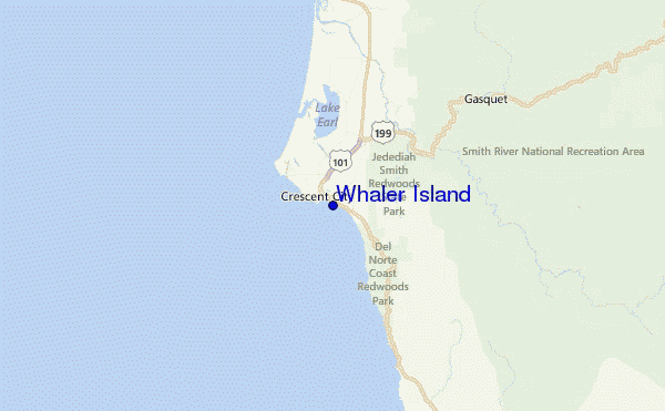
Explore Whaler Island Location Map
Interactive Whaler Island surf break location map. View information about nearby surf breaks, their wave consistency and rating compared to other spots in the region. Current swell conditions from local buoys are shown along with live wind speed and direction from nearby weather stations. Click icons on the map for more detail. The nearest passenger airport to Whaler Island is Chico Muni Airport (CIC) in USA, which is 292 km (181 miles) away (directly). The second closest airport to Whaler Island is Beale Afb (Marysville) Airport (BAB), also in USA, 372 km (231 miles) away.
- Map Icons:
 Break
Break Live Wave Height (m)
 Live Wind Speed (km/h)
 Surf Rating (10 Max)
 Ocean Swells (m)
- Wind Speed (km/h)
Monday, 8 June 2026, 19:15 Local Time
| Mon | Tue | |||
| 8PM | 11PM | 2AM | 5AM | |
| Wave (m) | ||||
| Period (s) | 8 | 9 | 9 | 9 |
| Wind (km/h) | ||||
| Wind State | cross | cross | glass | cross |
Tides at Whaler Island
| NEXT | IS AT (local time) | remaining |
|---|---|---|
| high tide | ||
| low tide |

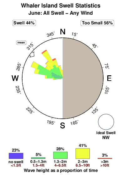
Swell History at Whaler Island
Surf stats for Whaler Island, see the swell variation by month or season on the history page here.

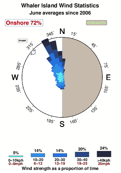
Wind History at Whaler Island
Wind stats for Whaler Island, see the variation in direction and stength by month or season on the history page here.
Other Nearby Breaks Closest To:
Discover surf breaks near Whaler Island. Click below to view there surf guides.
 Nearest