

The Point Surf Guide
The Point in North Carolina is an exposed beach break that has reasonably consistent surf The best wind direction is from the northeast. Tends to receive a mix of groundswells and windswells and the ideal swell angle is from the south. The beach break favours left handers. Surfable at all stages of the tide. It very rarely gets crowded here. Take care of the strong rips here.
The Point Spot Info
| Type: | Rating: | Reliability: | Todays Sea Temp*: |
|---|---|---|---|
| fairly consistent | 23.7°C*ocean temperature recorded from satellite |
Surfing The Point:
The best conditions reported for surf at The Point occur when a South swell combines with an offshore wind direction from the Northwest.
What's the best time of year to surf The Point (for consistent clean waves)?
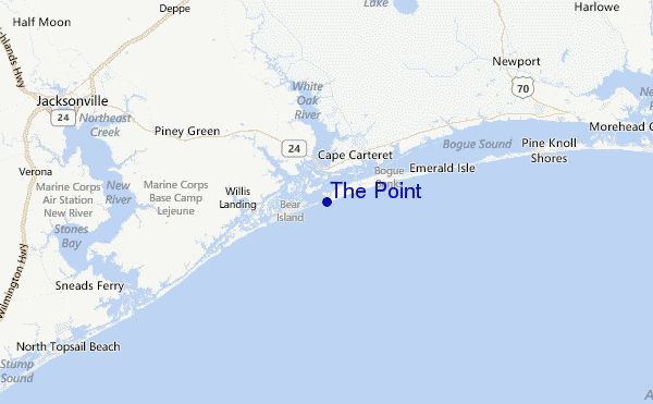
Explore The Point Location Map
Interactive The Point surf break location map. View information about nearby surf breaks, their wave consistency and rating compared to other spots in the region. Current swell conditions from local buoys are shown along with live wind speed and direction from nearby weather stations. Click icons on the map for more detail. The closest passenger airport to The Point is New River Mcas (Jacksonville) Airport (NCA) in USA, 32 km (20 miles) away (directly). The second nearest airport to The Point is Cherry Point Mcas Airport (NKT), also in USA, 35 km (22 miles) away.
- Map Icons:
 Break
Break Live Wave Height (m)
 Live Wind Speed (km/h)
 Surf Rating (10 Max)
 Ocean Swells (m)
- Wind Speed (km/h)
Wednesday, 10 June 2026, 14:07 Local Time
| Wednesday 10 | ||||
| 11AM | 2PM | 5PM | 8PM | |
| Wave (m) | ||||
| Period (s) | 8 | 8 | 8 | 4 |
| Wind (km/h) | ||||
| Wind State | cross | cross- on |
cross- on |
cross- on |
Tides at The Point
| NEXT | IS AT (local time) | remaining |
|---|---|---|
| high tide | ||
| low tide |
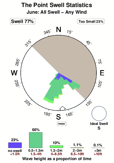
Swell History at The Point
Surf stats for The Point, see the swell variation by month or season on the history page here.

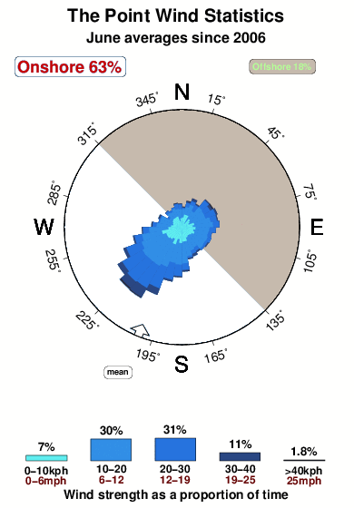
Wind History at The Point
Wind stats for The Point, see the variation in direction and stength by month or season on the history page here.
Other Nearby Breaks Closest To:
Discover surf breaks near The Point. Click below to view there surf guides.
- Bogue Pier
 Beach/jetty
 2.0
2.0
Reliability: fairly consistent12km away - Atlantic Beach
- Beach
- 2.0
Reliability: inconsistent34km away - Triple S Pier
- Beach/jetty
- 2.0
Reliability: fairly consistent37km away - Topsail Island
- Beach/jetty
 4.0
4.0
Reliability: fairly consistent41km away - Shackleford Banks
- Beach
- 2.0
Reliability: very consistent46km away
 Nearest