
Batu Mandi Surf Guide
Batu Mandi in Central Java is an exposed reef break that has reliable surf. May-Oct (Dry Season) is the best time of year for waves. Works best in offshore winds from the north northeast. Most of the surf here comes from groundswells and the best swell direction is from the south. A reef breaks left. Unlikely to be too crowded, even when the surf is up. Hazards include rips and rocks.
Batu Mandi Spot Info
| Type: | Rating: | Reliability: | Todays Sea Temp*: |
|---|---|---|---|
| consistent | 28.1°C*ocean temperature recorded from satellite |
Surfing Batu Mandi:
The best conditions reported for surf at Batu Mandi occur when a South swell combines with an offshore wind direction from the North-northeast.
What's the best time of year to surf Batu Mandi (for consistent clean waves)?
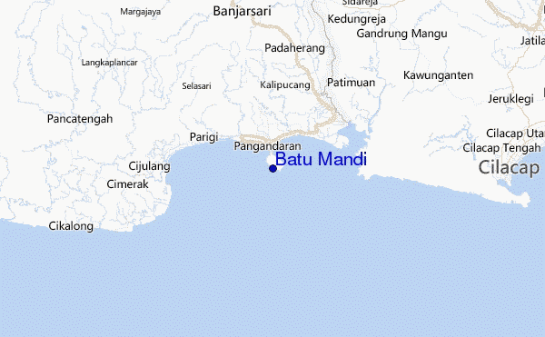
Explore Batu Mandi Location Map
Interactive Batu Mandi surf break location map. View information about nearby surf breaks, their wave consistency and rating compared to other spots in the region. Current swell conditions from local buoys are shown along with live wind speed and direction from nearby weather stations. Click icons on the map for more detail. The closest passenger airport to Batu Mandi is Tunggul Wulung (Cilacap) Airport (CXP) in Indonesia, 42 km (26 miles) away (directly). The second nearest airport to Batu Mandi is Penggung (Cirebon) Airport (CBN), also in Indonesia, 109 km (68 miles) away.
- Map Icons:
 Break
Break Live Wave Height (m)
 Live Wind Speed (km/h)
 Surf Rating (10 Max)
 Ocean Swells (m)
- Wind Speed (km/h)
Tuesday, 23 June 2026, 00:27 Local Time
| Mon | Tuesday 23 | |||
| 10PM | 1AM | 4AM | 7AM | |
| Wave (m) | ||||
| Period (s) | 16 | 16 | 15 | 15 |
| Wind (km/h) | ||||
| Wind State | glass | off | cross- off |
glass |
Tides at Batu Mandi
| NEXT | IS AT (local time) | remaining |
|---|---|---|
| high tide | ||
| low tide |
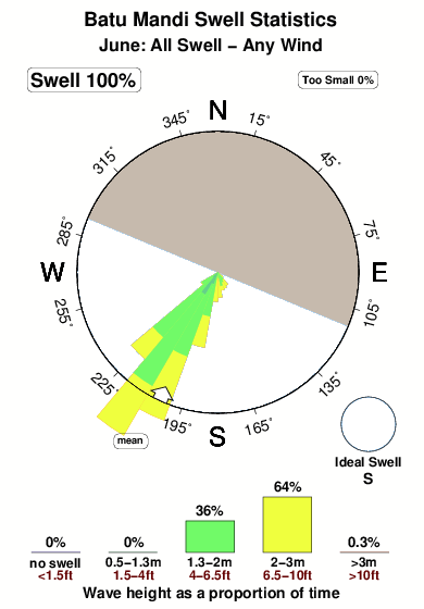
Swell History at Batu Mandi
Surf stats for Batu Mandi, see the swell variation by month or season on the history page here.

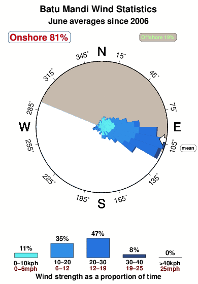
Wind History at Batu Mandi
Wind stats for Batu Mandi, see the variation in direction and stength by month or season on the history page here.
Other Nearby Breaks Closest To:
Discover surf breaks near Batu Mandi. Click below to view there surf guides.
 Nearest