

Surf Forecasts:

Right and Left Side surf forecast from 3 Aug 2026:
- Most powerful swell: Monday 10 Aug, 1PM (local time) - 13ft (4.0m), 14s period, W swell with 6,135 kJ wave energy.
Best Forecast Surf Conditions for Right and Left Side this week:
The most powerful waves expected at Right and Left Side in the next 16 days are 4.0m 14s and forecast to arrive on Monday (Aug 10) at 1PM. Winds are predicted to be cross-onshore at the time the swell arrives. The largest open ocean swell (not directed at the beach) is 3.0m 9s period and expected on Sunday (Aug 09) at 1PM.
| Wave Type | Time (ChST) & Date | Wave Height & Period |
|---|---|---|
| Next good surf (1 star+) | - | - |
| Best Surf | - | - |
| Most Powerful | 1PM (Mon 10th Aug) | 13ft (4.0m) 14s |
Table - best surf conditions forecast for Right and Left Side over the next 16 days.
The Lowdown
Alright, Rusty here. Let’s have a good look at Right and Left Side. This is a reef break, exposed to the north, and it's inconsistent, so it needs a proper swell to show its teeth. The water's sitting at 86°, which is about 0.5° warmer than the norm for this time of year, so nothing wild there – just your typical warm tropical bath.
Right now, the story is pretty grim. We’ve got a solid stretch of poor surf conditions right through the first week of August. The wind is hammering in from the WSW at 22 to 22 mph, cross-on or cross, and it's lumpy and choppy. The swell is there, between 4 ft and 6 ft, but it’s a short-period windswell, and the energy is moderate to strong (697 to 1784), but it's completely blown out. No point even thinking about a paddle.
We hit a bit of a lull in the quality, but things start to look a little more interesting around Saturday the 8th of August. The swell bumps up to 8 ft from the west, with a 12-second period, and the energy jumps to strong (2721). The wind is still cross-shore at 16 mph, creating a cross-chop. It's marginal, but it's the first sign of something more substantial. The same goes for Sunday morning, the 9th, with 6 ft from the NW and a 14-second period, but the wind stays on it.
Now, here’s the real kicker. From Sunday afternoon the 9th right through to the end of the 16-day window, the swell gets seriously big. We’re talking 12 ft to 13 ft from the west, with periods between 12 and 14 seconds. The energy is massive, hitting 6080 by Monday the 10th. But, and it's a big but, the wind is almost always a fresh 19-22 mph cross-on or cross-shore, making it lumpy, choppy, and messy. For a reef break, that’s just dangerous and ugly. It’s big enough for experts only, and honestly, with that wind, it’s looking more like a kiteboarding session than a surf.
If I had to pick a standout, it’s a tough call. The morning of Saturday the 8th of August offers the first real size with 8 ft west swell, but the wind isn't clean. The morning of Sunday the 9th is a touch smaller but with a longer period, but again, the wind is a problem. Nothing here is a true standout for paddle surfing. It’s all either too windy or too messy.
This is a long stretch of poor to marginal conditions. For a spot that's already inconsistent, this kind of blank run is what you’ve got to expect. Forecasts can change, but right now, I’d be finding something else to do for the next two weeks.
Rusty.
Short Range ForecastHeavy rain (total 40mm), heaviest during Wed night. Warm (max 29°C on Tue morning, min 28°C on Mon afternoon). Mainly fresh winds. | Days 5-7 Weather SummaryHeavy rain (total 22mm), heaviest during Sat night. Warm (max 29°C on Thu afternoon, min 27°C on Sat night). Wind will be generally light. | |||||||||||||||||||
Mon 3 | Tuesday 4 | Wednesday 5 | Thursday 6 | Friday 7 | Saturday 8 | Sunday 9 | ||||||||||||||
PM | Night | AM | PM | Night | AM | PM | Night | AM | PM | Night | AM | PM | Night | AM | PM | Night | AM | PM | Night | |
Swell Height Map |  | 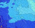 | 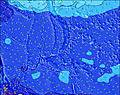 | 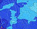 |  |  | 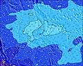 | |||||||||||||
Wave Height (m) Direction Period (s) | NE 14 | NE 14 | NNE 14 | NNE 13 | N 13 | N 13 | N 13 | NNW 13 | NNW 13 | NNW 13 | NNW 14 | NW 14 | NW 14 | W 12 | W 12 | W 12 | W 11 | NW 14 | W 13 | W 12 |
Wave Graph | ||||||||||||||||||||
659 | 581 | 631 | 632 | 663 | 633 | 643 | 703 | 892 | 965 | 990 | 1167 | 885 | 1278 | 1794 | 1817 | 1493 | 1330 | 4263 | 3337 | |
Wind (km/h) | ||||||||||||||||||||
Wind State on-shore cross-onshore cross-shore cross-offshore off-shore glassy | cross-on | cross-on | cross-on | cross | cross | cross-on | cross-on | cross-on | cross-on | cross-on | cross-on | cross-on | cross-on | cross-on | cross | cross | cross | cross | cross-on | cross-on |
High Tide | 11:06PM0.90m | 11:17AM0.74m | 11:30PM0.90m | 12:35PM0.71m | 11:59PM0.89m | 2:12PM0.71m | 00:35AM0.89m | 4:04PM0.73m | 1:21AM0.89m | 5:38PM0.78m | 2:19AM0.89m | 6:40PM0.83m | 3:28AM0.89m | |||||||
Low Tide | 4:31PM0.34m | 5:37AM0.41m | 5:06PM0.43m | 6:27AM0.34m | 5:46PM0.52m | 7:23AM0.27m | 6:34PM0.61m | 8:25AM0.20m | 7:41PM0.68m | 9:30AM0.13m | 9:14PM0.73m | 10:34AM0.07m | 10:45PM0.74m | |||||||
— | — | 6:05 | — | — | 6:05 | — | — | 6:05 | — | — | 6:05 | — | — | 6:07 | — | — | 6:07 | — | — | |
6:47 | — | — | 6:46 | — | — | 6:46 | — | — | 6:46 | — | — | 6:45 | — | — | 6:45 | — | — | 6:45 | — | |
mm | 4 | 4 | 4 | 4 | 7 | 3 | 5 | 6 | 3 | 3 | 4 | 2 | 1 | 4 | — | 1 | 4 | 3 | 4 | 11 |
Temp °C | 28 | 28 | 29 | 28 | 28 | 29 | 29 | 28 | 29 | 29 | 28 | 29 | 29 | 28 | 29 | 29 | 28 | 29 | 28 | 28 |
Feels °C | 27 | 29 | 29 | 27 | 28 | 30 | 29 | 29 | 31 | 30 | 29 | 30 | 31 | 30 | 31 | 31 | 29 | 30 | 28 | 29 |
Swell 1 Height (m) Direction Period (s) | NE 14 | NE 14 | NNE 14 | NNE 13 | N 13 | N 13 | N 13 | NNW 13 | NNW 13 | NNW 13 | NNW 14 | NW 14 | NW 14 | NW 14 | NW 14 | NW 14 | NW 14 | NW 14 | ENE 12 | ENE 12 |
659 | 581 | 631 | 632 | 663 | 633 | 643 | 703 | 892 | 965 | 990 | 1167 | 885 | 656 | 746 | 659 | 924 | 1330 | 184 | 90 | |
Swell 2 Height (m) Direction Period (s) | SSE 9 | SSE 9 | SE 8 | SE 8 | SE 8 | ENE 13 | NE 12 | S 6 | ENE 11 | SSE 10 | SSE 9 | ENE 10 | ENE 10 | ENE 11 | ENE 11 | ENE 11 | ENE 14 | ENE 13 | SE 10 | NE 15 |
7 | 8 | 18 | 18 | 17 | 32 | 35 | 28 | 44 | 56 | 47 | 37 | 35 | 138 | 99 | 101 | 290 | 253 | 15 | 55 | |
Swell 3 Height (m) Direction Period (s) | NNE 20 | ENE 14 | ENE 14 | ENE 13 | ENE 13 | SE 13 | E 18 | ENE 11 | SSE 8 | WNW 10 | ENE 10 | SE 9 | SE 9 | SE 9 | ENE 14 | ENE 14 | SE 10 | SE 10 | SE 10 | SE 9 |
38 | 19 | 18 | 17 | 33 | 7 | 6 | 51 | 24 | 41 | 41 | 21 | 21 | 21 | 82 | 81 | 16 | 15 | 15 | 14 | |
Wind waves Height (m) Direction Period (s) | WSW 7 | WSW 8 | WSW 8 | WSW 8 | WSW 8 | WSW 8 | WSW 8 | W 8 | WSW 8 | W 8 | W 9 | W 9 | W 10 | W 12 | W 12 | W 12 | W 11 | WSW 9 | W 13 | W 12 |
428 | 554 | 512 | 576 | 763 | 745 | 722 | 566 | 574 | 562 | 668 | 580 | 740 | 1278 | 1794 | 1817 | 1493 | 1076 | 4263 | 3337 | |
Nearest Offshore or Glassy | ||||||||||||||||||||
Distance (km) | 1863 | 1858 | 1835 | 1863 | 1835 | 1835 | 1863 | 1835 | 1835 | 1904 | 16 | 1835 | 16 | 16 | 16 | 1904 | 1835 | 1835 | 1904 | 1835 |
Best forecast wave conditions in Guam | ||||||||||||||||||||
Best forecast wave conditions in Guam | ||||||||||||||||||||
Header Global | ||||||||||||||||||||
- Map Icons:
 Break
Break Live Wave Height (m)
 Live Wind Speed (km/h)
 Surf Rating (10 Max)
 Ocean Swells (m)
- Wind Speed (km/h)
Latest Updates


FREE! Surf-Forecast.com widget for your website
The surf report / weather widget below is available to embed on third party websites free of charge and provides a summary of our Right and Left Side surf forecast. Simply grab the html code snippet that we provide and paste it into your own site. You can choose your preferred language and metric/imperial units for the surf forecast feed to suit users of your site. Click here to get the code.
Information about the Right and Left Side Surf forecast
The above surf forecast table for Right and Left Side provides essential information for determining whether the surfing conditions will be good over the next 16 days. A general guide to surfing at Right and Left Side can be found by selecting the local surf guide option on the grey menu. Our Right and Left Side surf forecast is unique since it includes wave energy (power) that defines the real feel of the surf rather than just the height or the period. If you surf the same spot (Right and Left Side) regularly then make a mental note of the wave energy from the surf forecast table each time you go. Very soon you may start to choose your surf days based on the wave energy alone combined with our forecast of favourable offshore wind conditions. Our star ratings will help here and of course you will also find the usual wave height and period predictions on our surf forecasts as well as a full break down of the swell components under our advanced users option (to reveal that, click the little Einstein character under the tide times).
Further information to help with frequently asked questions about our surf forecast for Right and Left Side may be found under the help tab on the top menu and also by moving your mouse over the question marks on the surf forecast table itself. Please always bear in mind that the forecast is for near-shore open water and local factors at each surf break influence the actual breaking wave height, such as the beach / reef profile, water depths offshore and shelter.
Right and Left Side is 1 km (1 miles) from Agana. If you plan a holiday in Guam, look for hotels and other accommodation in Agana. Agana has rooms for a wide range of budgets as well as car hire and transport links.
 Nearest