

Surf Forecasts:

How big are the waves at Westport-The Groins today (08 Jun):
- Afternoon surf: Afternoon surf (08 Jun, local time) - 2ft (0.6m), 15s period with SW swell.
- Evening surf: Evening surf (08 Jun, local time) - 5ft (1.6m), 8s period with SSW swell.
The current surf forecast for Westport-The Groins at 7PM is: 1.4m 8s primary swell from a South-southwest direction and 0.6m 15s secondary swell from a Southwest direction (forecast issued at 04:00pm June 08). An open ocean swell of 0.7m 4s is not directed at the surf break. The wind direction is predicted to be cross-offshore.
| Time (PDT) & Date | Wave Height | Wave Period |
|---|---|---|
| Morning (08 Jun) | - | - |
| Afternoon (08 Jun) | 2ft (0.6m) | 15s |
| Evening (08 Jun) | 5ft (1.6m) | 8s |
Table - waves today at Westport-The Groins. (Swell directed towards the surf break)
Updates in hr min s Forecast update imminent
Short Range ForecastHeavy rain (total 29mm), heaviest during Mon afternoon. Very mild (max 13°C on Mon night, min 10°C on Wed night). Mainly fresh winds. | ||||||||||||||||||||||||
Mon 8 | Tuesday 9 | Wednesday 10 | Thu 11 | |||||||||||||||||||||
2 PM | 5 PM | 8 PM | 11 PM | 2 AM | 5 AM | 8 AM | 11 AM | 2 PM | 5 PM | 8 PM | 11 PM | 2 AM | 5 AM | 8 AM | 11 AM | 2 PM | 5 PM | 8 PM | 11 PM | 2 AM | 5 AM | 8 AM | 11 AM | |
Swell Height Map |  | 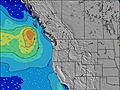 | 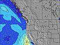 | 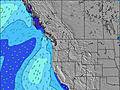 | 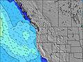 | 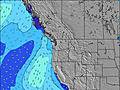 | 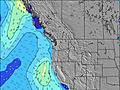 | 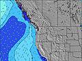 | 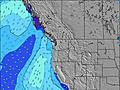 | 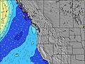 | ||||||||||||||
Wave Height (m) Direction Period (s) | SW 15 | SW 15 | SSW 8 | SW 8 | SSW 8 | WSW 8 | W 8 | WSW 9 | WSW 9 | W 9 | W 9 | W 9 | W 9 | W 9 | W 9 | W 9 | W 9 | W 9 | W 9 | W 9 | W 9 | W 9 | W 10 | W 10 |
Wave Graph | ||||||||||||||||||||||||
215 | 171 | 292 | 353 | 196 | 534 | 675 | 888 | 841 | 715 | 593 | 613 | 580 | 528 | 469 | 408 | 357 | 357 | 311 | 268 | 270 | 249 | 260 | 249 | |
Wind (km/h) | ||||||||||||||||||||||||
Wind State on-shore cross-onshore cross-shore cross-offshore off-shore glassy | cross-off | cross-off | cross-off | off | cross-on | cross | cross | cross | cross | cross | cross | cross | cross | cross-on | cross-on | cross-on | cross-on | cross-on | cross-on | cross-on | on | on | on | cross-on |
High Tide | 7:54PM2.32m | 8:01AM1.83m | 8:40PM2.47m | 9:21AM1.83m | 9:26PM2.65m | 10:34AM1.93m | ||||||||||||||||||
Low Tide | 12:56PM0.33m | 2:07AM0.69m | 1:51PM0.49m | 3:09AM0.37m | 2:49PM0.64m | 4:06AM0.03m | ||||||||||||||||||
— | — | — | — | — | 5:22 | — | — | — | — | — | — | — | 5:20 | — | — | — | — | — | — | — | 5:20 | — | — | |
— | — | 9:07 | — | — | — | — | — | — | — | 9:08 | — | — | — | — | — | — | — | 9:09 | — | — | — | — | 9:09 | |
mm | 6 | 4 | 5 | 5 | 1 | — | 1 | — | 1 | 1 | 1 | 1 | 1 | 1 | 1 | — | — | — | — | — | — | — | — | — |
Temp °C | 12 | 12 | 12 | 13 | 12 | 12 | 12 | 13 | 12 | 12 | 12 | 12 | 12 | 12 | 12 | 12 | 13 | 13 | 12 | 12 | 11 | 10 | 10 | 12 |
Feels °C | 6 | 6 | 8 | 12 | 7 | 7 | 6 | 7 | 6 | 6 | 7 | 7 | 8 | 8 | 8 | 9 | 8 | 8 | 8 | 8 | 7 | 7 | 7 | 9 |
Swell 1 Height (m) Direction Period (s) | WSW 7 | SSW 7 | SSW 8 | SW 8 | SSW 8 | SSW 8 | SSW 8 | SW 14 | SW 14 | SW 21 | SW 14 | SW 14 | SW 20 | SW 20 | W 9 | W 9 | W 9 | W 9 | W 9 | W 9 | W 9 | W 9 | W 10 | W 10 |
127 | 138 | 292 | 353 | 196 | 75 | 44 | 130 | 128 | 224 | 127 | 97 | 188 | 306 | 469 | 408 | 357 | 357 | 311 | 268 | 270 | 235 | 260 | 223 | |
Swell 2 Height (m) Direction Period (s) | SW 15 | SW 15 | SW 15 | SW 14 | WSW 8 | SW 14 | SW 15 | SW 21 | SW 21 | SW 14 | SW 21 | SW 21 | SW 14 | SW 14 | SW 19 | SW 19 | SW 19 | SSW 19 | SW 18 | SW 18 | SW 18 | SW 18 | SW 18 | SW 18 |
215 | 171 | 134 | 132 | 176 | 132 | 75 | 162 | 224 | 128 | 162 | 218 | 96 | 65 | 303 | 303 | 303 | 243 | 255 | 249 | 249 | 249 | 249 | 249 | |
Swell 3 Height (m) Direction Period (s) | W 16 | W 8 | W 8 | SW 24 | SW 14 | SW 24 | SW 23 | SW 21 | W 15 | SSW 6 | SSW 18 | W 16 | W 16 | W 16 | SW 13 | SW 13 | SW 13 | SW 13 | SW 13 | SW 13 | SW 13 | SW 13 | SW 13 | SW 13 |
20 | 45 | 47 | 141 | 132 | 141 | 83 | 117 | 17 | 8 | 31 | 20 | 20 | 5 | 63 | 62 | 61 | 61 | 43 | 61 | 44 | 44 | 44 | 27 | |
Wind waves Height (m) Direction Period (s) | E 3 | ESE 4 | SE 4 | ESE 3 | NW 2 | WSW 8 | W 8 | WSW 9 | WSW 9 | W 9 | W 9 | W 9 | W 9 | W 9 | — | — | — | — | — | — | — | — | — | — |
11 | 17 | 14 | 5 | 1 | 534 | 675 | 888 | 841 | 715 | 593 | 613 | 580 | 528 | — | — | — | — | — | — | — | — | — | — | |
Nearest Offshore or Glassy | ||||||||||||||||||||||||
Distance (km) | 116 | 169 | 1 | 0 | 512 | 366 | 512 | 512 | 512 | 1120 | 143 | 143 | 140 | 51 | 45 | 3 | 963 | 1120 | 1021 | 105 | 6 | 3 | 3 | 3 |
Best forecast wave conditions in Washington State | ||||||||||||||||||||||||
Best forecast wave conditions in United States | ||||||||||||||||||||||||
Header Global | ||||||||||||||||||||||||
- Map Icons:
 Break
Break Live Wave Height (m)
 Live Wind Speed (km/h)
 Surf Rating (10 Max)
 Ocean Swells (m)
- Wind Speed (km/h)


FREE! Surf-Forecast.com widget for your website
The surf report / weather widget below is available to embed on third party websites free of charge and provides a summary of our Westport-The Groins surf forecast. Simply grab the html code snippet that we provide and paste it into your own site. You can choose your preferred language and metric/imperial units for the surf forecast feed to suit users of your site. Click here to get the code.
 Nearest