
State Line Surf Guide
State Line in Oregon_South is an exposed beach break that has pretty consitent surf. Summer offers the best conditions for surfing. Offshore winds blow from the northeast. Most of the surf here comes from groundswells and the best swell direction is from the southwest. The beach breaks offer lefts and rights. Best around mid tide. When it's working here, it can get crowded. Beware of rips, sharks and rocks.
State Line Spot Info
| Type: | Rating: | Reliability: | Todays Sea Temp*: |
|---|---|---|---|
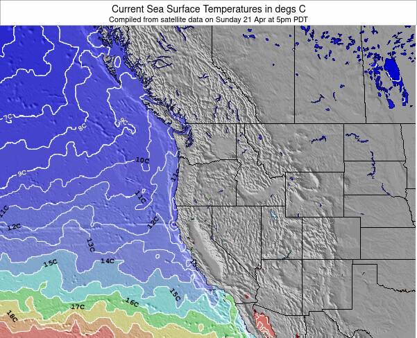
| fairly consistent | 9.3°C*ocean temperature recorded from satellite |
Surfing State Line:
The best conditions reported for surf at State Line occur when a Southwest swell combines with an offshore wind direction from the Northeast.
What's the best time of year to surf State Line (for consistent clean waves)?
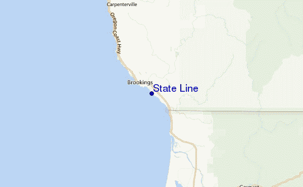
Explore State Line Location Map
Interactive State Line surf break location map. View information about nearby surf breaks, their wave consistency and rating compared to other spots in the region. Current swell conditions from local buoys are shown along with live wind speed and direction from nearby weather stations. Click icons on the map for more detail. The nearest passenger airport to State Line is Chico Muni Airport (CIC) in USA, which is 320 km (199 miles) away (directly). The second closest airport to State Line is Mc Minnville Muni (Mackminnville) Airport (MMV), also in USA, 363 km (225 miles) away.
- Map Icons:
 Break
Break Live Wave Height (m)
 Live Wind Speed (km/h)
 Surf Rating (10 Max)
 Ocean Swells (m)
- Wind Speed (km/h)
Wednesday, 10 June 2026, 05:30 Local Time
| Wednesday 10 | ||||
| 2AM | 5AM | 8AM | 11AM | |
| Wave (m) | ||||
| Period (s) | 19 | 19 | 18 | 18 |
| Wind (km/h) | ||||
| Wind State | off | off | cross- off |
cross |
Tides at State Line
| NEXT | IS AT (local time) | remaining |
|---|---|---|
| high tide | ||
| low tide |
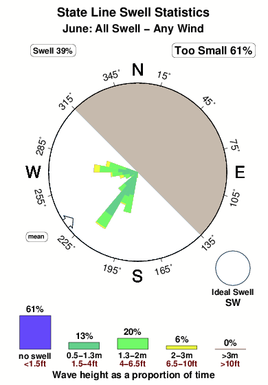
Swell History at State Line
Surf stats for State Line, see the swell variation by month or season on the history page here.

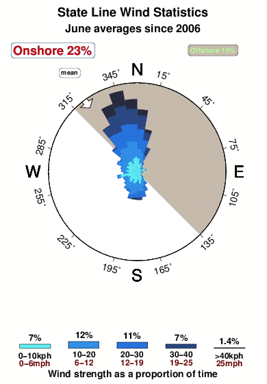
Wind History at State Line
Wind stats for State Line, see the variation in direction and stength by month or season on the history page here.
Other Nearby Breaks Closest To:
Discover surf breaks near State Line. Click below to view there surf guides.
- Brookings/South Jetty
 Beach/jetty
 1.0
1.0
Reliability: fairly consistent3km away - Rainbow Rocks
- Beach and reef
- 1.0
Reliability: fairly consistent7km away - Smith River and Kellogg Rd
- Beach
 2.0
2.0
Reliability: inconsistent14km away - Point St George
- Beach and point
- 2.0
Reliability: inconsistent28km away - Garths Reef
 Reef
Reef- 2.0
Reliability: inconsistent29km away
 Nearest