

Surf Forecasts:

| Time (WEST) & Date | Wave Height | Wave Period |
|---|---|---|
| Morning (20 Jul) | 0.5ft (0.1m) | 13s |
| Afternoon (20 Jul) | 0.5ft (0.1m) | 16s |
| Evening (20 Jul) | 0.5ft (0.1m) | 16s |
Table - waves today at Salema. (Swell directed towards the surf break)
Short Range ForecastMostly dry. Warm (max 25°C on Wed morning, min 17°C on Mon night). Mainly fresh winds. | ||||||||||||||||||||||||
Monday 20 | Tuesday 21 | Wednesday 22 | ||||||||||||||||||||||
1 AM | 4 AM | 7 AM | 10 AM | 1 PM | 4 PM | 7 PM | 10 PM | 1 AM | 4 AM | 7 AM | 10 AM | 1 PM | 4 PM | 7 PM | 10 PM | 1 AM | 4 AM | 7 AM | 10 AM | 1 PM | 4 PM | 7 PM | 10 PM | |
Swell Height Map |  | 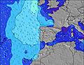 |  |  | 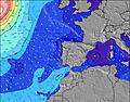 |  |  | 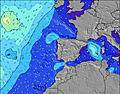 |  | |||||||||||||||
Wave Height (m) Direction Period (s) | NW 5 | NW 5 | WNW 5 | W 13 | S 16 | S 16 | S 16 | S 16 | S 16 | S 15 | S 15 | W 7 | W 7 | S 14 | S 15 | W 7 | W 7 | S 14 | S 14 | S 14 | S 13 | S 13 | S 13 | S 13 |
Wave Graph | ||||||||||||||||||||||||
0 | 0 | 0 | 3 | 5 | 5 | 5 | 5 | 5 | 4 | 4 | 4 | 4 | 4 | 4 | 4 | 4 | 4 | 4 | 4 | 3 | 3 | 3 | 3 | |
Wind (km/h) | ||||||||||||||||||||||||
Wind State on-shore cross-onshore cross-shore cross-offshore off-shore glassy | off | off | off | off | off | off | off | off | off | off | off | off | off | off | off | off | off | off | off | off | off | off | off | off |
High Tide | 7:29AM2.38m | 7:48PM2.47m | 8:20AM2.24m | 8:42PM2.24m | 9:18AM2.13m | 9:47PM2.07m | ||||||||||||||||||
Low Tide | 1:14AM0.46m | 1:25PM0.64m | 2:01AM0.66m | 2:19PM0.81m | 2:53AM0.84m | 3:25PM0.95m | ||||||||||||||||||
— | 6:30 | — | — | — | — | — | — | — | 6:31 | — | — | — | — | — | — | — | 6:31 | — | — | — | — | — | — | |
— | — | — | — | — | — | 8:52 | — | — | — | — | — | — | — | 8:51 | — | — | — | — | — | — | — | 8:51 | — | |
mm | — | — | — | — | — | — | — | — | — | — | — | — | — | — | — | — | — | — | — | — | — | — | — | — |
Temp °C | 18 | 18 | 18 | 21 | 23 | 23 | 21 | 18 | 18 | 18 | 17 | 21 | 24 | 23 | 22 | 19 | 19 | 19 | 18 | 22 | 25 | 23 | 22 | 19 |
Feels °C | 16 | 17 | 17 | 20 | 20 | 19 | 17 | 14 | 15 | 17 | 15 | 20 | 22 | 20 | 19 | 16 | 17 | 17 | 16 | 20 | 22 | 19 | 18 | 15 |
Swell 1 Height (m) Direction Period (s) | WNW 9 | WNW 8 | WNW 8 | WNW 8 | WNW 8 | WNW 8 | WNW 8 | WNW 8 | WNW 8 | WNW 7 | WNW 11 | WNW 11 | WNW 11 | WNW 11 | WNW 10 | WNW 10 | WNW 10 | WNW 10 | WNW 10 | WNW 10 | WNW 10 | WNW 10 | WNW 10 | WNW 10 |
15 | 14 | 13 | 13 | 13 | 13 | 12 | 11 | 11 | 11 | 12 | 12 | 22 | 22 | 21 | 20 | 20 | 33 | 33 | 32 | 32 | 32 | 31 | 18 | |
Swell 2 Height (m) Direction Period (s) | NW 8 | NW 8 | NW 9 | NW 9 | W 12 | W 12 | W 12 | WNW 11 | WNW 11 | WNW 11 | W 7 | W 7 | W 7 | S 14 | S 15 | W 7 | W 7 | N 9 | N 9 | S 14 | S 13 | S 13 | S 13 | N 10 |
2 | 2 | 3 | 3 | 3 | 3 | 3 | 13 | 12 | 12 | 4 | 4 | 4 | 4 | 4 | 4 | 4 | 2 | 2 | 4 | 3 | 3 | 3 | 2 | |
Swell 3 Height (m) Direction Period (s) | NW 9 | NW 9 | NW 8 | W 13 | S 16 | S 16 | S 16 | S 16 | S 16 | S 15 | S 15 | S 14 | S 14 | — | — | S 14 | NW 10 | S 14 | S 14 | S 14 | — | — | — | S 13 |
3 | 3 | 2 | 3 | 5 | 5 | 5 | 5 | 5 | 4 | 4 | 4 | 4 | — | — | 4 | 4 | 4 | 4 | 4 | — | — | — | 3 | |
Wind waves Height (m) Direction Period (s) | NW 5 | NW 5 | WNW 5 | NW 5 | NW 5 | NW 4 | NW 4 | NW 4 | NW 4 | NW 6 | NW 6 | NW 7 | NW 6 | NW 7 | NW 4 | NW 4 | NW 4 | NW 5 | NW 5 | NW 5 | NW 5 | NW 4 | NW 4 | NW 4 |
23 | 20 | 17 | 11 | 19 | 17 | 21 | 24 | 22 | 36 | 31 | 44 | 31 | 59 | 17 | 14 | 16 | 24 | 21 | 20 | 20 | 22 | 31 | 29 | |
Nearest Offshore or Glassy | ||||||||||||||||||||||||
Distance (km) | 349 | 187 | 248 | 187 | 771 | 617 | 524 | 389 | 187 | 80 | 80 | 15 | 816 | 816 | 514 | 80 | 80 | 80 | 80 | 187 | 381 | 716 | 381 | 283 |
Best forecast wave conditions in The Algarve | ||||||||||||||||||||||||
Best forecast wave conditions in Portugal | ||||||||||||||||||||||||
Header Global | ||||||||||||||||||||||||
- Map Icons:
 Break
Break Live Wave Height (m)
 Live Wind Speed (km/h)
 Surf Rating (10 Max)
 Ocean Swells (m)
- Wind Speed (km/h)


FREE! Surf-Forecast.com widget for your website
The surf report / weather widget below is available to embed on third party websites free of charge and provides a summary of our Salema surf forecast. Simply grab the html code snippet that we provide and paste it into your own site. You can choose your preferred language and metric/imperial units for the surf forecast feed to suit users of your site. Click here to get the code.
 Nearest