
Roads End Surf Guide
Roads End in Oregon_North is an exposed beach and reef break that has fairly consistent surf and can work at any time of the year. The best wind direction is from the east. Most of the surf here comes from groundswells and the optimum swell angle is from the west. Waves at the beach break both left and right together with both left and right hand reef breaks offshore.. When it's working here, it can get crowded. Take care of rips and sharks.
Roads End Spot Info
| Type: | Rating: | Reliability: | Todays Sea Temp*: |
|---|---|---|---|
| fairly consistent | 12.6°C*ocean temperature recorded from satellite |
Surfing Roads End:
The best conditions reported for surf at Roads End occur when a West swell combines with an offshore wind direction from the East.
What's the best time of year to surf Roads End (for consistent clean waves)?
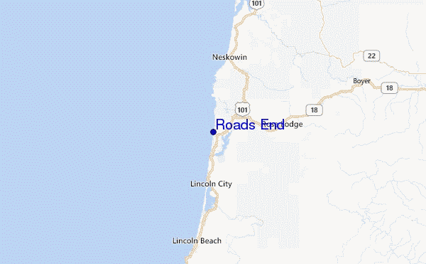
Explore Roads End Location Map
Interactive Roads End surf break location map. View information about nearby surf breaks, their wave consistency and rating compared to other spots in the region. Current swell conditions from local buoys are shown along with live wind speed and direction from nearby weather stations. Click icons on the map for more detail. The closest passenger airport to Roads End is Mc Minnville Muni (Mackminnville) Airport (MMV) in USA, which is 72 km (45 miles) away (directly). The second nearest airport to Roads End is Scappoose Industrial Airpark (San Luis) Airport (SPB), also in USA, 124 km (77 miles) away.
- Map Icons:
 Break
Break Live Wave Height (m)
 Live Wind Speed (km/h)
 Surf Rating (10 Max)
 Ocean Swells (m)
- Wind Speed (km/h)
Tuesday, 9 June 2026, 17:59 Local Time
| Tuesday 09 | ||||
| 2PM | 5PM | 8PM | 11PM | |
| Wave (m) | ||||
| Period (s) | 9 | 9 | 9 | 9 |
| Wind (km/h) | ||||
| Wind State | on | on | on | on |
Tides at Roads End
| NEXT | IS AT (local time) | remaining |
|---|---|---|
| high tide | ||
| low tide |
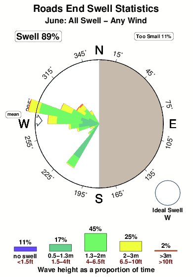
Swell History at Roads End
Surf stats for Roads End, see the swell variation by month or season on the history page here.

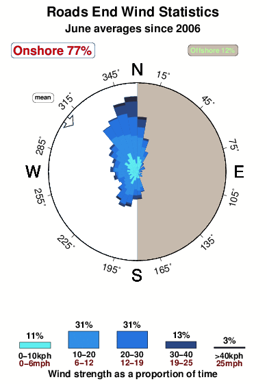
Wind History at Roads End
Wind stats for Roads End, see the variation in direction and stength by month or season on the history page here.
Other Nearby Breaks Closest To:
Discover surf breaks near Roads End. Click below to view there surf guides.
- Lincoln City Nelscott Reef
 Reef
Reef 4.0
4.0
Reliability: fairly consistent6km away - Lincoln City
 Beach and reef
 1.0
1.0
Reliability: fairly consistent7km away - Taft (Siltetz River)
 River
River
Reliability: fairly consistent8km away - Gleneden Beach
- Beach
- 1.0
Reliability: fairly consistent13km away - Boiler Bay
- Reef
- 1.0
Reliability: fairly consistent18km away
 Nearest