

Surf Forecasts:

How big are the waves at Bayobar - Punta Tur today (11 Jun):
- Morning surf: Morning surf (11 Jun, local time) - 3.5ft (1.0m), 17s period with SW swell.
- Afternoon surf: Afternoon surf (11 Jun, local time) - 4ft (1.2m), 17s period with SW swell.
- Evening surf: Evening surf (11 Jun, local time) - 4.5ft (1.4m), 16s period with SW swell.
The current surf forecast for Bayobar - Punta Tur at 9AM is: 1.0m 17s primary swell from a Southwest direction and 1.1m 7s secondary swell from a South direction, 1.1m 13s secondary swell from a Southwest direction (forecast issued at 12:00am June 11). The wind direction is predicted to be cross-offshore.
| Time (-05) & Date | Wave Height | Wave Period |
|---|---|---|
| Morning (11 Jun) | 3.5ft (1.0m) | 17s |
| Afternoon (11 Jun) | 4ft (1.2m) | 17s |
| Evening (11 Jun) | 4.5ft (1.4m) | 16s |
Table - waves today at Bayobar - Punta Tur. (Swell directed towards the surf break)
Updates in hr min s Forecast update imminent
Short Range ForecastMostly dry. Warm (max 24°C on Thu afternoon, min 22°C on Wed night). Wind will be generally light. | ||||||||||||||||||||||||
Thursday 11 | Friday 12 | Saturday 13 | ||||||||||||||||||||||
1 AM | 4 AM | 7 AM | 10 AM | 1 PM | 4 PM | 7 PM | 10 PM | 1 AM | 4 AM | 7 AM | 10 AM | 1 PM | 4 PM | 7 PM | 10 PM | 1 AM | 4 AM | 7 AM | 10 AM | 1 PM | 4 PM | 7 PM | 10 PM | |
Swell Height Map |  | 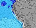 | 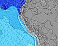 | 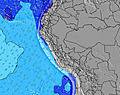 | 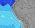 |  | 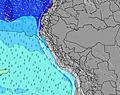 | 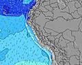 | 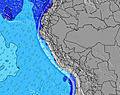 | |||||||||||||||
Wave Height (m) Direction Period (s) | SSW 13 | SW 13 | SSW 13 | SW 17 | SSW 17 | SW 17 | SW 16 | SW 16 | SW 16 | SW 16 | SSW 16 | SSW 15 | SW 15 | SSW 15 | SSW 15 | SSW 15 | SSW 15 | SSW 16 | SSW 16 | SSW 15 | SSW 15 | SSW 15 | SSW 14 | SSW 14 |
Wave Graph | ||||||||||||||||||||||||
472 | 400 | 465 | 573 | 753 | 815 | 795 | 1286 | 1239 | 1208 | 1322 | 1271 | 1103 | 1206 | 1190 | 1117 | 1147 | 1241 | 1241 | 1178 | 1038 | 1024 | 899 | 886 | |
Wind (km/h) | ||||||||||||||||||||||||
Wind State on-shore cross-onshore cross-shore cross-offshore off-shore glassy | cross-off | cross-off | cross-off | cross-off | cross | cross | cross | cross | cross-off | cross-off | cross-off | cross | cross-on | cross | cross | cross-off | cross-off | cross-off | cross-off | cross-off | cross | cross | cross-off | cross |
High Tide | 12:19PM1.41m | 1:24AM1.34m | 1:14PM1.44m | 2:19AM1.46m | 2:08PM1.47m | |||||||||||||||||||
Low Tide | 6:08AM0.57m | 6:58PM0.26m | 7:14AM0.53m | 7:49PM0.14m | 8:16AM0.47m | 8:39PM0.04m | ||||||||||||||||||
— | 6:30 | — | — | — | — | — | — | — | 6:30 | — | — | — | — | — | — | — | 6:30 | — | — | — | — | — | — | |
— | — | — | — | — | 6:16 | — | — | — | — | — | — | — | 6:16 | — | — | — | — | — | — | — | 6:17 | — | — | |
mm | — | — | — | — | — | — | — | — | — | — | — | — | — | — | — | — | — | — | — | — | — | — | — | — |
Temp °C | 22 | 22 | 22 | 23 | 23 | 24 | 23 | 22 | 22 | 22 | 22 | 23 | 23 | 24 | 23 | 23 | 22 | 22 | 22 | 23 | 24 | 23 | 23 | 23 |
Feels °C | 20 | 20 | 21 | 23 | 23 | 23 | 22 | 21 | 21 | 21 | 23 | 24 | 22 | 23 | 22 | 22 | 22 | 22 | 22 | 23 | 23 | 21 | 22 | 22 |
Swell 1 Height (m) Direction Period (s) | SSW 13 | SW 13 | SSW 13 | S 7 | SSW 17 | SW 17 | SW 16 | SW 16 | SW 16 | SW 16 | SSW 16 | SSW 15 | SW 15 | SSW 15 | SSW 15 | SSW 15 | SSW 15 | SSW 16 | SSW 16 | SSW 15 | SSW 15 | SSW 15 | SSW 14 | SSW 14 |
472 | 400 | 465 | 111 | 753 | 815 | 795 | 1286 | 1239 | 1208 | 1322 | 1271 | 1103 | 1206 | 1190 | 1117 | 1147 | 1241 | 1241 | 1178 | 1038 | 1024 | 899 | 886 | |
Swell 2 Height (m) Direction Period (s) | SW 19 | SW 19 | SW 18 | SW 13 | S 7 | SSW 13 | SSW 13 | NW 10 | S 7 | S 7 | S 7 | S 7 | SSW 19 | NW 11 | NW 11 | NW 10 | NW 10 | NW 9 | NW 9 | S 7 | SW 18 | SW 18 | SW 18 | SW 18 |
353 | 353 | 383 | 400 | 114 | 299 | 295 | 15 | 100 | 100 | 79 | 62 | 119 | 30 | 29 | 36 | 14 | 13 | 13 | 35 | 51 | 49 | 49 | 78 | |
Swell 3 Height (m) Direction Period (s) | NW 10 | NW 10 | NW 10 | SW 17 | SW 13 | NW 10 | NW 10 | NW 15 | NW 10 | NW 10 | NW 10 | NW 11 | NW 11 | NW 13 | NW 13 | SW 24 | NW 12 | WNW 12 | WNW 12 | NW 9 | NW 9 | NW 12 | NW 12 | NW 12 |
15 | 15 | 15 | 573 | 394 | 16 | 16 | 8 | 15 | 15 | 14 | 18 | 18 | 7 | 7 | 22 | 21 | 14 | 14 | 12 | 12 | 22 | 22 | 22 | |
Wind waves Height (m) Direction Period (s) | S 6 | S 6 | S 7 | — | — | S 7 | S 7 | S 7 | — | — | — | — | S 7 | SSW 7 | S 7 | S 7 | S 7 | S 7 | S 7 | S 4 | S 7 | S 7 | S 7 | S 7 |
97 | 100 | 107 | — | — | 120 | 124 | 121 | — | — | — | — | 62 | 82 | 79 | 61 | 61 | 61 | 61 | 8 | 60 | 73 | 58 | 56 | |
Nearest Offshore or Glassy | ||||||||||||||||||||||||
Distance (km) | 193 | 185 | 79 | 94 | 403 | 403 | 333 | 180 | 197 | 185 | 0 | 5 | 278 | 278 | 278 | 278 | 278 | 197 | 153 | 8 | 835 | 532 | 403 | 197 |
Best forecast wave conditions in Piura | ||||||||||||||||||||||||
Best forecast wave conditions in Peru | ||||||||||||||||||||||||
Header Global | ||||||||||||||||||||||||
- Map Icons:
 Break
Break Live Wave Height (m)
 Live Wind Speed (km/h)
 Surf Rating (10 Max)
 Ocean Swells (m)
- Wind Speed (km/h)


FREE! Surf-Forecast.com widget for your website
The surf report / weather widget below is available to embed on third party websites free of charge and provides a summary of our Bayobar - Punta Tur surf forecast. Simply grab the html code snippet that we provide and paste it into your own site. You can choose your preferred language and metric/imperial units for the surf forecast feed to suit users of your site. Click here to get the code.
 Nearest