
Port O'Conner Surf Guide
Port O'Conner in Texas is an exposed beach/Jetty break that only works when conditions are just right. The best conditions for surfing are during the hurricane season. Offshore winds blow from the northwest. Most of the surf comes fis in the form of windswells and the best wave direction is from the southeast. The beach break provides left and right handers. Rarely crowded here. Beware of rips, obstacles, sharks and jellyfish.
Port O'Conner Spot Info
| Type: | Rating: | Reliability: | Todays Sea Temp*: |
|---|---|---|---|
| inconsistent | 28.7°C*ocean temperature recorded from satellite |
Surfing Port O'Conner:
The best conditions reported for surf at Port O'Conner occur when a Southeast swell combines with an offshore wind direction from the Northwest.
What's the best time of year to surf Port O'Conner (for consistent clean waves)?
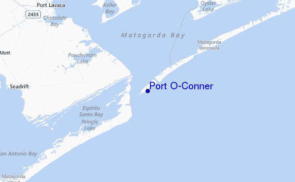
Explore Port O'Conner Location Map
Interactive Port O'Conner surf break location map. View information about nearby surf breaks, their wave consistency and rating compared to other spots in the region. Current swell conditions from local buoys are shown along with live wind speed and direction from nearby weather stations. Click icons on the map for more detail. The closest passenger airport to Port O'Conner is Palacios Muni Airport (PSX) in USA, 37 km (23 miles) away (directly). The second nearest airport to Port O'Conner is Corpus Christi International Airport (CRP), also in USA, 133 km (83 miles) away.
- Map Icons:
 Break
Break Live Wave Height (m)
 Live Wind Speed (km/h)
 Surf Rating (10 Max)
 Ocean Swells (m)
- Wind Speed (km/h)
Wednesday, 10 June 2026, 20:32 Local Time
| Wednesday 10 | Thu | |||
| 4PM | 7PM | 10PM | 1AM | |
| Wave (m) | ||||
| Period (s) | 6 | 6 | 6 | 6 |
| Wind (km/h) | ||||
| Wind State | on | on | on | on |
Tides at Port O'Conner
| NEXT | IS AT (local time) | remaining |
|---|---|---|
| high tide | ||
| low tide |
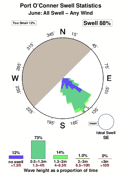
Swell History at Port O'Conner
Surf stats for Port O'Conner, see the swell variation by month or season on the history page here.

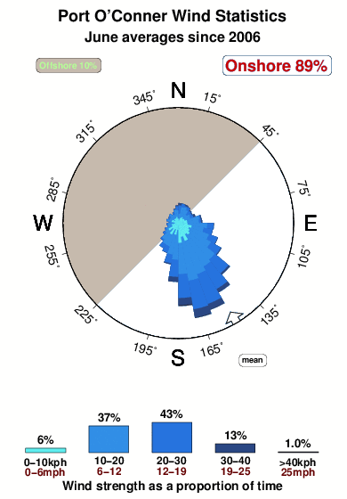
Wind History at Port O'Conner
Wind stats for Port O'Conner, see the variation in direction and stength by month or season on the history page here.
Other Nearby Breaks Closest To:
Discover surf breaks near Port O'Conner. Click below to view there surf guides.
- Matagorda
 River
River 3.0
3.0
Reliability: fairly consistent42km away - Coastal Bend Area
 Beach/jetty
 2.0
2.0
Reliability: fairly consistent67km away - San Jose Island
- Beach/jetty
- 2.0
Reliability: inconsistent82km away - St Joe s Island
 Breakwater
- 3.0
Reliability: inconsistent92km away - Horace Caldwell Pier
- Beach/pier
- 2.0
Reliability: fairly consistent93km away
 Nearest