

Long Sands Surf Guide
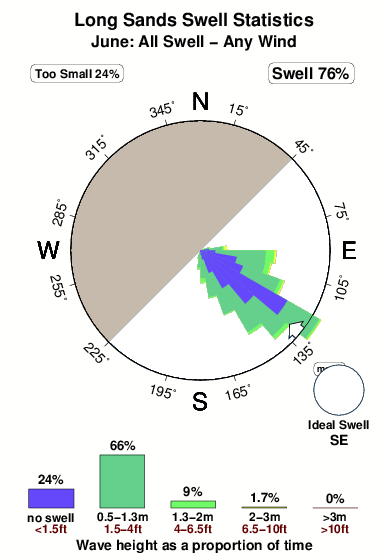
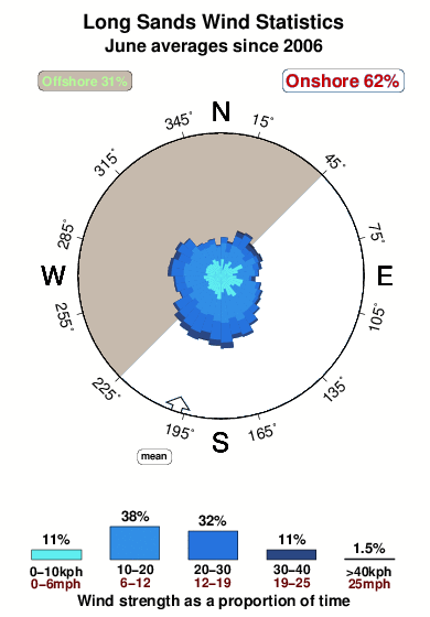
Long Sands in Maine is an exposed beach break that has pretty consitent surf and can work at any time of the year. Offshore winds blow from the northwest with some shelter here from north winds. Windswells and groundswells in equal measure and the best swell direction is from the southeast. The beach break provides left and right handers. Surfable at all stages of the tide. It very rarely gets crowded here. Beware of rips, rocks and pollution.
Long Sands Spot Info
| Type: | Rating: | Reliability: | Todays Sea Temp*: |
|---|---|---|---|
| fairly consistent | 12.6°C*ocean temperature recorded from satellite |
Surfing Long Sands:
The best conditions reported for surf at Long Sands occur when a Southeast swell combines with an offshore wind direction from the Northwest.
What's the best time of year to surf Long Sands (for consistent clean waves)?
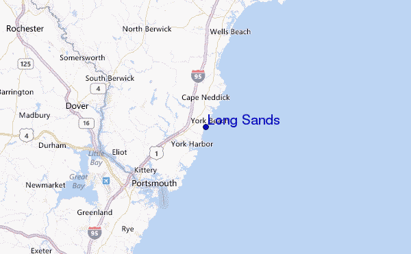
Explore Long Sands Location Map
Interactive Long Sands surf break location map. View information about nearby surf breaks, their wave consistency and rating compared to other spots in the region. Current swell conditions from local buoys are shown along with live wind speed and direction from nearby weather stations. Click icons on the map for more detail. The closest passenger airport to Long Sands is Portland International Jetport Airport (PWM) in USA, 59 km (37 miles) away (directly). The second nearest airport to Long Sands is Laurence G Hanscom Fld (Bedford) Airport (BED), also in USA, 94 km (58 miles) away.
- Map Icons:
 Break
Break Live Wave Height (m)
 Live Wind Speed (km/h)
 Surf Rating (10 Max)
 Ocean Swells (m)
- Wind Speed (km/h)
Wednesday, 10 June 2026, 10:22 Local Time
| Wednesday 10 | ||||
| 11AM | 2PM | 5PM | 8PM | |
| Wave (m) | ||||
| Period (s) | 5 | 4 | 4 | 6 |
| Wind (km/h) | ||||
| Wind State | cross- on |
cross- on |
on | cross- off |
Tides at Long Sands
| NEXT | IS AT (local time) | remaining |
|---|---|---|
| high tide | ||
| low tide |
Swell History at Long Sands
Surf stats for Long Sands, see the swell variation by month or season on the history page here.

Wind History at Long Sands
Wind stats for Long Sands, see the variation in direction and stength by month or season on the history page here.
Other Nearby Breaks Closest To:
Discover surf breaks near Long Sands. Click below to view there surf guides.
 Nearest