

Camp Pendleton Surf Guide
Camp Pendleton in Virginia is an exposed beach/Jetty break that has quite reliable surf The best wind direction is from the west. Most of the surf here comes from groundswells and the best swell direction is from the east southeast. The beach break offers both left and right hand waves. Best around low tide. It's sometimes crowded here. Surfing here means negotiating dangerous rips.
Camp Pendleton Spot Info
| Type: | Rating: | Reliability: | Todays Sea Temp*: |
|---|---|---|---|
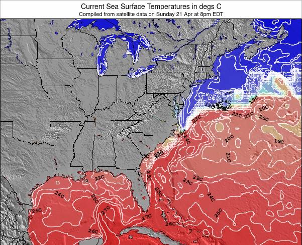
| fairly consistent | 22.5°C*ocean temperature recorded from satellite |
Surfing Camp Pendleton:
The best conditions reported for surf at Camp Pendleton occur when a East-southeast swell combines with an offshore wind direction from the West.
What's the best time of year to surf Camp Pendleton (for consistent clean waves)?
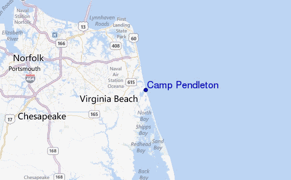
Explore Camp Pendleton Location Map
Interactive Camp Pendleton surf break location map. View information about nearby surf breaks, their wave consistency and rating compared to other spots in the region. Current swell conditions from local buoys are shown along with live wind speed and direction from nearby weather stations. Click icons on the map for more detail. The closest passenger airport to Camp Pendleton is Oceana Nas Airport (NTU) in USA, 9 km (6 miles) away (directly). The second nearest airport to Camp Pendleton is Norfolk International Airport (ORF), also in USA, 26 km (16 miles) away.
- Map Icons:
 Break
Break Live Wave Height (m)
 Live Wind Speed (km/h)
 Surf Rating (10 Max)
 Ocean Swells (m)
- Wind Speed (km/h)
Tuesday, 9 June 2026, 22:06 Local Time
| Tue | Wednesday 10 | |||
| 11PM | 2AM | 5AM | 8AM | |
| Wave (m) | ||||
| Period (s) | 7 | 7 | 6 | 6 |
| Wind (km/h) | ||||
| Wind State | cross | cross- off |
cross- off |
cross- off |
Tides at Camp Pendleton
| NEXT | IS AT (local time) | remaining |
|---|---|---|
| high tide | ||
| low tide |
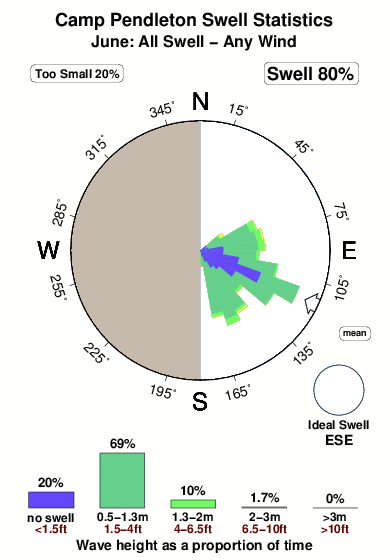
Swell History at Camp Pendleton
Surf stats for Camp Pendleton, see the swell variation by month or season on the history page here.

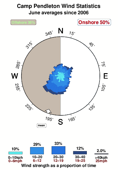
Wind History at Camp Pendleton
Wind stats for Camp Pendleton, see the variation in direction and stength by month or season on the history page here.
Camp Pendleton Reviews:
Interactive Porthcawl Point location map. View nearby buoy information, live wind conditions and surrounding roads, paths and locations to help find new breaks. Click the buoys or wind icon to view more information.
- Overall:
 2.0
2.0 - Quality on a good day:2.0
- Consistency of Surf:
 3.0
3.0 - Difficulty Level:
 1.0
1.0 - Crowds:3.0
Other Nearby Breaks Closest To:
Discover surf breaks near Camp Pendleton. Click below to view there surf guides.
- Croatan
 Beach/jetty
- 2.0
Reliability: fairly consistent1km away - Damneck Naval Base
- Beach
- 2.0
Reliability: fairly consistent1km away - 1st Street Jetty
- Beach/jetty
- 1.0
Reliability: consistent3km away - Virginia Beach
- Beach/jetty
- 2.0
Reliability: consistent5km away - 42nd St VA Beach
 Sandbar
- 2.0
Reliability: inconsistent11km away
 Nearest