East Anglia Surf
Detailed East Anglia surf forecast maps and the latest eyeball surf report from local surfers in the region. Near-shore swell is shown on the map together with the surf forecast rating for spots in East Anglia. Find the best places to surf in offshore conditions by selecting the wind option on the forecast map. Windsurfers and kite surfers can also use this option to find more favorable cross-shore conditions in East Anglia. Our local Wavefinder indicates where some of the best conditions are likely to be found in East Anglia over the next 7 days. Surf photos from East Anglia and reviews of the best spots and surfing conditions have been provided by local surfers.
East Anglia Surf Forecast map for predicting the best wave and wind conditions across the region. For surfers, the map shows the most powerful swell tracking across near-shore open water and not the peak waves experienced by boats out at sea. Move your mouse over the ocean swell symbols or the surf breaks on the coastline to see a more detailed surf forecast including wave period and wind conditions. The forecast updates every 6 hours and most live weather reports update every hour. You can animate the East Anglia Surf map or show live wind and wave conditions as reported from wavebuoys and local weather stations. Surf breaks shown along the East Anglia coastline are also listed below.
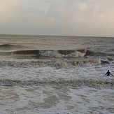
East Anglia Photos
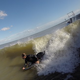
East Anglia Wavefinder
Wednesday 18 | Thursday 19 | Friday 20 | Saturday 21 | Sunday 22 | Monday 23 | Tuesday 24 | |||||||||||||||
AM | PM | Night | AM | PM | Night | AM | PM | Night | AM | PM | Night | AM | PM | Night | AM | PM | Night | AM | PM | Night | |
Best forecast wave conditions in East Anglia | |||||||||||||||||||||
Wave Height (m) Direction Period (s) | NNE 8 | NNE 9 | NNE 9 | NNE 8 | NNE 7 | NNE 6 | NE 6 | NE 6 | NNE 5 | N 7 | N 7 | NNE 7 | NNE 8 | NNE 8 | ENE 5 | N 8 | N 8 | N 8 | SSE 5 | SE 6 | SE 6 |
 kJ | 87 | 293 | 190 | 98 | 81 | 78 | 230 | 97 | 48 | 117 | 83 | 91 | 79 | 83 | 75 | 64 | 60 | 44 | 64 | 131 | 111 |
Wind (km/h) | |||||||||||||||||||||
Wind State on-shore cross-onshore cross-shore cross-offshore off-shore glassy | off | glassy | cross-off | cross-off | glassy | cross-off | on | cross-on | cross | cross-off | cross-off | cross-on | on | cross-on | cross-off | cross-off | cross-off | off | cross-off | cross | cross |
High Tide | 3:41PM1.82m | 3:05AM2.09m | 2:22PM3.83m | 3:59AM2.17m | 5:10PM2.12m | 4:45AM2.29m | 5:44PM2.28m | 5:27AM2.43m | 8:32PM2.21m | 6:09AM2.56m | 6:00PM3.38m | 6:48PM2.53m | 6:51AM2.68m | 7:22PM2.61m | |||||||
Low Tide | 8:33PM1.20m | 9:47AM0.66m | 10:07PM1.15m | 10:54AM0.51m | 11:19PM0.99m | 11:47AM0.34m | 00:11AM0.78m | 12:33PM0.18m | 2:29AM0.47m | 12:20PM0.21m | 1:38AM0.34m | 2:00PM0.01m | 2:20AM0.16m | ||||||||
 |  |  | | |  | |  |  | | | | |  | | | |  | | |  | |
mm | — | 4 | 3 | 3 | 2 | — | 1 | — | — | — | — | — | — | — | — | — | — | — | — | 1 | 8 |
Max °C | 8 | 9 | 9 | 9 | 9 | 9 | 9 | 9 | 8 | 7 | 7 | 8 | 8 | 9 | 8 | 7 | 8 | 8 | 7 | 7 | 9 |
Min °C | 8 | 9 | 8 | 8 | 8 | 8 | 9 | 8 | 7 | 6 | 7 | 7 | 8 | 9 | 7 | 7 | 8 | 5 | 7 | 6 | 6 |
Chill °C | 6 | 9 | 6 | 9 | 8 | 8 | 5 | 5 | 5 | 4 | 5 | 6 | 5 | 6 | 5 | 5 | 7 | 6 | 3 | 2 | 5 |
 | 7:20 | — | — | 7:20 | — | — | 7:22 | — | — | 7:24 | — | — | 7:26 | — | — | 7:28 | — | — | 7:28 | — | — |
 | — | 3:56 | — | — | 3:55 | — | — | 3:52 | — | — | 3:52 | — | — | 3:51 | — | — | 3:48 | — | — | 3:48 | — |
Swell 1 Height (m) Direction Period (s) | NNE 8 | NNE 9 | NNE 9 | NNE 8 | NNE 7 | NNE 6 | — | — | N 7 | N 7 | N 7 | NNE 7 | NNE 8 | NNE 8 | N 7 | N 8 | N 8 | N 8 | N 8 | N 8 | N 8 |
| kJ | 87 | 293 | 190 | 98 | 81 | 78 | — | — | 16 | 117 | 83 | 91 | 79 | 83 | 25 | 64 | 60 | 44 | 32 | 20 | 5 |
Swell 2 Height (m) Direction Period (s) | N 10 | S 6 | — | SSE 5 | SE 5 | NE 7 | — | — | — | — | — | — | — | SE 4 | — | ESE 4 | ENE 5 | NE 6 | NE 7 | NNE 7 | NE 6 |
| kJ | 31 | 2 | — | 5 | 1 | 7 | — | — | — | — | — | — | — | 5 | — | 7 | 7 | 11 | 7 | 4 | 2 |
Wind waves Height (m) Direction Period (s) | NW 4 | — | SSW 5 | — | — | — | NE 6 | NE 6 | NNE 5 | WNW 2 | — | — | E 3 | E 4 | ENE 5 | E 4 | — | SSE 3 | SSE 5 | SE 6 | SE 6 |
| kJ | 9 | — | 9 | — | — | — | 230 | 97 | 48 | 1 | — | — | 6 | 18 | 75 | 12 | — | 6 | 64 | 131 | 111 |
Sea °C | 11 | 11 | 11 | 11 | 11 | 11 | 11 | 11 | 11 | 11 | 11 | 11 | 11 | 11 | 11 | 11 | 11 | 11 | 11 | 11 | 11 |
Diff °C | |||||||||||||||||||||
East Anglia Surf Breaks
East Anglia is more know for it's beach side resorts rather than it's swell, although on its day can be quite fun. In general this part of coast is polluted and lacks any swell. East Runton is the more favorable of all the breaks with a sand and shingle bottom. The break is divided into three peaks: a long right, a left and a slow right with the third being a left breaking over some reef. All work best on a N swell and S wind. There's a pay and display car park up on the cliffs. For any beaches to have a rideable wave a large N swell is needed but even then it's unlikely it'll make it all the way down.
 Nearest