

Surf Forecasts:

How big are the waves at Pailongge today (21 Jun):
- Morning surf: Morning surf (21 Jun, local time) - 4.5ft (1.4m), 8s period with SSE swell.
- Afternoon surf: Afternoon surf (21 Jun, local time) - 4.5ft (1.4m), 8s period with SSE swell.
- Evening surf: Evening surf (21 Jun, local time) - 4.5ft (1.4m), 8s period with SSE swell.
The current surf forecast for Pailongge at 4AM is: 1.3m 8s primary swell from a South-southeast direction and 0.2m 11s secondary swell from a South direction, 0.2m 11s secondary swell from a South direction (forecast issued at 10:00pm June 20). The wind direction is predicted to be cross-shore.
| Time (+11) & Date | Wave Height | Wave Period |
|---|---|---|
| Morning (21 Jun) | 4.5ft (1.4m) | 8s |
| Afternoon (21 Jun) | 4.5ft (1.4m) | 8s |
| Evening (21 Jun) | 4.5ft (1.4m) | 8s |
Table - waves today at Pailongge. (Swell directed towards the surf break)
Updates in hr min s Forecast update imminent
Short Range ForecastHeavy rain (total 26mm), heaviest during Mon night. Warm (max 28°C on Mon afternoon, min 26°C on Mon night). Winds increasing (light winds from the SE on Sun afternoon, fresh winds from the SE by Tue afternoon). | ||||||||||||||||||||||||
Sat 20 | Sunday 21 | Monday 22 | Tuesday 23 | |||||||||||||||||||||
8 PM | 11 PM | 2 AM | 5 AM | 8 AM | 11 AM | 2 PM | 5 PM | 8 PM | 11 PM | 2 AM | 5 AM | 8 AM | 11 AM | 2 PM | 5 PM | 8 PM | 11 PM | 2 AM | 5 AM | 8 AM | 11 AM | 2 PM | 5 PM | |
Swell Height Map | 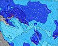 | 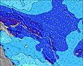 | 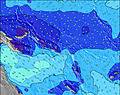 | 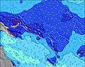 | 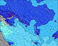 | 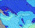 | 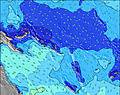 | 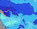 | 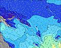 | |||||||||||||||
Wave Height (m) Direction Period (s) | SSE 9 | SSE 8 | SSE 8 | SSE 8 | SSE 8 | SSE 8 | SSE 8 | SSE 8 | SSE 8 | SSE 8 | SSE 8 | SE 8 | SSE 8 | SSE 8 | SE 8 | SE 8 | SSE 8 | SSE 8 | SSE 8 | SE 7 | SE 7 | SE 7 | SE 6 | SE 6 |
Wave Graph | ||||||||||||||||||||||||
297 | 239 | 234 | 234 | 284 | 262 | 268 | 433 | 284 | 383 | 261 | 400 | 294 | 267 | 419 | 419 | 273 | 261 | 356 | 305 | 335 | 309 | 284 | 379 | |
Wind (km/h) | ||||||||||||||||||||||||
Wind State on-shore cross-onshore cross-shore cross-offshore off-shore glassy | cross | cross | cross | cross | cross | cross | cross-on | cross-on | cross | cross | cross | cross | cross | cross | cross-on | cross-on | cross | cross | cross | cross | cross | cross | cross-on | cross-on |
High Tide | 4:25AM0.84m | 4:37AM0.78m | 4:36AM0.71m | |||||||||||||||||||||
Low Tide | 1:42PM0.25m | 1:18PM0.27m | 1:02PM0.26m | |||||||||||||||||||||
— | — | — | 6:43 | — | — | — | — | — | — | — | 6:45 | — | — | — | — | — | — | — | 6:45 | — | — | — | — | |
— | — | — | — | — | — | — | 6:23 | — | — | — | — | — | — | — | 6:23 | — | — | — | — | — | — | — | 6:23 | |
mm | — | — | — | — | 1 | — | — | 2 | 2 | 1 | — | — | — | — | 1 | 4 | 3 | 3 | 6 | 3 | — | — | — | — |
Temp °C | 27 | 27 | 27 | 27 | 27 | 27 | 27 | 27 | 27 | 27 | 27 | 27 | 27 | 27 | 28 | 28 | 27 | 27 | 26 | 27 | 27 | 27 | 27 | 27 |
Feels °C | 28 | 29 | 29 | 29 | 28 | 29 | 29 | 30 | 30 | 28 | 28 | 28 | 29 | 29 | 30 | 30 | 29 | 28 | 25 | 27 | 27 | 27 | 25 | 24 |
Swell 1 Height (m) Direction Period (s) | S 11 | SSE 8 | S 11 | S 11 | S 11 | SSE 8 | SSE 8 | SSE 8 | SSE 8 | SSE 8 | S 10 | SSE 8 | SSE 8 | SSE 8 | SSE 9 | SSE 9 | S 16 | S 16 | S 15 | S 15 | S 15 | S 14 | S 14 | S 13 |
10 | 239 | 9 | 9 | 9 | 262 | 268 | 329 | 284 | 284 | 8 | 294 | 294 | 267 | 297 | 297 | 21 | 20 | 17 | 17 | 17 | 16 | 15 | 14 | |
Swell 2 Height (m) Direction Period (s) | S 11 | S 11 | S 11 | S 11 | S 13 | S 11 | S 21 | S 21 | S 20 | S 19 | S 19 | S 18 | S 18 | S 18 | S 17 | S 16 | S 13 | S 12 | S 12 | S 12 | S 12 | S 11 | S 11 | S 11 |
10 | 9 | 9 | 9 | 3 | 9 | 9 | 8 | 8 | 7 | 7 | 6 | 25 | 25 | 24 | 21 | 3 | 3 | 11 | 11 | 3 | 3 | 2 | 2 | |
Swell 3 Height (m) Direction Period (s) | — | — | — | S 13 | S 13 | — | S 21 | — | — | S 19 | S 19 | S 10 | S 13 | S 13 | S 13 | S 13 | S 13 | — | — | S 18 | S 18 | — | — | — |
— | — | — | 3 | 3 | — | 9 | — | — | 7 | 7 | 2 | 4 | 3 | 3 | 3 | 3 | — | — | 6 | 6 | — | — | — | |
Wind waves Height (m) Direction Period (s) | SSE 9 | — | SSE 8 | SSE 8 | SSE 8 | — | — | SSE 8 | — | SSE 8 | SSE 8 | SE 8 | — | — | SE 8 | SE 8 | SSE 8 | SSE 8 | SSE 8 | SE 7 | SE 7 | SE 7 | SE 6 | SE 6 |
297 | — | 234 | 234 | 284 | — | — | 433 | — | 383 | 261 | 400 | — | — | 419 | 419 | 273 | 261 | 356 | 305 | 335 | 309 | 284 | 379 | |
Nearest Offshore or Glassy | ||||||||||||||||||||||||
Distance (km) | 1767 | 43 | 43 | 48 | 48 | 19 | 1767 | 43 | 1767 | 1767 | 1767 | 1767 | 1640 | 1320 | 1806 | 1806 | 1767 | 1767 | 1767 | 1320 | 1320 | 1905 | 1905 | 1905 |
Best forecast wave conditions in New Georgia | ||||||||||||||||||||||||
Best forecast wave conditions in Solomon Islands | ||||||||||||||||||||||||
Header Global | ||||||||||||||||||||||||
- Map Icons:
 Break
Break Live Wave Height (m)
 Live Wind Speed (km/h)
 Surf Rating (10 Max)
 Ocean Swells (m)
- Wind Speed (km/h)


FREE! Surf-Forecast.com widget for your website
The surf report / weather widget below is available to embed on third party websites free of charge and provides a summary of our Pailongge surf forecast. Simply grab the html code snippet that we provide and paste it into your own site. You can choose your preferred language and metric/imperial units for the surf forecast feed to suit users of your site. Click here to get the code.
 Nearest