

- Forecast
- Maps
- Live
- Weather State
- Spot Information

Surf Forecasts
Reef
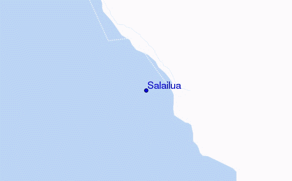
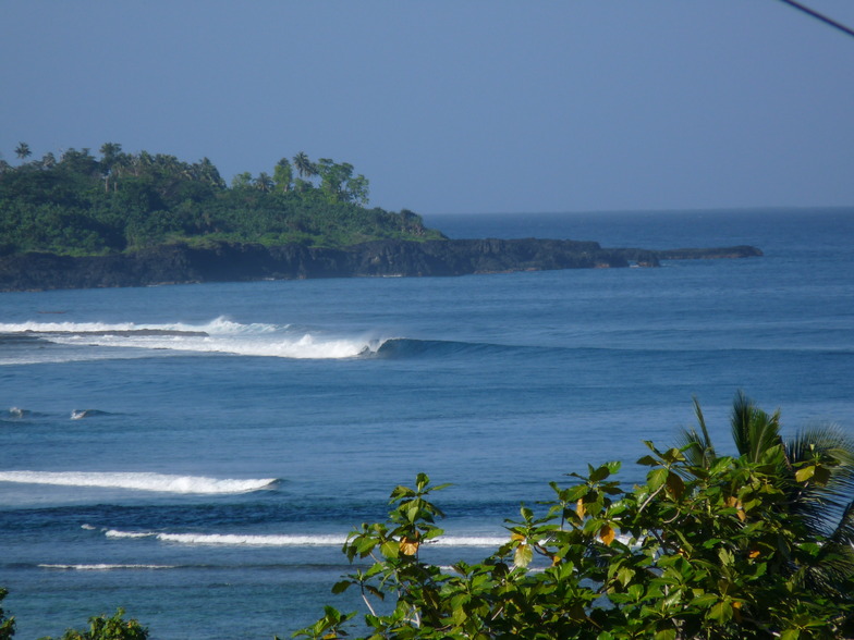
Salailua surf Forecast / Savaii / Samoa
48hr Weather and Surf, issued 6 am Saturday 11 May 2024 +13
Forecast update in hr min s Update imminent
Salailua surf forecast is for near shore open water. Breaking waves will often be smaller at less exposed spots.
Today's Salailua sea temperature is 30.3°C (Statistics for 11 May 1981-2005 - mean: 28.7 °C max: 29.6 °C min: 27.4 °C)
- Map Icons:
 Break
Break Live Wave Height (m)
 Live Wind Speed (km/h)
 Surf Rating (10 Max)
 Ocean Swells (m)
- Wind Speed (km/h)
Salailua surf forecast is for near shore open water. Breaking waves will often be smaller at less exposed spots.
Today's Salailua sea temperature is 30.3°C (Statistics for 11 May 1981-2005 - mean: 28.7 °C max: 29.6 °C min: 27.4 °C)
How big are the waves at Salailua today?
The current surf forecast for Salailua at 11AM is: 0.7m 14s primary swell from a Southwest direction and 0.5m 16s secondary swell from a Southwest direction, 1.3m 7s secondary swell from a South direction (forecast issued at 06:00am May 11). The wind direction is predicted to be cross-shore.
| Time (+13) & Date | Wave Height | Wave Period |
|---|---|---|
| Morning (11 May) | 2.5ft (0.8m) | 13s |
| Afternoon (11 May) | 2.5ft (0.8m) | 15s |
| Evening (11 May) | 4.5ft (1.4m) | 14s |
Table - waves today at Salailua. (Swell directed towards the surf break)
Updates in hr min s Update imminent
Saturday 11 | Sunday 12 | Monday 13 | Tuesday 14 | Wednesday 15 | Thursday 16 | Friday 17 | Saturday 18 | |||||||||||||||||||||||||||||||||||||||||||||||||||||
| 4 AM | 7 AM | 10 AM | 1 PM | 4 PM | 7 PM | 10 PM | 1 AM | 4 AM | 7 AM | 10 AM | 1 PM | 4 PM | 7 PM | 10 PM | 1 AM | 4 AM | 7 AM | 10 AM | 1 PM | 4 PM | 7 PM | 10 PM | 1 AM | 4 AM | 7 AM | 10 AM | 1 PM | 4 PM | 7 PM | 10 PM | 1 AM | 4 AM | 7 AM | 10 AM | 1 PM | 4 PM | 7 PM | 10 PM | 1 AM | 4 AM | 7 AM | 10 AM | 1 PM | 4 PM | 7 PM | 10 PM | 1 AM | 4 AM | 7 AM | 10 AM | 1 PM | 4 PM | 7 PM | 10 PM | 1 AM | 4 AM | 7 AM | 10 AM | 1 PM | |
Rating (10 max) | ||||||||||||||||||||||||||||||||||||||||||||||||||||||||||||
Swell Height Map |    |   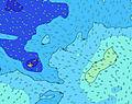 |  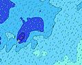 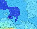 | 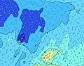 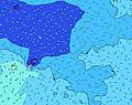 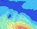 | 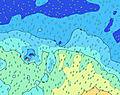 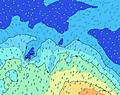 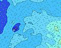 | 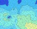 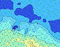 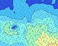 | 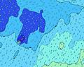 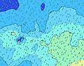 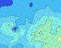 | 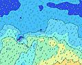 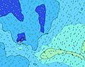 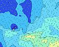 | ||||||||||||||||||||||||||||||||||||||||||||||||||||
| Wave Height (m) & direction (?) | ||||||||||||||||||||||||||||||||||||||||||||||||||||||||||||
| Period(s) (?) | 14 | 14 | 13 | 14 | 16 | 15 | 14 | 13 | 13 | 13 | 12 | 12 | 12 | 12 | 14 | 14 | 14 | 15 | 15 | 14 | 14 | 13 | 13 | 13 | 12 | 12 | 12 | 18 | 16 | 16 | 15 | 14 | 14 | 14 | 14 | 17 | 16 | 16 | 10 | 9 | 9 | 9 | 10 | 10 | 20 | 19 | 18 | 18 | 17 | 16 | 16 | 16 | 15 | 15 | 14 | 14 | 14 | 13 | 13 | 13 |
Wave (?)Graph | ||||||||||||||||||||||||||||||||||||||||||||||||||||||||||||
| Energy (?) | 236 | 661 | 229 | 200 | 287 | 640 | 747 | 902 | 986 | 848 | 784 | 668 | 855 | 1065 | 2379 | 2775 | 2248 | 2942 | 2863 | 2775 | 2323 | 1862 | 1514 | 1293 | 830 | 940 | 847 | 781 | 763 | 617 | 567 | 1162 | 1155 | 1016 | 1295 | 2256 | 1017 | 1160 | 415 | 721 | 492 | 736 | 384 | 441 | 497 | 730 | 786 | 885 | 835 | 759 | 607 | 710 | 545 | 422 | 411 | 324 | 315 | 229 | 171 | 168 |
Wind (km/h) | ||||||||||||||||||||||||||||||||||||||||||||||||||||||||||||
| Wind State (?) onshore cross-onshore cross-shore cross-offshore offshore glassy | cross | cross | cross | cross | cross | cross | cross | cross | cross | cross | cross | cross | cross | cross | cross- off | cross- off | cross- off | cross- off | cross- off | cross- off | cross- off | cross- off | cross- off | cross- off | cross- off | cross- off | cross- off | cross- off | cross- off | cross- off | cross- off | cross- off | cross- off | cross- off | cross- off | cross- off | cross- off | cross- off | cross- off | cross- off | cross- off | cross- off | cross- off | cross- off | cross- off | cross- off | cross- off | cross- off | cross- off | cross- off | cross- off | glass | glass | glass | glass | glass | glass | cross- on | glass | glass |
High Tide / height (m) | 8:46AM 1.21 | 9:30PM 1.00 | 9:42AM 1.13 | 10:32PM 0.94 | 10:43AM 1.06 | 11:37PM 0.91 | 11:47AM 1.01 | 12:41AM 0.90 | 12:49PM 0.99 | 1:38AM 0.92 | 1:44PM 0.98 | 2:25AM 0.96 | 2:33PM 0.99 | 3:06AM 1.00 | ||||||||||||||||||||||||||||||||||||||||||||||
Low Tide / height (m) | 2:26AM 0.21 | 3:16PM 0.14 | 3:20AM 0.29 | 4:15PM 0.21 | 4:20AM 0.35 | 5:17PM 0.26 | 5:25AM 0.40 | 6:21PM 0.30 | 6:33AM 0.42 | 7:19PM 0.31 | 7:35AM 0.41 | 8:09PM 0.32 | 8:28AM 0.39 | 8:50PM 0.31 | 9:13AM 0.36 | |||||||||||||||||||||||||||||||||||||||||||||
Saturday 11 | Sunday 12 | Monday 13 | Tuesday 14 | Wednesday 15 | Thursday 16 | Friday 17 | Saturday 18 | |||||||||||||||||||||||||||||||||||||||||||||||||||||
| Sunrise | - | 6:41 | - | - | - | - | - | - | - | 6:41 | - | - | - | - | - | - | - | 6:41 | - | - | - | - | - | - | - | 6:41 | - | - | - | - | - | - | - | 6:41 | - | - | - | - | - | - | - | 6:41 | - | - | - | - | - | - | - | 6:43 | - | - | - | - | - | - | - | 6:43 | - | - |
| Sunset | - | - | - | - | 6:12 | - | - | - | - | - | - | - | 6:10 | - | - | - | - | - | - | - | 6:10 | - | - | - | - | - | - | - | 6:10 | - | - | - | - | - | - | - | 6:10 | - | - | - | - | - | - | - | 6:09 | - | - | - | - | - | - | - | 6:09 | - | - | - | - | - | - | - |
Rain (mm) | 2 | 2 | 2 | 2 | 3 | 2 | 2 | 1 | 1 | 1 | 1 | 1 | 2 | 2 | 3 | 4 | 2 | 2 | 2 | 2 | 2 | 2 | 1 | 3 | 2 | - | 1 | 1 | 1 | 2 | 1 | - | - | 1 | 2 | 1 | 1 | 6 | 5 | 2 | 1 | 1 | 1 | 1 | 1 | 2 | 2 | 3 | 4 | 2 | 1 | 2 | 2 | 3 | 1 | 1 | 1 | 3 | 1 | - |
| Temp. °C | 27 | 27 | 27 | 27 | 27 | 27 | 27 | 27 | 27 | 27 | 27 | 27 | 27 | 28 | 27 | 27 | 27 | 27 | 27 | 27 | 28 | 29 | 29 | 29 | 29 | 29 | 29 | 29 | 29 | 29 | 29 | 29 | 29 | 29 | 29 | 29 | 29 | 26 | 28 | 29 | 29 | 29 | 29 | 29 | 30 | 29 | 29 | 29 | 29 | 29 | 29 | 29 | 29 | 29 | 29 | 29 | 29 | 28 | 29 | 29 |
| Feels °C (?) | 29 | 30 | 29 | 29 | 28 | 27 | 26 | 26 | 26 | 25 | 25 | 25 | 25 | 26 | 25 | 25 | 25 | 25 | 25 | 25 | 28 | 29 | 29 | 29 | 29 | 29 | 29 | 29 | 29 | 30 | 30 | 29 | 30 | 30 | 30 | 29 | 30 | 25 | 28 | 29 | 29 | 28 | 28 | 28 | 30 | 29 | 29 | 30 | 31 | 31 | 32 | 34 | 34 | 34 | 34 | 35 | 35 | 32 | 33 | 34 |
FREE! Surf-Forecast.com widget for your website
The surf report / weather widget below is available to embed on third party websites free of charge and provides a summary of our Salailua surf forecast. Simply grab the html code snippet that we provide and paste it into your own site. You can choose your preferred language and metric/imperial units for the surf forecast feed to suit users of your site. Click here to get the code.


 Nearest