

Surf Forecasts:

Playa de San Xurxo surf forecast from 15 Jul 2026:
- Best quality surf: Monday 20 Jul, 5AM (local time) - 3.5ft (1.1m), 7s period, N swell with cross-offshore winds.
- Most powerful swell: Tuesday 21 Jul, 5PM (local time) - 7ft (2.1m), 7s period, NNE swell with 362 kJ wave energy.
- Next surfable swell (1★+): Monday 20 Jul, 5AM (local time) - 3.5ft (1.1m), 7s period with N swell.
Best Forecast Surf Conditions for Playa de San Xurxo this week:
The surf forecast for Playa de San Xurxo over the next 16 days: The first swell (rated 1 star or higher) is forecast to arrive on Monday (Jul 20) at 5AM. The primary swell is predicted to be 1.1m and 7s period with a secondary swell of 0.2m and 8s. The wind is predicted to be cross-offshore as the swell arrives.
The most powerful waves expected at Playa de San Xurxo in the next 16 days are 2.1m 7s and forecast to arrive on Tuesday (Jul 21) at 5PM. Winds are predicted to be cross-shore at the time the swell arrives. The largest open ocean swell (not directed at the beach) is 2.0m 6s period and expected on Wednesday (Jul 22) at 8PM.
| Wave Type | Time (CEST) & Date | Wave Height & Period |
|---|---|---|
| Next good surf (1 star+) | 5AM (Mon 20th Jul) | 3.5ft (1.1m) 7s |
| Best Surf | 5AM (Mon 20th Jul) | 3.5ft (1.1m) 7s |
| Most Powerful | 5PM (Tue 21st Jul) | 7ft (2.1m) 7s |
Table - best surf conditions forecast for Playa de San Xurxo over the next 16 days.
The Lowdown
Alright guys, Rusty here. Let's break down what Playa de San Xurxo is looking like for the next couple of weeks. I'll level with you – the charts are a bit of a bummer for the most part. A lot of tiny, weak swell and messy wind, so keep your expectations in check. The first time we see anything worth getting wet for isn't until Monday the 20th, so the first four days are pretty much a blank.
Thursday 16th and Friday 17th are a washout. We're talking 1ft waves from the west with next to no energy, and the wind is either cross or cross-onshore, junking it up. Saturday the 18th shows a bit more push, with a 5ft short-period swell from the NNE in the afternoon and combined energy hitting 130, but that 25 mph crosswind will tear it apart. Sunday the 19th is more of the same – some size, but the wind is too strong for a clean face.
Then on Monday morning, July 20th, the wind drops to complete glass. It's dead calm. There's a 4ft wave from the north with moderate energy (133). The report calls it "surfable but very ordinary," but when it's glassy like that, you just get out there. It'll be the best session of the week, hands down. Get the dawn patrol.
Tuesday morning, July 21st is another option. A 5ft swell from the NNE with moderate energy (213) and a light cross-shore breeze. The wave comment says "marginal," but it's better than nothing. This spot is very consistent and for intermediates, so you'll find a wave. Water temp is about normal for the season, nothing weird.
Wednesday morning, July 22nd gives us another glass-off. The wind is calm again, with a 4ft swell from the NNE (129 energy). Again, just "surfable." The crowds are listed as "sometimes," so you might not have it to yourself, but with clean conditions, it's worth a look.
Heading into the second week, the size picks up but the wind stays nasty. From the 28th of July onward, a WNW swell builds with energy jumping to 305 on Tuesday morning, 404 Tuesday afternoon, and 547 on Wednesday morning. But it's all cross-shore wind from the NNE at 15 to 25 mph, making it lumpy and choppy. That's more of a kite-surfing scene than a clean paddle session. The period is short, around 8-9 seconds, so the waves will be a bit fat. If you're an expert who doesn't mind the mess, those mornings from the 28th to the 30th might have some grunt, but the conditions are fighting it.
The real standouts are those two early glassy windows: Monday July 20th and Wednesday July 22nd. They won't be world-class, but clean, glassy surf on a consistent break like this is a gift. Get in the water.
Rusty.
Short Range ForecastSome drizzle, heaviest during Thu afternoon. Warm (max 22°C on Sat afternoon, min 17°C on Fri morning). Winds increasing (calm on Thu night, fresh winds from the NNE by Sat afternoon). | Days 5-7 Weather SummaryMostly dry. Warm (max 25°C on Mon afternoon, min 18°C on Sun night). Winds decreasing (strong winds from the NNE on Sun afternoon, calm by Mon morning). | ||||||||||||||||||||
Thursday 16 | Friday 17 | Saturday 18 | Sunday 19 | Monday 20 | Tuesday 21 | Wed 22 | |||||||||||||||
Night | AM | PM | Night | AM | PM | Night | AM | PM | Night | AM | PM | Night | AM | PM | Night | AM | PM | Night | AM | PM | |
Swell Height Map |  |  |  |  |  |  |  | 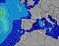 | |||||||||||||
Wave Height (m) Direction Period (s) | W 8 | W 9 | W 9 | W 8 | W 8 | W 8 | W 8 | WNW 8 | NNE 5 | NNE 6 | NNE 6 | NNE 6 | N 7 | N 7 | NNE 7 | WNW 11 | NNE 7 | NNE 7 | WNW 10 | NNE 6 | NNE 6 |
Wave Graph | |||||||||||||||||||||
22 | 25 | 25 | 22 | 12 | 12 | 12 | 13 | 113 | 93 | 103 | 170 | 113 | 114 | 157 | 23 | 180 | 362 | 18 | 109 | 277 | |
Wind (km/h) | |||||||||||||||||||||
Wind State on-shore cross-onshore cross-shore cross-offshore off-shore glassy | off | cross | cross-on | cross-off | glassy | cross-on | cross | cross | cross | cross | cross | cross | cross | glassy | cross | cross | cross | cross | cross-off | glassy | on |
High Tide | 6:29AM3.34m | 6:46PM3.72m | 7:15AM3.28m | 7:32PM3.64m | 8:00AM3.17m | 8:17PM3.46m | 8:45AM3.01m | 9:02PM3.21m | 9:31AM2.84m | 9:50PM2.93m | 10:21AM2.67m | 10:43PM2.67m | 11:18AM2.54m | ||||||||
Low Tide | 00:15AM-0.07m | 12:26PM0.10m | 1:02AM-0.04m | 1:11PM0.16m | 1:48AM0.08m | 1:56PM0.29m | 2:33AM0.27m | 2:42PM0.47m | 3:18AM0.49m | 3:31PM0.69m | 4:05AM0.73m | 4:24PM0.90m | 4:58AM0.94m | 5:28PM1.07m | |||||||
— | 7:05 | — | — | 7:07 | — | — | 7:07 | — | — | 7:07 | — | — | 7:09 | — | — | 7:09 | — | — | 7:11 | — | |
10:12 | — | — | 10:10 | — | — | 10:10 | — | — | 10:09 | — | — | 10:08 | — | — | 10:07 | — | — | 10:07 | — | 10:06 | |
mm | — | — | 1 | — | — | — | — | — | — | — | — | — | — | — | — | — | — | — | — | — | — |
Temp °C | 20 | 19 | 19 | 19 | 18 | 20 | 20 | 21 | 22 | 22 | 22 | 23 | 21 | 20 | 25 | 24 | 21 | 25 | 25 | 20 | 21 |
Feels °C | 20 | 20 | 19 | 20 | 19 | 19 | 18 | 19 | 18 | 17 | 19 | 18 | 17 | 22 | 22 | 19 | 21 | 22 | 21 | 21 | 22 |
Swell 1 Height (m) Direction Period (s) | W 8 | W 9 | W 9 | W 8 | W 8 | W 8 | W 8 | WNW 8 | WNW 8 | NW 9 | NW 9 | NW 8 | N 7 | N 7 | WNW 11 | WNW 11 | WNW 10 | WNW 10 | WNW 10 | WNW 10 | WNW 9 |
22 | 25 | 25 | 22 | 12 | 12 | 12 | 13 | 13 | 13 | 28 | 18 | 113 | 114 | 25 | 23 | 33 | 33 | 18 | 18 | 17 | |
Swell 2 Height (m) Direction Period (s) | NNE 7 | WSW 5 | N 6 | W 4 | NNE 6 | — | — | N 11 | NW 10 | WNW 8 | W 10 | W 9 | W 8 | W 8 | W 8 | NNW 7 | — | — | — | NW 7 | — |
9 | 2 | 2 | 1 | 3 | — | — | 2 | 4 | 11 | 2 | 6 | 5 | 5 | 5 | 9 | — | — | — | 2 | — | |
Swell 3 Height (m) Direction Period (s) | WSW 5 | NNE 6 | — | N 6 | SW 4 | — | — | — | — | W 11 | — | NW 10 | NNW 8 | WNW 12 | NW 8 | W 8 | — | — | — | — | — |
6 | 7 | — | 2 | 1 | — | — | — | — | 2 | — | 4 | 6 | 14 | 3 | 1 | — | — | — | — | — | |
Wind waves Height (m) Direction Period (s) | — | — | W 5 | — | — | N 5 | NNE 3 | NNE 4 | NNE 5 | NNE 6 | NNE 6 | NNE 6 | — | — | NNE 7 | NE 6 | NNE 7 | NNE 7 | NNE 7 | NNE 6 | NNE 6 |
— | — | 4 | — | — | 5 | 4 | 10 | 113 | 93 | 103 | 170 | — | — | 157 | 162 | 180 | 362 | 237 | 109 | 277 | |
Nearest Offshore or Glassy | |||||||||||||||||||||
Distance (km) | 18 | 117 | 888 | 596 | 547 | 902 | 1247 | 824 | 967 | 107 | 76 | 76 | 48 | 0 | 97 | 97 | 5 | 119 | 19 | 0 | 295 |
Best forecast wave conditions in Galicia | |||||||||||||||||||||
Best forecast wave conditions in Spain (Europe) | |||||||||||||||||||||
Header Global | |||||||||||||||||||||
- Map Icons:
 Break
Break Live Wave Height (m)
 Live Wind Speed (km/h)
 Surf Rating (10 Max)
 Ocean Swells (m)
- Wind Speed (km/h)


FREE! Surf-Forecast.com widget for your website
The surf report / weather widget below is available to embed on third party websites free of charge and provides a summary of our Playa de San Xurxo surf forecast. Simply grab the html code snippet that we provide and paste it into your own site. You can choose your preferred language and metric/imperial units for the surf forecast feed to suit users of your site. Click here to get the code.
Information about the Playa de San Xurxo Surf forecast
The above surf forecast table for Playa de San Xurxo provides essential information for determining whether the surfing conditions will be good over the next 16 days. A general guide to surfing at Playa de San Xurxo can be found by selecting the local surf guide option on the grey menu. Our Playa de San Xurxo surf forecast is unique since it includes wave energy (power) that defines the real feel of the surf rather than just the height or the period. If you surf the same spot (Playa de San Xurxo) regularly then make a mental note of the wave energy from the surf forecast table each time you go. Very soon you may start to choose your surf days based on the wave energy alone combined with our forecast of favourable offshore wind conditions. Our star ratings will help here and of course you will also find the usual wave height and period predictions on our surf forecasts as well as a full break down of the swell components under our advanced users option (to reveal that, click the little Einstein character under the tide times).
Further information to help with frequently asked questions about our surf forecast for Playa de San Xurxo may be found under the help tab on the top menu and also by moving your mouse over the question marks on the surf forecast table itself. Please always bear in mind that the forecast is for near-shore open water and local factors at each surf break influence the actual breaking wave height, such as the beach / reef profile, water depths offshore and shelter.
Playa de San Xurxo is 8 km (5 miles) from El Ferrol. If you plan a holiday in Galicia, look for hotels and other accommodation in El Ferrol. El Ferrol has rooms for a wide range of budgets as well as car hire and transport links.
 Nearest