

Surf Forecasts:

How big are the waves at Matadeiro today (10 Jun):
- Morning surf: Morning surf (10 Jun, local time) - 6ft (1.8m), 11s period with NW swell.
- Afternoon surf: Afternoon surf (10 Jun, local time) - 5ft (1.6m), 10s period with NW swell.
- Evening surf: Evening surf (10 Jun, local time) - 5ft (1.6m), 10s period with NW swell.
The current surf forecast for Matadeiro at 4PM is: 1.6m 10s primary swell from a Northwest direction and 0.6m 9s secondary swell from a West direction (forecast issued at 01:00pm June 10). The wind direction is predicted to be onshore.
| Time (CEST) & Date | Wave Height | Wave Period |
|---|---|---|
| Morning (10 Jun) | 6ft (1.8m) | 11s |
| Afternoon (10 Jun) | 5ft (1.6m) | 10s |
| Evening (10 Jun) | 5ft (1.6m) | 10s |
Table - waves today at Matadeiro. (Swell directed towards the surf break)
Updates in hr min s Forecast update imminent
Short Range ForecastMostly dry. Warm (max 33°C on Fri afternoon, min 11°C on Wed night). Winds decreasing (fresh winds from the NNE on Thu afternoon, calm by Sat morning). | ||||||||||||||||||||||||
Wed 10 | Thursday 11 | Friday 12 | Sat 13 | |||||||||||||||||||||
11 AM | 2 PM | 5 PM | 8 PM | 11 PM | 2 AM | 5 AM | 8 AM | 11 AM | 2 PM | 5 PM | 8 PM | 11 PM | 2 AM | 5 AM | 8 AM | 11 AM | 2 PM | 5 PM | 8 PM | 11 PM | 2 AM | 5 AM | 8 AM | |
Swell Height Map |  |  |  | 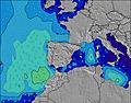 |  |  | 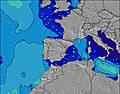 |  |  | |||||||||||||||
Wave Height (m) Direction Period (s) | NW 10 | NW 10 | NW 10 | NW 10 | NNW 10 | NW 10 | NW 9 | NW 9 | NW 9 | NW 9 | NW 9 | NNE 6 | NNE 5 | NW 8 | NW 8 | NE 6 | NE 6 | NW 10 | NW 10 | NW 14 | NW 13 | NW 13 | NW 12 | WNW 12 |
Wave Graph | ||||||||||||||||||||||||
664 | 530 | 520 | 480 | 490 | 320 | 272 | 266 | 206 | 156 | 138 | 145 | 94 | 84 | 84 | 68 | 59 | 100 | 132 | 241 | 488 | 668 | 597 | 647 | |
Wind (km/h) | ||||||||||||||||||||||||
Wind State on-shore cross-onshore cross-shore cross-offshore off-shore glassy | cross-on | on | on | on | cross-on | cross-on | cross-on | cross | cross-on | cross-on | cross-on | cross-on | cross-on | cross-on | cross-on | cross-on | cross-on | cross-on | cross-on | cross-on | cross | cross | cross-off | cross-off |
High Tide | 12:48PM2.66m | 1:06AM2.83m | 1:47PM2.84m | 2:08AM2.97m | 2:43PM3.05m | 3:06AM3.12m | ||||||||||||||||||
Low Tide | 6:52PM0.87m | 7:28AM0.61m | 7:54PM0.69m | 8:24AM0.46m | 8:52PM0.48m | |||||||||||||||||||
— | — | — | — | — | — | 6:52 | — | — | — | — | — | — | — | 6:52 | — | — | — | — | — | — | — | 6:52 | — | |
— | — | — | 10:13 | — | — | — | — | — | — | — | 10:13 | — | — | — | — | — | — | — | 10:14 | — | — | — | 10:14 | |
mm | — | — | — | — | — | — | — | — | — | — | — | — | — | — | — | — | — | — | — | — | — | — | — | — |
Temp °C | 15 | 16 | 16 | 16 | 14 | 12 | 11 | 11 | 17 | 22 | 22 | 21 | 17 | 17 | 18 | 19 | 25 | 31 | 33 | 31 | 25 | 22 | 22 | 22 |
Feels °C | 14 | 13 | 12 | 12 | 11 | 10 | 9 | 9 | 15 | 17 | 16 | 16 | 13 | 13 | 15 | 16 | 22 | 26 | 29 | 28 | 24 | 21 | 21 | 20 |
Swell 1 Height (m) Direction Period (s) | NW 10 | NW 10 | NW 10 | NW 10 | NNW 10 | NW 10 | NW 9 | NW 9 | NW 9 | NW 9 | NW 9 | NW 8 | NW 8 | NW 8 | NW 8 | NW 8 | NW 9 | NW 10 | NW 10 | NW 14 | NW 13 | NW 13 | NW 12 | WNW 12 |
664 | 530 | 520 | 480 | 490 | 320 | 272 | 266 | 206 | 156 | 129 | 118 | 84 | 84 | 84 | 58 | 59 | 100 | 120 | 241 | 488 | 668 | 597 | 647 | |
Swell 2 Height (m) Direction Period (s) | W 10 | W 10 | W 9 | W 9 | W 9 | W 9 | W 9 | W 9 | W 8 | W 8 | W 8 | W 8 | W 8 | W 8 | W 8 | W 8 | WNW 8 | WNW 9 | WNW 9 | NW 9 | NE 6 | NE 6 | NE 7 | NE 7 |
90 | 89 | 61 | 58 | 57 | 40 | 39 | 37 | 35 | 34 | 34 | 37 | 36 | 36 | 36 | 36 | 24 | 25 | 26 | 86 | 85 | 42 | 43 | 26 | |
Swell 3 Height (m) Direction Period (s) | — | — | — | — | — | — | — | — | — | — | — | — | — | — | — | NNW 11 | NW 11 | NW 16 | NW 15 | WNW 9 | W 9 | — | NNW 9 | NW 9 |
— | — | — | — | — | — | — | — | — | — | — | — | — | — | — | 23 | 30 | 10 | 54 | 26 | 14 | — | 8 | 3 | |
Wind waves Height (m) Direction Period (s) | — | — | — | — | — | NE 4 | NE 3 | NE 3 | NE 4 | NNE 4 | NNE 5 | NNE 6 | NNE 5 | NE 5 | NE 6 | NE 6 | NE 6 | NE 6 | NE 6 | NE 6 | — | — | — | — |
— | — | — | — | — | 7 | 3 | 2 | 3 | 42 | 138 | 145 | 94 | 67 | 61 | 68 | 58 | 82 | 132 | 132 | — | — | — | — | |
Nearest Offshore or Glassy | ||||||||||||||||||||||||
Distance (km) | 0 | 0 | 74 | 74 | 90 | 75 | 74 | 0 | 0 | 0 | 0 | 89 | 222 | 177 | 82 | 82 | 0 | 0 | 0 | 80 | 90 | 80 | 0 | 0 |
Best forecast wave conditions in Galicia | ||||||||||||||||||||||||
Best forecast wave conditions in Spain (Europe) | ||||||||||||||||||||||||
Header Global | ||||||||||||||||||||||||
- Map Icons:
 Break
Break Live Wave Height (m)
 Live Wind Speed (km/h)
 Surf Rating (10 Max)
 Ocean Swells (m)
- Wind Speed (km/h)


FREE! Surf-Forecast.com widget for your website
The surf report / weather widget below is available to embed on third party websites free of charge and provides a summary of our Matadeiro surf forecast. Simply grab the html code snippet that we provide and paste it into your own site. You can choose your preferred language and metric/imperial units for the surf forecast feed to suit users of your site. Click here to get the code.
 Nearest