
- Forecast
- Maps
- Live
- Weather State
- Spot Information
Pererenan Surf Forecast
/ Bali – Kuta (4 surf breaks) /Surf Forecasts:

Pererenan surfForecast / Bali – Kuta / Indonesia
Forecast update in hr min s Forecast update imminent
Pererenan surf forecast is for near shore open water. Breaking waves will often be smaller at less exposed spots.
Today's Pererenan sea temperature is
29.4° C
(Which is slightly warmer than usual)How big are the waves at Pererenan today?
The current surf forecast for Pererenan at 12PM is: 2.1m 15s primary swell from a South-southwest direction (forecast issued at 07:00am April 23). An open ocean swell of 0.4m 6s is not directed at the surf break. The wind direction is predicted to be cross-shore.
| Time (WITA) & Date | Wave Height | Wave Period |
|---|---|---|
| Morning (23 Apr) | 7ft (2.1m) | 16s |
| Afternoon (23 Apr) | 7ft (2.1m) | 15s |
| Evening (23 Apr) | 7ft (2.1m) | 14s |
Table - waves today at Pererenan. (Swell directed towards the surf break)
Updates in hr min s Forecast update imminent
Short Range ForecastLight rain (total 8mm), mostly falling on Fri afternoon. Warm (max 29°C on Thu afternoon, min 26°C on Thu morning). Wind will be generally light. | ||||||||||||||||||||||||
Thursday 23 | Friday 24 | Saturday 25 | Sun 26 | |||||||||||||||||||||
5 AM | 8 AM | 11 AM | 2 PM | 5 PM | 8 PM | 11 PM | 2 AM | 5 AM | 8 AM | 11 AM | 2 PM | 5 PM | 8 PM | 11 PM | 2 AM | 5 AM | 8 AM | 11 AM | 2 PM | 5 PM | 8 PM | 11 PM | 2 AM | |
Swell Height Map |    |    |    |  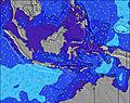  | ||||||||||||||||||||
SSW 16 | SSW 16 | SSW 16 | SSW 15 | SSW 14 | SSW 14 | SSW 14 | SSW 14 | SSW 14 | SSW 13 | SSW 13 | SSW 13 | SSW 13 | SSW 13 | SSW 13 | SSW 13 | SSW 13 | SSW 13 | SSW 12 | SSW 13 | SSW 15 | SSW 17 | SSW 17 | SSW 16 | |
1875 | 2054 | 2028 | 1825 | 1752 | 1887 | 1704 | 1680 | 1318 | 1127 | 1127 | 1018 | 950 | 837 | 734 | 722 | 587 | 497 | 473 | 423 | 1193 | 717 | 2024 | 1794 | |
Wind (km/h) | ||||||||||||||||||||||||
off | off | cross | cross | cross-off | cross-off | cross-off | off | off | cross-off | glassy | cross | cross-off | glassy | cross-off | off | off | cross-off | cross-off | cross | cross-off | cross-off | glassy | glassy | |
High Tide | 1:22PM2.43m | 2:32AM1.63m | 2:14PM2.15m | 4:06AM1.54m | 3:38PM1.87m | |||||||||||||||||||
Low Tide | 6:57AM0.79m | 8:21PM0.47m | 7:44AM0.99m | 9:29PM0.71m | 9:05AM1.20m | 11:08PM0.86m | ||||||||||||||||||
6:22 | — | — | — | — | — | — | — | 6:22 | — | — | — | — | — | — | — | 6:22 | — | — | — | — | — | — | 6:22 | |
— | — | — | — | 6:13 | — | — | — | — | — | — | — | 6:13 | — | — | — | — | — | — | — | 6:12 | — | — | 6:12 | |
— | — | — | — | — | — | — | — | — | — | — | — | 2 | 1 | 1 | — | — | — | — | 1 | 1 | — | — | 1 | |
Temp °C | 25 | 26 | 28 | 29 | 28 | 27 | 27 | 26 | 26 | 26 | 28 | 28 | 29 | 28 | 27 | 26 | 26 | 26 | 29 | 28 | 28 | 27 | 27 | 27 |
29 | 30 | 31 | 31 | 31 | 30 | 30 | 29 | 30 | 30 | 33 | 32 | 33 | 33 | 31 | 30 | 30 | 29 | 32 | 30 | 31 | 31 | 32 | 32 | |
Swell 1 Height (m) Direction Period (s) | SSW 16 | SSW 16 | SSW 16 | SSW 15 | SSW 14 | SSW 14 | SSW 14 | SSW 14 | SSW 14 | SSW 13 | SSW 13 | SSW 13 | SSW 13 | SSW 13 | SSW 13 | SSW 13 | SSW 13 | SSW 13 | SSW 12 | SSW 13 | SSW 15 | SSW 14 | SSW 17 | SSW 16 |
1875 | 2054 | 2028 | 1825 | 1752 | 1887 | 1704 | 1680 | 1318 | 1127 | 1127 | 1018 | 950 | 837 | 734 | 722 | 587 | 497 | 473 | 423 | 1193 | 692 | 2024 | 1794 | |
Swell 2 Height (m) Direction Period (s) | ESE 6 | SE 6 | SE 6 | SE 6 | — | — | SE 6 | SE 6 | SE 6 | SE 6 | SE 6 | SE 6 | SE 5 | SE 6 | SE 6 | SE 6 | SE 6 | SSW 16 | SSW 16 | SSW 15 | SE 8 | SSW 17 | SE 8 | SE 7 |
13 | 8 | 8 | 16 | — | — | 9 | 9 | 8 | 5 | 5 | 5 | 10 | 11 | 18 | 25 | 26 | 201 | 280 | 322 | 64 | 717 | 67 | 52 | |
Swell 3 Height (m) Direction Period (s) | — | — | — | — | — | — | — | — | — | — | — | — | — | S 23 | SW 22 | SSW 21 | SSW 16 | SE 7 | SE 7 | SE 7 | WSW 15 | SE 8 | WSW 15 | — |
— | — | — | — | — | — | — | — | — | — | — | — | — | 11 | 19 | 45 | 103 | 29 | 30 | 42 | 21 | 86 | 21 | — | |
Wind waves Height (m) Direction Period (s) | — | — | — | — | SE 6 | ESE 6 | ESE 6 | ESE 6 | — | ESE 6 | — | — | — | — | — | — | — | — | — | — | — | — | — | — |
— | — | — | — | 17 | 14 | 22 | 19 | — | 22 | — | — | — | — | — | — | — | — | — | — | — | — | — | — | |
Nearest Offshore or Glassy | ||||||||||||||||||||||||
Distance (km) | 0 | 0 | 4 | 12 | 0 | 0 | 0 | 0 | 0 | 0 | 0 | 4 | 0 | 0 | 0 | 0 | 0 | 0 | 0 | 12 | 0 | 0 | 0 | 0 |
Best forecast wave conditions in West Coast of Bali | ||||||||||||||||||||||||
Best forecast wave conditions in Indonesia | ||||||||||||||||||||||||
Header Global | ||||||||||||||||||||||||
- Map Icons:
 Break
Break Live Wave Height (m)
 Live Wind Speed (km/h)
 Surf Rating (10 Max)
 Ocean Swells (m)
- Wind Speed (km/h)


FREE! Surf-Forecast.com widget for your website
The surf report / weather widget below is available to embed on third party websites free of charge and provides a summary of our Pererenan surf forecast. Simply grab the html code snippet that we provide and paste it into your own site. You can choose your preferred language and metric/imperial units for the surf forecast feed to suit users of your site. Click here to get the code.
 Nearest