
- Forecast
- Maps
- Live
- Weather State
- Spot Information
Mimiwhangata Surf Forecast
/ Northland (73 surf breaks) /Surf Forecasts:

Mimiwhangata surfForecast / Northland / New Zealand
Forecast update in hr min s Forecast update imminent
Mimiwhangata surf forecast is for near shore open water. Breaking waves will often be smaller at less exposed spots.
Today's Mimiwhangata sea temperature is
19.2° C
(Which is slightly warmer than usual)How big are the waves at Mimiwhangata today?
The current surf forecast for Mimiwhangata at 11PM is: 0.2m 12s primary swell from a North direction and 0.1m 12s secondary swell from a Northeast direction (forecast issued at 05:00pm May 01). An open ocean swell of 1.9m 8s is not directed at the surf break. The wind direction is predicted to be cross-offshore.
| Time (NZST) & Date | Wave Height | Wave Period |
|---|---|---|
| Morning (01 May) | - | - |
| Afternoon (01 May) | 0.5ft (0.2m) | 11s |
| Evening (01 May) | 0.5ft (0.2m) | 12s |
Table - waves today at Mimiwhangata. (Swell directed towards the surf break)
Updates in hr min s Forecast update imminent
Short Range ForecastMostly dry. Very mild (max 18°C on Mon morning, min 16°C on Fri afternoon). Mainly fresh winds. | ||||||||||||||||||||||||
Fri 1 | Saturday 2 | Sunday 3 | Mon 4 | |||||||||||||||||||||
3 PM | 6 PM | 9 PM | 12 AM | 3 AM | 6 AM | 9 AM | 12 PM | 3 PM | 6 PM | 9 PM | 12 AM | 3 AM | 6 AM | 9 AM | 12 PM | 3 PM | 6 PM | 9 PM | 12 AM | 3 AM | 6 AM | 9 AM | 12 PM | |
Swell Height Map |    |    |    |   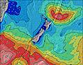 | ||||||||||||||||||||
N 11 | N 11 | N 12 | N 12 | N 15 | NE 8 | N 10 | N 15 | N 14 | N 14 | N 14 | N 13 | N 13 | N 13 | N 13 | N 13 | N 12 | N 12 | N 12 | N 12 | N 12 | N 12 | N 12 | N 11 | |
9 | 10 | 11 | 11 | 17 | 111 | 8 | 4 | 4 | 15 | 14 | 14 | 4 | 4 | 3 | 3 | 12 | 12 | 12 | 3 | 3 | 3 | 11 | 2 | |
Wind (km/h) | ||||||||||||||||||||||||
cross-off | cross-off | cross-off | cross-off | cross-off | cross-off | cross-off | cross-off | cross-off | cross-off | cross-off | cross-off | cross-off | cross-off | cross-off | cross-off | cross-off | cross-off | cross-off | cross-off | cross-off | cross-off | cross-off | cross-off | |
High Tide | 7:21PM1.94m | 7:31AM1.90m | 8:02PM1.97m | 8:11AM1.89m | 8:41PM1.98m | 8:50AM1.86m | ||||||||||||||||||
Low Tide | 1:30AM0.37m | 1:46PM0.22m | 2:11AM0.37m | 2:24PM0.23m | 2:52AM0.38m | |||||||||||||||||||
— | — | — | — | — | 6:58 | — | — | — | — | — | — | — | 7:00 | — | — | — | — | — | — | — | 7:01 | — | — | |
5:38 | — | — | — | — | — | — | — | 5:37 | — | — | — | — | — | — | — | 5:37 | — | — | — | — | — | — | 5:36 | |
— | — | — | — | — | — | — | — | — | — | — | — | — | — | — | — | — | — | — | — | — | — | — | — | |
Temp °C | 17 | 16 | 16 | 16 | 16 | 16 | 17 | 17 | 17 | 17 | 17 | 17 | 16 | 17 | 17 | 17 | 17 | 16 | 16 | 16 | 16 | 17 | 17 | 18 |
11 | 11 | 11 | 11 | 12 | 12 | 13 | 13 | 13 | 14 | 13 | 14 | 13 | 14 | 13 | 13 | 14 | 13 | 13 | 12 | 13 | 13 | 13 | 15 | |
Swell 1 Height (m) Direction Period (s) | NE 8 | NE 8 | N 12 | NE 12 | NE 7 | NE 8 | NE 7 | NE 8 | ENE 8 | NE 8 | N 14 | ENE 8 | ENE 8 | ENE 8 | ENE 8 | N 11 | E 9 | ENE 8 | ENE 8 | ENE 8 | N 12 | E 8 | N 12 | N 11 |
91 | 34 | 11 | 6 | 84 | 111 | 128 | 169 | 198 | 255 | 14 | 319 | 284 | 270 | 270 | 2 | 6 | 277 | 226 | 221 | 3 | 29 | 3 | 2 | |
Swell 2 Height (m) Direction Period (s) | N 11 | N 11 | NE 12 | N 12 | NE 12 | NE 12 | N 10 | N 10 | N 14 | N 14 | N 11 | N 13 | N 13 | N 13 | N 11 | E 9 | N 12 | E 9 | ESE 9 | ESE 10 | N 10 | N 12 | N 12 | — |
9 | 10 | 6 | 11 | 6 | 6 | 8 | 2 | 4 | 15 | 2 | 14 | 4 | 4 | 2 | 2 | 12 | 6 | 17 | 18 | 2 | 3 | 11 | — | |
Swell 3 Height (m) Direction Period (s) | NE 13 | NE 12 | N 15 | N 15 | N 15 | N 15 | NE 12 | N 15 | N 10 | N 10 | N 11 | N 10 | N 11 | N 11 | N 13 | N 13 | — | N 12 | N 12 | N 12 | — | N 10 | N 10 | — |
6 | 6 | 4 | 4 | 17 | 4 | 6 | 4 | 2 | 2 | 9 | 2 | 2 | 2 | 3 | 3 | — | 12 | 12 | 3 | — | 2 | 2 | — | |
Wind waves Height (m) Direction Period (s) | ESE 8 | E 8 | E 8 | E 7 | ESE 7 | ESE 7 | ESE 7 | ESE 7 | ESE 7 | ESE 7 | ENE 8 | ESE 7 | ESE 7 | ESE 7 | — | ENE 8 | ENE 8 | — | — | — | ENE 8 | ENE 8 | ENE 8 | ENE 8 |
486 | 463 | 458 | 388 | 208 | 166 | 151 | 102 | 53 | 53 | 328 | 77 | 77 | 70 | — | 277 | 277 | — | — | — | 210 | 216 | 215 | 210 | |
Nearest Offshore or Glassy | ||||||||||||||||||||||||
Distance (km) | 127 | 127 | 127 | 84 | 84 | 84 | 84 | 122 | 121 | 84 | 84 | 51 | 68 | 84 | 100 | 84 | 84 | 84 | 84 | 84 | 84 | 84 | 84 | 84 |
Best forecast wave conditions in Northland | ||||||||||||||||||||||||
Best forecast wave conditions in New Zealand | ||||||||||||||||||||||||
Header Global | ||||||||||||||||||||||||
- Map Icons:
 Break
Break Live Wave Height (m)
 Live Wind Speed (km/h)
 Surf Rating (10 Max)
 Ocean Swells (m)
- Wind Speed (km/h)


FREE! Surf-Forecast.com widget for your website
The surf report / weather widget below is available to embed on third party websites free of charge and provides a summary of our Mimiwhangata surf forecast. Simply grab the html code snippet that we provide and paste it into your own site. You can choose your preferred language and metric/imperial units for the surf forecast feed to suit users of your site. Click here to get the code.
 Nearest