
- Forecast
- Maps
- Live
- Weather State
- Spot Information
St Jean de Luz - La Bougie Surf Forecast
/ La Cote Basque (36 surf breaks) /Surf Forecasts:

St Jean de Luz - La Bougie surfForecast / La Cote Basque / France
Forecast update in hr min s Forecast update imminent
Today's St Jean de Luz - La Bougie sea temperature is
16.8° C
(Which is 3.3°C warmer than normal for this time of year)Updates in hr min s Forecast update imminent
Short Range ForecastModerate rain (total 14mm), heaviest on Mon night. Very mild (max 18°C on Sun afternoon, min 12°C on Sun morning). Wind will be generally light. | ||||||||||||||||||||||||
Sunday 26 | Monday 27 | Tuesday 28 | ||||||||||||||||||||||
2 AM | 5 AM | 8 AM | 11 AM | 2 PM | 5 PM | 8 PM | 11 PM | 2 AM | 5 AM | 8 AM | 11 AM | 2 PM | 5 PM | 8 PM | 11 PM | 2 AM | 5 AM | 8 AM | 11 AM | 2 PM | 5 PM | 8 PM | 11 PM | |
Swell Height Map |  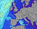  |    |    | |||||||||||||||||||||
W 9 | W 9 | W 9 | W 9 | W 8 | W 8 | W 8 | W 8 | W 8 | W 10 | W 10 | W 10 | W 9 | W 9 | W 9 | W 9 | W 8 | W 8 | W 11 | W 11 | W 11 | W 10 | W 15 | NW 15 | |
0 | 0 | 0 | 0 | 0 | 0 | 0 | 0 | 0 | 0 | 0 | 0 | 0 | 0 | 0 | 0 | 0 | 0 | 0 | 0 | 0 | 0 | 0 | 0 | |
Wind (km/h) | ||||||||||||||||||||||||
cross | glassy | glassy | glassy | on | on | glassy | glassy | cross | cross-off | cross | glassy | on | on | glassy | glassy | cross-off | glassy | cross | cross | on | cross-on | on | glassy | |
High Tide | 1:15AM3.64m | 2:04PM3.48m | 2:22AM3.80m | 2:58PM3.67m | 3:14AM3.95m | 3:42PM3.84m | ||||||||||||||||||
Low Tide | 7:35AM1.34m | 7:56PM1.49m | 8:36AM1.19m | 8:52PM1.27m | 9:24AM1.04m | 9:38PM1.07m | ||||||||||||||||||
— | 7:07 | — | — | — | — | — | — | — | 7:05 | — | — | — | — | — | — | — | 7:03 | — | — | — | — | — | — | |
— | — | — | — | — | — | 9:01 | — | — | — | — | — | — | — | 9:02 | — | — | — | — | — | — | — | 9:04 | — | |
— | — | — | — | — | — | — | — | — | — | — | — | — | — | 1 | 1 | 3 | 2 | 1 | — | — | — | 2 | 1 | |
Temp °C | 13 | 12 | 12 | 16 | 18 | 18 | 16 | 15 | 14 | 14 | 14 | 15 | 17 | 18 | 16 | 16 | 15 | 14 | 14 | 15 | 16 | 14 | 13 | 13 |
12 | 11 | 11 | 16 | 17 | 17 | 16 | 15 | 14 | 14 | 14 | 15 | 17 | 17 | 16 | 16 | 15 | 14 | 14 | 14 | 15 | 13 | 13 | 13 | |
Swell 1 Height (m) Direction Period (s) | NW 4 | NW 4 | NW 4 | NW 4 | NW 4 | NW 4 | NW 4 | W 8 | W 8 | W 8 | W 10 | W 10 | W 9 | W 9 | W 9 | W 9 | W 8 | NW 4 | — | — | — | — | NNW 5 | NNW 5 |
1 | 1 | 1 | 1 | 1 | 1 | 1 | 1 | 1 | 1 | 2 | 2 | 2 | 2 | 2 | 1 | 1 | 1 | — | — | — | — | 2 | 3 | |
Swell 2 Height (m) Direction Period (s) | W 9 | W 9 | W 9 | W 9 | W 8 | W 8 | W 8 | NW 4 | — | — | — | — | — | — | — | — | — | W 8 | W 8 | W 8 | W 8 | W 8 | W 15 | NW 15 |
2 | 2 | 2 | 2 | 1 | 1 | 1 | 1 | — | — | — | — | — | — | — | — | — | 1 | 1 | 1 | 1 | 1 | 4 | 8 | |
Swell 3 Height (m) Direction Period (s) | — | — | — | — | — | — | — | — | — | W 10 | — | — | — | — | — | — | — | — | W 11 | W 11 | W 11 | W 10 | W 10 | W 10 |
— | — | — | — | — | — | — | — | — | 2 | — | — | — | — | — | — | — | — | 2 | 2 | 2 | 2 | 2 | 2 | |
Wind waves Height (m) Direction Period (s) | — | — | — | — | — | — | — | — | — | — | — | — | — | — | — | — | — | — | — | — | — | — | — | — |
— | — | — | — | — | — | — | — | — | — | — | — | — | — | — | — | — | — | — | — | — | — | — | — | |
Nearest Offshore or Glassy | ||||||||||||||||||||||||
Distance (km) | 308 | 96 | 96 | 96 | 292 | 336 | 336 | 478 | 453 | 453 | 214 | 282 | 454 | 454 | 503 | 83 | 96 | 77 | 96 | 143 | 96 | 106 | 11 | 3 |
Best forecast wave conditions in La Cote Basque | ||||||||||||||||||||||||
Best forecast wave conditions in France | ||||||||||||||||||||||||
Header Global | ||||||||||||||||||||||||
- Map Icons:
 Break
Break Live Wave Height (m)
 Live Wind Speed (km/h)
 Surf Rating (10 Max)
 Ocean Swells (m)
- Wind Speed (km/h)


FREE! Surf-Forecast.com widget for your website
The surf report / weather widget below is available to embed on third party websites free of charge and provides a summary of our St Jean de Luz - La Bougie surf forecast. Simply grab the html code snippet that we provide and paste it into your own site. You can choose your preferred language and metric/imperial units for the surf forecast feed to suit users of your site. Click here to get the code.
 Nearest