

Surf Forecasts:

How big are the waves at El Bajo / La Bestia today (31 Jul):
- Morning surf: Morning surf (31 Jul, local time) - 3ft (0.9m), 12s period with WSW swell.
- Afternoon surf: Afternoon surf (31 Jul, local time) - 3ft (0.9m), 12s period with SW swell.
- Evening surf: Evening surf (31 Jul, local time) - 3ft (0.9m), 12s period with SW swell.
The current surf forecast for El Bajo / La Bestia at 4PM is: 0.9m 12s primary swell from a Southwest direction and 0.4m 8s secondary swell from a South-southwest direction (forecast issued at 01:00am July 31). The wind direction is predicted to be onshore.
| Time (-04) & Date | Wave Height | Wave Period |
|---|---|---|
| Morning (31 Jul) | 3ft (0.9m) | 12s |
| Afternoon (31 Jul) | 3ft (0.9m) | 12s |
| Evening (31 Jul) | 3ft (0.9m) | 12s |
Table - waves today at El Bajo / La Bestia. (Swell directed towards the surf break)
Short Range ForecastMostly dry. Warm (max 20°C on Sat morning, min 16°C on Fri morning). Wind will be generally light. | ||||||||||||||||||||||||
Friday 31 | Saturday 1 | Sunday 2 | ||||||||||||||||||||||
2 AM | 5 AM | 8 AM | 11 AM | 2 PM | 5 PM | 8 PM | 11 PM | 2 AM | 5 AM | 8 AM | 11 AM | 2 PM | 5 PM | 8 PM | 11 PM | 2 AM | 5 AM | 8 AM | 11 AM | 2 PM | 5 PM | 8 PM | 11 PM | |
Swell Height Map |  | |  | 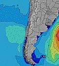 | 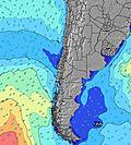 |  |  | 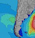 | 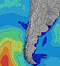 | |||||||||||||||
Wave Height (m) Direction Period (s) | SW 12 | WSW 12 | WSW 12 | WSW 12 | SW 12 | SW 12 | SW 12 | SW 11 | SW 11 | SW 11 | SW 11 | SW 11 | SW 11 | SW 10 | SW 10 | SW 10 | SW 10 | SW 10 | WSW 14 | WSW 14 | SW 10 | SW 10 | SW 10 | SW 9 |
Wave Graph | ||||||||||||||||||||||||
341 | 243 | 243 | 243 | 205 | 205 | 205 | 246 | 242 | 237 | 303 | 414 | 406 | 377 | 328 | 322 | 322 | 192 | 140 | 136 | 225 | 245 | 204 | 176 | |
Wind (km/h) | ||||||||||||||||||||||||
Wind State on-shore cross-onshore cross-shore cross-offshore off-shore glassy | glassy | on | cross-on | on | cross-on | on | on | cross-on | on | on | on | cross-on | glassy | glassy | glassy | glassy | glassy | glassy | on | cross-on | cross-on | glassy | glassy | glassy |
High Tide | 10:28AM1.36m | 10:55PM0.94m | 10:59AM1.32m | 11:31PM0.97m | 11:31AM1.27m | |||||||||||||||||||
Low Tide | 3:50AM0.39m | 5:14PM0.34m | 4:27AM0.41m | 5:42PM0.34m | 5:05AM0.44m | 6:11PM0.35m | ||||||||||||||||||
— | 7:11 | — | — | — | — | — | — | — | 7:09 | — | — | — | — | — | — | — | 7:09 | — | — | — | — | — | — | |
— | — | — | — | — | 6:22 | — | — | — | — | — | — | — | 6:22 | — | — | — | — | — | — | — | 6:22 | — | — | |
mm | — | — | — | — | — | — | — | — | — | — | — | — | — | — | — | — | — | — | — | — | — | — | — | — |
Temp °C | 17 | 16 | 16 | 18 | 18 | 18 | 19 | 17 | 18 | 18 | 18 | 20 | 19 | 18 | 17 | 17 | 17 | 18 | 18 | 19 | 19 | 18 | 17 | 17 |
Feels °C | 18 | 16 | 16 | 18 | 18 | 17 | 17 | 16 | 17 | 17 | 17 | 20 | 20 | 19 | 18 | 18 | 17 | 18 | 18 | 18 | 19 | 19 | 18 | 18 |
Swell 1 Height (m) Direction Period (s) | SW 12 | WSW 12 | WSW 12 | WSW 12 | SW 12 | SW 12 | SW 12 | SW 11 | SW 11 | SW 11 | SW 11 | SW 11 | SW 11 | SW 10 | SW 10 | SW 10 | SW 10 | SW 10 | SW 9 | SW 9 | SW 10 | SW 10 | SW 10 | SW 9 |
341 | 243 | 243 | 243 | 205 | 205 | 205 | 246 | 242 | 237 | 303 | 414 | 406 | 377 | 328 | 322 | 322 | 192 | 120 | 120 | 225 | 245 | 204 | 176 | |
Swell 2 Height (m) Direction Period (s) | SSW 9 | SSW 9 | SSW 9 | SSW 8 | SSW 8 | SSW 8 | SW 18 | WSW 18 | SSW 8 | SW 5 | SW 6 | SW 16 | WSW 16 | WSW 16 | SW 16 | WSW 15 | WSW 15 | WSW 15 | WSW 14 | SSW 6 | SSW 6 | WSW 14 | WSW 13 | SW 12 |
17 | 32 | 27 | 14 | 27 | 27 | 12 | 31 | 6 | 22 | 28 | 66 | 100 | 99 | 62 | 87 | 85 | 142 | 140 | 26 | 21 | 105 | 154 | 144 | |
Swell 3 Height (m) Direction Period (s) | W 13 | W 13 | W 13 | NW 13 | W 13 | SW 17 | W 13 | W 13 | WSW 17 | WSW 16 | WSW 16 | W 12 | W 12 | — | — | — | — | SW 10 | SSW 6 | WSW 14 | WSW 14 | SW 13 | SSW 13 | WSW 13 |
13 | 3 | 3 | 7 | 3 | 12 | 3 | 3 | 30 | 27 | 51 | 3 | 3 | — | — | — | — | 61 | 23 | 136 | 129 | 83 | 111 | 154 | |
Wind waves Height (m) Direction Period (s) | — | — | — | — | — | — | SSW 8 | SSW 8 | SW 5 | — | — | — | — | — | — | — | — | — | — | — | — | — | — | — |
— | — | — | — | — | — | 25 | 35 | 10 | — | — | — | — | — | — | — | — | — | — | — | — | — | — | — | |
Nearest Offshore or Glassy | ||||||||||||||||||||||||
Distance (km) | 0 | 2 | 2 | 2 | 2 | 2 | 2 | 2 | 2 | 2 | 2 | 2 | 0 | 0 | 0 | 0 | 0 | 0 | 2 | 2 | 2 | 0 | 0 | 0 |
Best forecast wave conditions in Tarapaca | ||||||||||||||||||||||||
Best forecast wave conditions in Chile | ||||||||||||||||||||||||
Header Global | ||||||||||||||||||||||||
- Map Icons:
 Break
Break Live Wave Height (m)
 Live Wind Speed (km/h)
 Surf Rating (10 Max)
 Ocean Swells (m)
- Wind Speed (km/h)
Latest Updates


FREE! Surf-Forecast.com widget for your website
The surf report / weather widget below is available to embed on third party websites free of charge and provides a summary of our El Bajo / La Bestia surf forecast. Simply grab the html code snippet that we provide and paste it into your own site. You can choose your preferred language and metric/imperial units for the surf forecast feed to suit users of your site. Click here to get the code.
 Nearest