

Surf Forecasts:

How big are the waves at K.O.A today (10 Jun):
- Morning surf: Morning surf (10 Jun, local time) - 2.5ft (0.7m), 7s period with ENE swell.
- Afternoon surf: Afternoon surf (10 Jun, local time) - 1.5ft (0.5m), 6s period with NE swell.
- Evening surf: Evening surf (10 Jun, local time) - 1.5ft (0.4m), 8s period with ESE swell.
The current surf forecast for K.O.A at 4PM is: 0.4m 8s primary swell from a East-southeast direction and 0.5m 6s secondary swell from a Northeast direction (forecast issued at 01:00pm June 10). An open ocean swell of 0.7m 4s is not directed at the surf break. The wind direction is predicted to be cross-offshore.
| Time (EDT) & Date | Wave Height | Wave Period |
|---|---|---|
| Morning (10 Jun) | 2.5ft (0.7m) | 7s |
| Afternoon (10 Jun) | 1.5ft (0.5m) | 6s |
| Evening (10 Jun) | 1.5ft (0.4m) | 8s |
Table - waves today at K.O.A. (Swell directed towards the surf break)
Updates in hr min s Forecast update imminent
Short Range ForecastModerate rain (total 11mm), heaviest on Wed night. Warm (max 27°C on Fri afternoon, min 22°C on Sat morning). Winds decreasing (strong winds from the SW on Wed night, light winds from the NW by Fri night). | ||||||||||||||||||||||||
Wed 10 | Thursday 11 | Friday 12 | Sat 13 | |||||||||||||||||||||
11 AM | 2 PM | 5 PM | 8 PM | 11 PM | 2 AM | 5 AM | 8 AM | 11 AM | 2 PM | 5 PM | 8 PM | 11 PM | 2 AM | 5 AM | 8 AM | 11 AM | 2 PM | 5 PM | 8 PM | 11 PM | 2 AM | 5 AM | 8 AM | |
Swell Height Map |  | 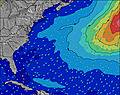 | 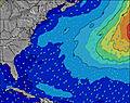 | 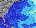 | 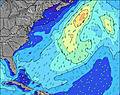 | 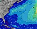 | 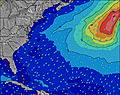 | 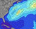 | 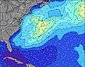 | |||||||||||||||
Wave Height (m) Direction Period (s) | ENE 7 | NE 6 | ESE 8 | ESE 8 | SE 8 | NE 6 | SE 7 | ESE 7 | ESE 8 | ESE 7 | ESE 8 | SE 7 | SE 7 | ESE 8 | E 9 | ESE 9 | ESE 9 | ESE 9 | ESE 9 | ESE 9 | ESE 9 | ESE 9 | ESE 9 | ESE 9 |
Wave Graph | ||||||||||||||||||||||||
30 | 19 | 24 | 23 | 15 | 11 | 14 | 11 | 11 | 11 | 11 | 14 | 14 | 11 | 7 | 8 | 15 | 8 | 16 | 16 | 8 | 16 | 16 | 16 | |
Wind (km/h) | ||||||||||||||||||||||||
Wind State on-shore cross-onshore cross-shore cross-offshore off-shore glassy | cross-off | cross-off | cross-off | cross-off | cross-off | cross-off | cross-off | cross-off | cross-off | cross-off | cross-off | cross-off | cross-off | cross-off | cross-off | cross-off | cross-off | cross-off | cross-off | off | cross-off | cross-off | cross-off | cross-off |
High Tide | 7:53PM0.20m | 6:32AM0.20m | 8:39PM0.21m | 7:30AM0.20m | 9:19PM0.21m | |||||||||||||||||||
Low Tide | 12:17PM0.06m | 00:19AM0.13m | 1:05PM0.06m | 1:18AM0.13m | 1:55PM0.06m | 4:05AM0.12m | ||||||||||||||||||
— | — | — | — | — | — | 5:45 | — | — | — | — | — | — | — | 5:45 | — | — | — | — | — | — | — | 5:45 | — | |
— | — | — | 8:15 | — | — | — | — | — | — | — | 8:16 | — | — | — | — | — | — | — | 8:16 | — | — | — | 8:17 | |
mm | — | — | — | — | — | 1 | 2 | 1 | — | — | 1 | — | — | 1 | — | — | — | — | — | 2 | 2 | 1 | — | — |
Temp °C | 23 | 23 | 24 | 23 | 23 | 23 | 23 | 23 | 25 | 25 | 25 | 25 | 25 | 24 | 24 | 24 | 25 | 27 | 26 | 25 | 25 | 23 | 23 | 23 |
Feels °C | 22 | 21 | 21 | 20 | 19 | 19 | 19 | 20 | 24 | 23 | 23 | 22 | 22 | 24 | 23 | 23 | 26 | 27 | 26 | 25 | 25 | 23 | 24 | 23 |
Swell 1 Height (m) Direction Period (s) | ENE 7 | NE 6 | NE 6 | ENE 6 | NE 6 | ESE 8 | SE 7 | ESE 7 | ESE 8 | ESE 7 | ESE 8 | SE 7 | SE 7 | ESE 8 | ESE 7 | ESE 9 | ESE 9 | ESE 9 | ESE 9 | ESE 9 | ESE 9 | ESE 9 | SSW 6 | S 6 |
30 | 19 | 19 | 16 | 10 | 11 | 14 | 11 | 11 | 11 | 11 | 14 | 14 | 11 | 5 | 8 | 15 | 8 | 16 | 16 | 8 | 16 | 82 | 49 | |
Swell 2 Height (m) Direction Period (s) | ESE 8 | ESE 8 | ESE 8 | ESE 8 | SE 8 | NE 6 | ENE 6 | ENE 6 | ENE 7 | NE 8 | NE 7 | NE 7 | E 10 | SE 7 | E 9 | ESE 7 | SE 7 | SE 7 | SE 7 | SE 7 | SE 7 | SE 6 | ESE 9 | ESE 9 |
14 | 14 | 24 | 23 | 15 | 10 | 4 | 4 | 5 | 2 | 2 | 2 | 2 | 7 | 7 | 5 | 2 | 2 | 7 | 2 | 2 | 2 | 16 | 16 | |
Swell 3 Height (m) Direction Period (s) | SE 7 | ENE 8 | SE 7 | ESE 7 | NE 8 | ESE 7 | NE 8 | NE 8 | ENE 7 | NE 7 | NE 7 | E 10 | NE 7 | E 7 | — | — | — | — | — | — | — | — | SE 7 | SE 7 |
8 | 12 | 8 | 5 | 3 | 5 | 2 | 2 | 5 | 2 | 2 | 2 | 2 | 1 | — | — | — | — | — | — | — | — | 2 | 2 | |
Wind waves Height (m) Direction Period (s) | SSW 3 | S 3 | S 4 | S 5 | SSW 5 | SSW 5 | SSW 5 | SSW 5 | SSW 5 | SSW 5 | SSW 5 | SSW 6 | SSW 6 | SW 6 | SSW 6 | SSW 6 | SSW 6 | SSW 6 | SSW 6 | SSW 6 | SSW 6 | SSW 6 | — | — |
3 | 8 | 19 | 52 | 72 | 94 | 90 | 83 | 69 | 51 | 62 | 87 | 119 | 142 | 118 | 94 | 82 | 70 | 82 | 109 | 108 | 144 | — | — | |
Nearest Offshore or Glassy | ||||||||||||||||||||||||
Distance (km) | 99 | 278 | 278 | 2159 | 2139 | 901 | 328 | 299 | 334 | 145 | 159 | 264 | 310 | 299 | 466 | 401 | 227 | 220 | 220 | 690 | 508 | 472 | 320 | 40 |
Best forecast wave conditions in North Carolina | ||||||||||||||||||||||||
Best forecast wave conditions in United States | ||||||||||||||||||||||||
Header Global | ||||||||||||||||||||||||
- Map Icons:
 Break
Break Live Wave Height (m)
 Live Wind Speed (km/h)
 Surf Rating (10 Max)
 Ocean Swells (m)
- Wind Speed (km/h)


FREE! Surf-Forecast.com widget for your website
The surf report / weather widget below is available to embed on third party websites free of charge and provides a summary of our K.O.A surf forecast. Simply grab the html code snippet that we provide and paste it into your own site. You can choose your preferred language and metric/imperial units for the surf forecast feed to suit users of your site. Click here to get the code.
 Nearest