Ipitanga Surf Forecast and Surf Reports
(Bahia – Norte, Brazil)
- Forecast
- Maps
- Live
- Weather State
- Spot Information
Ipitanga Surf Guide
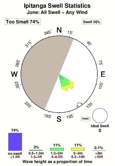
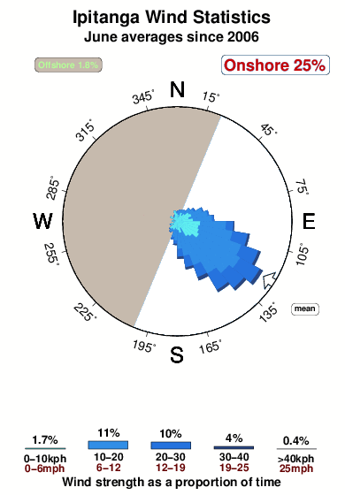
Ipitanga in North Bahia is an exposed beach break that has very reliable surf. Winter is the best time of year for surfing here. Offshore winds are from the west northwest. Most of the surf here comes from groundswells and the ideal swell angle is from the south. The beach break offers both left and right hand waves. Good surf at all stages of the tide. When the surf is up, it can get quite busy in the water.
Ipitanga Spot Info
| Type: | Rating: | Reliability: | Todays Sea Temp*: |
|---|---|---|---|
| very consistent | 81°F*ocean temperature recorded from satellite |
Surfing Ipitanga:
The best conditions reported for surf at Ipitanga occur when a South swell combines with an offshore wind direction from the West-northwest.
What's the best time of year to surf Ipitanga (for consistent clean waves)?
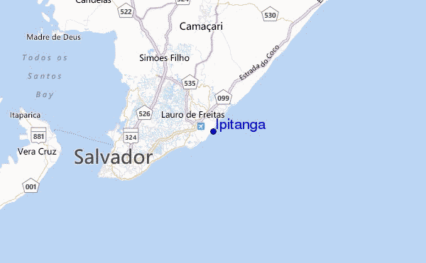
Explore Ipitanga Location Map
Interactive Ipitanga surf break location map. View information about nearby surf breaks, their wave consistency and rating compared to other spots in the region. Current swell conditions from local buoys are shown along with live wind speed and direction from nearby weather stations. Click icons on the map for more detail. The nearest passenger airport to Ipitanga is Deputado Luis Eduardo Magalhaes (Salvador) Airport (SSA) in Brazil, which is 2 km (1 miles) away (directly). The second closest airport to Ipitanga is Ilheus Airport (IOS), also in Brazil, 224 km (139 miles) away.
- Map Icons:
 Break
Break Live Wave Height (ft)
 Live Wind Speed (mph)
 Surf Rating (10 Max)
 Ocean Swells (ft)
- Wind Speed (mph)
Wednesday, 18 June 2025, 03:43 Local Time
| Tue | Wed | |||
| 6PM | 9PM | 0AM | 3AM | |
| Wave (ft) | ||||
| Period (s) | 8 | 8 | 9 | 8 |
| Wind (mph) | ||||
| Wind State | on | on | on | on |
Tides at Ipitanga
| NEXT | IS AT (local time) | remaining |
|---|---|---|
| high tide | ||
| low tide |
Swell History at Ipitanga
Surf stats for Ipitanga, see the swell variation by month or season on the history page here.

Wind History at Ipitanga
Wind stats for Ipitanga, see the variation in direction and stength by month or season on the history page here.
Other Nearby Breaks Closest To:
Discover surf breaks near Ipitanga. Click below to view there surf guides.


 Nearest