

Horseshoe Bay Surf Guide
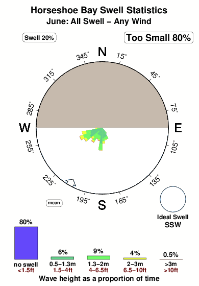
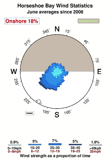
Horseshoe Bay in - is an exposed beach break that has inconsistent surf Offshore winds are from the north. Groundswells and windswells are equally likely and the optimum swell angle is from the south southwest. The beach break offers both left and right hand waves. Best around low tide when the tide is rising. Even when there are waves, it's not likley to be crowded. Watch out for rocks.
Horseshoe Bay Spot Info
| Type: | Rating: | Reliability: | Todays Sea Temp*: |
|---|---|---|---|
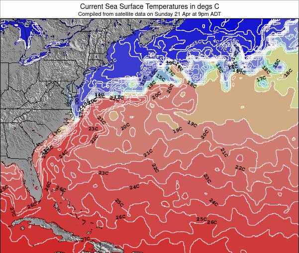
| inconsistent | 24.2°C*ocean temperature recorded from satellite |
Surfing Horseshoe Bay:
The best conditions reported for surf at Horseshoe Bay occur when a South-southwest swell combines with an offshore wind direction from the North.
What's the best time of year to surf Horseshoe Bay (for consistent clean waves)?
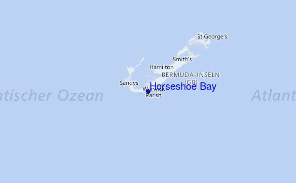
Explore Horseshoe Bay Location Map
Interactive Horseshoe Bay surf break location map. View information about nearby surf breaks, their wave consistency and rating compared to other spots in the region. Current swell conditions from local buoys are shown along with live wind speed and direction from nearby weather stations. Click icons on the map for more detail. The nearest passenger airport to Horseshoe Bay is Nantucket Mem Airport (ACK) in USA, which is 1104 km (686 miles) away (directly). The second closest airport to Horseshoe Bay is Elizabeth City Cgas Rgnl Airport (ECG), also in USA, 1134 km (704 miles) away.
- Map Icons:
 Break
Break Live Wave Height (m)
 Live Wind Speed (km/h)
 Surf Rating (10 Max)
 Ocean Swells (m)
- Wind Speed (km/h)
Monday, 8 June 2026, 23:14 Local Time
| Tuesday 09 | ||||
| 0AM | 3AM | 6AM | 9AM | |
| Wave (m) | ||||
| Period (s) | 7 | 8 | 8 | 8 |
| Wind (km/h) | ||||
| Wind State | cross- off |
cross- off |
cross- off |
off |
Tides at Horseshoe Bay
| NEXT | IS AT (local time) | remaining |
|---|---|---|
| high tide | ||
| low tide |
Swell History at Horseshoe Bay
Surf stats for Horseshoe Bay, see the swell variation by month or season on the history page here.

Wind History at Horseshoe Bay
Wind stats for Horseshoe Bay, see the variation in direction and stength by month or season on the history page here.
Other Nearby Breaks Closest To:
Discover surf breaks near Horseshoe Bay. Click below to view there surf guides.
 Nearest