

- Forecast
- Maps
- Live
- Weather State
- Spot Information

Surf Forecasts
Reef
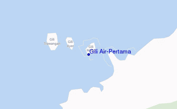
Gili Air-Pertama surf Forecast / Lombok – West / Indonesia
48hr Weather and Surf, issued 7 pm Friday 26 Apr 2024 WITA
Forecast update in hr min s Update imminent
Gili Air-Pertama surf forecast is for near shore open water. Breaking waves will often be smaller at less exposed spots.
Today's Gili Air-Pertama sea temperature is 30.1°C (Statistics for 26 Apr 1981-2005 - mean: 28.8 °C max: 30.1 °C min: 28.0 °C)
- Map Icons:
 Break
Break Live Wave Height (m)
 Live Wind Speed (km/h)
 Surf Rating (10 Max)
 Ocean Swells (m)
- Wind Speed (km/h)
Gili Air-Pertama surf forecast is for near shore open water. Breaking waves will often be smaller at less exposed spots.
Today's Gili Air-Pertama sea temperature is 30.1°C (Statistics for 26 Apr 1981-2005 - mean: 28.8 °C max: 30.1 °C min: 28.0 °C)
How big are the waves at Gili Air-Pertama today?
The current surf forecast for Gili Air-Pertama at 1AM is: 0.4m 12s primary swell from a South-southwest direction (forecast issued at 07:00pm April 26). An open ocean swell of 0.2m 5s is not directed at the surf break. The wind direction is predicted to be glassy.
| Time (WITA) & Date | Wave Height | Wave Period |
|---|---|---|
| Morning (27 Apr) | 1.5ft (0.4m) | 12s |
| Afternoon (27 Apr) | 1.5ft (0.4m) | 12s |
| Evening (27 Apr) | 0.5ft (0.2m) | 18s |
Table - waves today at Gili Air-Pertama. (Swell directed towards the surf break)
 Recent Eyeball Surf Reports for Lombok - West
Expand
<
>
View all
Updates in hr min s Update imminent
Friday 26 | Saturday 27 | Sunday 28 | Monday 29 | Tuesday 30 | Wednesday 01 | Thursday 02 | Friday 03 | Sat 04 | ||||||||||||||||||||||||||||||||||||||||||||||||||||
| 5 PM | 8 PM | 11 PM | 2 AM | 5 AM | 8 AM | 11 AM | 2 PM | 5 PM | 8 PM | 11 PM | 2 AM | 5 AM | 8 AM | 11 AM | 2 PM | 5 PM | 8 PM | 11 PM | 2 AM | 5 AM | 8 AM | 11 AM | 2 PM | 5 PM | 8 PM | 11 PM | 2 AM | 5 AM | 8 AM | 11 AM | 2 PM | 5 PM | 8 PM | 11 PM | 2 AM | 5 AM | 8 AM | 11 AM | 2 PM | 5 PM | 8 PM | 11 PM | 2 AM | 5 AM | 8 AM | 11 AM | 2 PM | 5 PM | 8 PM | 11 PM | 2 AM | 5 AM | 8 AM | 11 AM | 2 PM | 5 PM | 8 PM | 11 PM | 2 AM | |
Rating (10 max) | ||||||||||||||||||||||||||||||||||||||||||||||||||||||||||||
Swell Height Map |    |    |    |    |    |   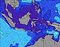 |  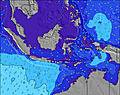 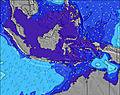 |  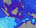 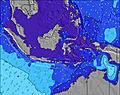 | 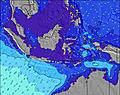 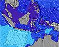 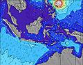 | |||||||||||||||||||||||||||||||||||||||||||||||||||
| Wave Height (m) & direction (?) | ||||||||||||||||||||||||||||||||||||||||||||||||||||||||||||
| Period(s) (?) | 13 | 12 | 12 | 12 | 12 | 12 | 12 | 12 | 12 | 18 | 17 | 16 | 16 | 16 | 16 | 15 | 21 | 21 | 20 | 20 | 19 | 19 | 19 | 18 | 18 | 18 | 18 | 17 | 16 | 16 | 16 | 16 | 16 | 16 | 16 | 15 | 14 | 14 | 14 | 14 | 14 | 14 | 14 | 13 | 13 | 13 | 13 | 13 | 13 | 13 | 13 | 13 | 13 | 13 | 13 | 12 | 12 | 12 | 12 | 12 |
Wave (?)Graph | ||||||||||||||||||||||||||||||||||||||||||||||||||||||||||||
| Energy (?) | 64 | 61 | 59 | 58 | 58 | 57 | 57 | 56 | 34 | 30 | 27 | 51 | 51 | 65 | 63 | 88 | 86 | 86 | 98 | 186 | 184 | 183 | 170 | 211 | 249 | 316 | 312 | 302 | 271 | 261 | 258 | 255 | 255 | 251 | 193 | 171 | 138 | 136 | 136 | 136 | 136 | 134 | 127 | 84 | 88 | 88 | 70 | 102 | 118 | 101 | 99 | 67 | 66 | 64 | 62 | 60 | 58 | 57 | 56 | 56 |
Wind (km/h) | ||||||||||||||||||||||||||||||||||||||||||||||||||||||||||||
| Wind State (?) onshore cross-onshore cross-shore cross-offshore offshore glassy | glass | cross | glass | glass | glass | glass | glass | off | glass | cross- on | glass | glass | cross- on | glass | cross- on | glass | glass | cross- on | cross- on | cross- on | cross- on | cross | glass | glass | cross- on | cross- on | cross- on | cross- on | cross- on | cross- on | on | on | glass | cross- on | cross- on | on | cross- on | cross- on | glass | glass | glass | cross- on | cross- on | cross | cross- on | cross- on | glass | glass | glass | cross- on | glass | cross- on | cross- on | cross- on | glass | glass | cross- on | cross- on | cross | cross- on |
High Tide / height (m) | 2:03AM 1.08 | 12:04PM 1.65 | 3:10AM 1.02 | 12:32PM 1.64 | 1:06PM 1.62 | 1:48PM 1.57 | 2:49PM 1.48 | 9:28AM 1.22 | 4:33PM 1.38 | 8:47AM 1.29 | 6:35PM 1.33 | |||||||||||||||||||||||||||||||||||||||||||||||||
Low Tide / height (m) | 7:12PM 0.22 | 5:31AM 0.96 | 7:54PM 0.22 | 5:31AM 0.99 | 8:43PM 0.24 | 9:43PM 0.27 | 10:51PM 0.30 | 12:01AM 0.32 | 10:38AM 1.22 | 1:02AM 0.36 | 1:31PM 1.09 | 1:52AM 0.41 | ||||||||||||||||||||||||||||||||||||||||||||||||
Friday 26 | Saturday 27 | Sunday 28 | Monday 29 | Tuesday 30 | Wednesday 01 | Thursday 02 | Friday 03 | Sat 04 | ||||||||||||||||||||||||||||||||||||||||||||||||||||
| Sunrise | - | - | - | - | - | 6:18 | - | - | - | - | - | - | - | 6:18 | - | - | - | - | - | - | - | 6:18 | - | - | - | - | - | - | - | 6:18 | - | - | - | - | - | - | - | 6:18 | - | - | - | - | - | - | - | 6:18 | - | - | - | - | - | - | - | 6:18 | - | - | - | - | - | - |
| Sunset | 6:07 | - | - | - | - | - | - | - | 6:07 | - | - | - | - | - | - | - | 6:07 | - | - | - | - | - | - | - | 6:07 | - | - | - | - | - | - | - | 6:07 | - | - | - | - | - | - | - | 6:06 | - | - | - | - | - | - | - | 6:06 | - | - | - | - | - | - | - | 6:06 | - | - | - |
Rain (mm) | 1 | - | - | - | - | - | - | - | - | - | - | - | 1 | - | - | - | 1 | - | 1 | - | - | - | - | 1 | 1 | - | - | - | - | - | - | - | - | - | - | - | - | - | - | 1 | 1 | 1 | 1 | 1 | - | - | - | - | 1 | 1 | 1 | - | - | - | - | 1 | 1 | 1 | 1 | - |
| Temp. °C | 28 | 28 | 27 | 27 | 27 | 28 | 29 | 29 | 29 | 28 | 28 | 27 | 27 | 28 | 29 | 29 | 28 | 28 | 28 | 27 | 27 | 28 | 29 | 29 | 28 | 27 | 27 | 27 | 26 | 27 | 29 | 29 | 29 | 28 | 27 | 27 | 27 | 27 | 29 | 29 | 29 | 28 | 27 | 27 | 27 | 27 | 29 | 29 | 29 | 27 | 27 | 27 | 27 | 27 | 29 | 29 | 29 | 27 | 27 | 27 |
| Feels °C (?) | 32 | 32 | 32 | 32 | 32 | 33 | 34 | 34 | 34 | 32 | 34 | 32 | 31 | 33 | 33 | 34 | 33 | 33 | 33 | 30 | 30 | 32 | 34 | 34 | 32 | 30 | 30 | 31 | 29 | 30 | 33 | 33 | 34 | 32 | 31 | 31 | 31 | 30 | 34 | 33 | 34 | 32 | 31 | 31 | 31 | 30 | 33 | 34 | 34 | 30 | 31 | 31 | 30 | 30 | 33 | 33 | 33 | 29 | 30 | 30 |
FREE! Surf-Forecast.com widget for your website
The surf report / weather widget below is available to embed on third party websites free of charge and provides a summary of our Gili Air-Pertama surf forecast. Simply grab the html code snippet that we provide and paste it into your own site. You can choose your preferred language and metric/imperial units for the surf forecast feed to suit users of your site. Click here to get the code.


 Nearest