

Surf Forecasts:

How big are the waves at Dunes today (11 Jun):
- Morning surf: Morning surf (11 Jun, local time) - 6.5ft (2.0m), 12s period with WSW swell.
- Afternoon surf: Afternoon surf (11 Jun, local time) - 7ft (2.1m), 12s period with WSW swell.
- Evening surf: Evening surf (11 Jun, local time) - 7ft (2.2m), 12s period with WSW swell.
The current surf forecast for Dunes at 9AM is: 2.0m 12s primary swell from a West-southwest direction and 0.2m 11s secondary swell from a South direction, 0.2m 7s secondary swell from a West direction (forecast issued at 01:00am June 11). The wind direction is predicted to be cross-onshore.
| Time (SAST) & Date | Wave Height | Wave Period |
|---|---|---|
| Morning (11 Jun) | 6.5ft (2.0m) | 12s |
| Afternoon (11 Jun) | 7ft (2.1m) | 12s |
| Evening (11 Jun) | 7ft (2.2m) | 12s |
Table - waves today at Dunes. (Swell directed towards the surf break)
Updates in hr min s Forecast update imminent
Short Range ForecastLight rain (total 9mm), mostly falling on Thu night. Very mild (max 16°C on Thu afternoon, min 13°C on Fri night). Winds decreasing (strong winds from the NNW on Thu afternoon, calm by Fri night). | ||||||||||||||||||||||||
Thursday 11 | Friday 12 | Saturday 13 | ||||||||||||||||||||||
2 AM | 5 AM | 8 AM | 11 AM | 2 PM | 5 PM | 8 PM | 11 PM | 2 AM | 5 AM | 8 AM | 11 AM | 2 PM | 5 PM | 8 PM | 11 PM | 2 AM | 5 AM | 8 AM | 11 AM | 2 PM | 5 PM | 8 PM | 11 PM | |
Swell Height Map |  |  |  |  | 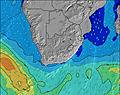 |  |  | 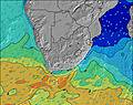 |  | |||||||||||||||
Wave Height (m) Direction Period (s) | SW 12 | WSW 13 | WSW 12 | WSW 12 | WSW 12 | WSW 12 | WSW 12 | W 12 | WSW 12 | WSW 12 | WSW 11 | WSW 11 | WSW 11 | WSW 10 | WSW 10 | WSW 10 | WSW 10 | SSW 12 | SSW 12 | SSW 13 | SSW 13 | SSW 13 | SSW 13 | SSW 13 |
Wave Graph | ||||||||||||||||||||||||
1305 | 1317 | 1354 | 1217 | 1227 | 1336 | 1288 | 2459 | 2588 | 2799 | 2779 | 2597 | 2170 | 1887 | 1600 | 1346 | 817 | 1649 | 2604 | 3287 | 3264 | 2953 | 2884 | 2736 | |
Wind (km/h) | ||||||||||||||||||||||||
Wind State on-shore cross-onshore cross-shore cross-offshore off-shore glassy | on | cross-on | cross-on | cross-on | cross-on | cross-on | cross-on | on | on | cross-on | cross-on | cross-on | cross-on | cross-on | glassy | glassy | glassy | off | off | off | off | off | off | off |
High Tide | 11:21PM1.36m | 12:07PM1.22m | 00:19AM1.44m | 1:04PM1.31m | 1:14AM1.51m | 1:56PM1.40m | ||||||||||||||||||
Low Tide | 5:55AM0.28m | 6:02PM0.38m | 6:51AM0.18m | 7:02PM0.30m | 7:43AM0.09m | 7:57PM0.22m | ||||||||||||||||||
— | 7:48 | — | — | — | — | — | — | — | 7:48 | — | — | — | — | — | — | — | 7:48 | — | — | — | — | — | — | |
— | — | — | — | — | 5:43 | — | — | — | — | — | — | — | 5:43 | — | — | — | — | — | — | — | 5:43 | — | — | |
mm | — | — | — | — | — | — | — | 6 | 1 | 1 | — | — | — | — | 1 | — | — | — | — | — | — | — | — | — |
Temp °C | 15 | 14 | 14 | 15 | 16 | 16 | 15 | 15 | 16 | 15 | 15 | 15 | 15 | 15 | 15 | 15 | 14 | 13 | 13 | 13 | 14 | 15 | 15 | 14 |
Feels °C | 14 | 10 | 9 | 9 | 9 | 9 | 8 | 10 | 10 | 8 | 9 | 9 | 10 | 11 | 13 | 14 | 13 | 11 | 10 | 10 | 12 | 12 | 12 | 11 |
Swell 1 Height (m) Direction Period (s) | SW 12 | WSW 13 | WSW 12 | WSW 12 | WSW 12 | WSW 12 | WSW 12 | NW 13 | NW 16 | — | — | WSW 11 | WSW 11 | WSW 10 | WSW 10 | WSW 10 | WSW 10 | SSW 12 | SSW 12 | SSW 13 | SSW 13 | SSW 13 | SSW 13 | SSW 13 |
1305 | 1317 | 1354 | 1217 | 1227 | 1336 | 1288 | 7 | 10 | — | — | 2597 | 2170 | 1887 | 1600 | 1346 | 817 | 1649 | 2604 | 3287 | 3264 | 2953 | 2884 | 2736 | |
Swell 2 Height (m) Direction Period (s) | WNW 7 | S 11 | S 11 | S 11 | E 9 | — | W 16 | NW 16 | — | — | — | — | — | — | NW 15 | SSW 12 | SSW 12 | W 10 | W 10 | W 10 | W 10 | W 10 | W 10 | W 10 |
5 | 9 | 9 | 9 | 2 | — | 5 | 10 | — | — | — | — | — | — | 8 | 86 | 725 | 484 | 371 | 273 | 188 | 190 | 149 | 121 | |
Swell 3 Height (m) Direction Period (s) | NW 11 | WNW 7 | NW 11 | NW 13 | — | — | — | — | — | — | — | — | — | — | NW 15 | NW 15 | SW 14 | SW 15 | — | NW 11 | NW 13 | NW 13 | NW 13 | NW 13 |
5 | 5 | 5 | 7 | — | — | — | — | — | — | — | — | — | — | 8 | 8 | 8 | 8 | — | 5 | 7 | 7 | 7 | 7 | |
Wind waves Height (m) Direction Period (s) | — | — | W 7 | NNW 4 | NNW 5 | NW 6 | NNW 6 | W 12 | WSW 12 | WSW 12 | WSW 11 | — | — | — | — | — | — | — | — | — | — | — | SE 5 | ESE 6 |
— | — | 4 | 35 | 87 | 148 | 275 | 2459 | 2588 | 2799 | 2779 | — | — | — | — | — | — | — | — | — | — | — | 98 | 134 | |
Nearest Offshore or Glassy | ||||||||||||||||||||||||
Distance (km) | 8 | 9 | 29 | 65 | 277 | 185 | 185 | 8 | 161 | 426 | 20 | 161 | 161 | 8 | 0 | 0 | 0 | 0 | 0 | 0 | 0 | 0 | 0 | 0 |
Best forecast wave conditions in Cape Town | ||||||||||||||||||||||||
Best forecast wave conditions in South Africa | ||||||||||||||||||||||||
Header Global | ||||||||||||||||||||||||
- Map Icons:
 Break
Break Live Wave Height (m)
 Live Wind Speed (km/h)
 Surf Rating (10 Max)
 Ocean Swells (m)
- Wind Speed (km/h)


FREE! Surf-Forecast.com widget for your website
The surf report / weather widget below is available to embed on third party websites free of charge and provides a summary of our Dunes surf forecast. Simply grab the html code snippet that we provide and paste it into your own site. You can choose your preferred language and metric/imperial units for the surf forecast feed to suit users of your site. Click here to get the code.
 Nearest