

- Forecast
- Maps
- Live
- Weather State
- Spot Information
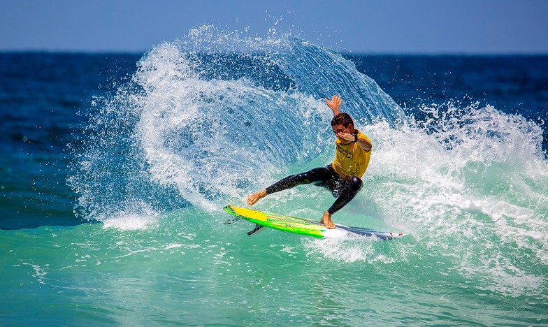
D Street Surf Forecast
/ CAL – San Diego County (71 breaks) / California (404 breaks) /
Surf Forecasts
sandbar
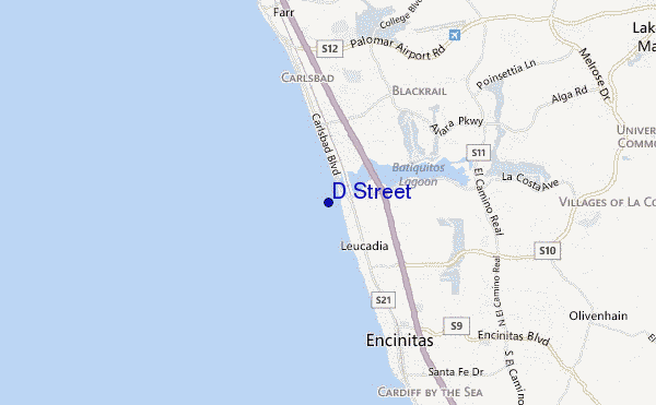
D Street surf Forecast / CAL – San Diego County / USA
48hr Weather and Surf, issued 10 pm Thursday 25 Apr 2024 PDT
Forecast update in hr min s Update imminent
D Street surf forecast is for near shore open water. Breaking waves will often be smaller at less exposed spots.
Today's D Street sea temperature is 16.5°C (Statistics for 25 Apr 1981-2005 - mean: 15.7 °C max: 18.3 °C min: 14.1 °C)
- Map Icons:
 Break
Break Live Wave Height (m)
 Live Wind Speed (km/h)
 Surf Rating (10 Max)
 Ocean Swells (m)
- Wind Speed (km/h)
D Street surf forecast is for near shore open water. Breaking waves will often be smaller at less exposed spots.
Today's D Street sea temperature is 16.5°C (Statistics for 25 Apr 1981-2005 - mean: 15.7 °C max: 18.3 °C min: 14.1 °C)
How big are the waves at D Street today?
The current surf forecast for D Street at 2AM is: 0.5m 18s primary swell from a Southwest direction and 0.8m 6s secondary swell from a West direction, 1.0m 6s secondary swell from a West direction (forecast issued at 10:00pm April 25). The wind direction is predicted to be cross-onshore.
| Time (PDT) & Date | Wave Height | Wave Period |
|---|---|---|
| Morning (26 Apr) | 2.5ft (0.7m) | 18s |
| Afternoon (26 Apr) | 6ft (1.9m) | 8s |
| Evening (26 Apr) | 10ft (3.0m) | 9s |
Table - waves today at D Street. (Swell directed towards the surf break)
Updates in hr min s Update imminent
Thu 25 | Friday 26 | Saturday 27 | Sunday 28 | Monday 29 | Tuesday 30 | Wednesday 01 | Thursday 02 | Fri 03 | ||||||||||||||||||||||||||||||||||||||||||||||||||||
| 8 PM | 11 PM | 2 AM | 5 AM | 8 AM | 11 AM | 2 PM | 5 PM | 8 PM | 11 PM | 2 AM | 5 AM | 8 AM | 11 AM | 2 PM | 5 PM | 8 PM | 11 PM | 2 AM | 5 AM | 8 AM | 11 AM | 2 PM | 5 PM | 8 PM | 11 PM | 2 AM | 5 AM | 8 AM | 11 AM | 2 PM | 5 PM | 8 PM | 11 PM | 2 AM | 5 AM | 8 AM | 11 AM | 2 PM | 5 PM | 8 PM | 11 PM | 2 AM | 5 AM | 8 AM | 11 AM | 2 PM | 5 PM | 8 PM | 11 PM | 2 AM | 5 AM | 8 AM | 11 AM | 2 PM | 5 PM | 8 PM | 11 PM | 2 AM | 5 AM | |
Rating (10 max) | ||||||||||||||||||||||||||||||||||||||||||||||||||||||||||||
Swell Height Map |  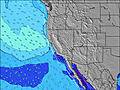 |    |    |   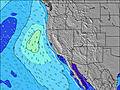 |    |    |    |    |    | |||||||||||||||||||||||||||||||||||||||||||||||||||
| Wave Height (m) & direction (?) | ||||||||||||||||||||||||||||||||||||||||||||||||||||||||||||
| Period(s) (?) | 18 | 18 | 18 | 18 | 18 | 8 | 8 | 8 | 9 | 10 | 10 | 9 | 9 | 9 | 9 | 9 | 9 | 9 | 9 | 9 | 9 | 9 | 9 | 9 | 9 | 9 | 9 | 9 | 10 | 10 | 10 | 10 | 10 | 10 | 10 | 10 | 11 | 11 | 11 | 11 | 11 | 11 | 11 | 11 | 11 | 11 | 18 | 18 | 10 | 17 | 16 | 16 | 16 | 16 | 16 | 16 | 16 | 16 | 16 | 8 |
Wave (?)Graph | ||||||||||||||||||||||||||||||||||||||||||||||||||||||||||||
| Energy (?) | 157 | 112 | 152 | 249 | 316 | 632 | 443 | 520 | 1051 | 2329 | 2360 | 1528 | 766 | 554 | 386 | 340 | 304 | 311 | 348 | 348 | 304 | 220 | 203 | 217 | 207 | 207 | 263 | 397 | 499 | 441 | 369 | 346 | 346 | 308 | 308 | 314 | 326 | 338 | 279 | 223 | 223 | 184 | 184 | 188 | 227 | 223 | 204 | 204 | 125 | 147 | 173 | 169 | 169 | 169 | 124 | 169 | 169 | 201 | 196 | 309 |
Wind (km/h) | ||||||||||||||||||||||||||||||||||||||||||||||||||||||||||||
| Wind State (?) onshore cross-onshore cross-shore cross-offshore offshore glassy | on | on | cross- on | cross | cross | cross- on | on | on | on | on | cross- on | cross- on | cross | cross- on | cross- on | cross- on | glass | cross | cross- off | cross- off | cross- off | cross- on | on | on | glass | glass | cross | cross- off | cross- off | cross- on | cross- on | cross- on | glass | cross | cross- off | cross- off | cross | cross- on | cross- on | cross- on | cross- on | cross | cross- off | cross | cross- off | cross- on | cross- on | cross- on | glass | glass | glass | glass | glass | cross- on | on | on | on | glass | glass | glass |
High Tide / height (m) | 10:14PM 2.16 | 12:02PM 1.42 | 10:43PM 2.13 | 1:06PM 1.33 | 11:18PM 2.08 | 2:52PM 1.30 | 12:04AM 2.01 | 1:11AM 1.91 | 5:56PM 1.48 | 2:45AM 1.83 | 6:12PM 1.61 | 4:22AM 1.81 | 6:35PM 1.77 | |||||||||||||||||||||||||||||||||||||||||||||||
Low Tide / height (m) | 5:32AM 0.35 | 4:14PM 1.12 | 6:20AM 0.40 | 4:31PM 1.20 | 7:18AM 0.44 | 4:41PM 1.28 | 8:29AM 0.47 | 9:44AM 0.46 | 8:42PM 1.43 | 10:48AM 0.42 | 10:52PM 1.30 | 11:39AM 0.39 | 12:06AM 1.06 | |||||||||||||||||||||||||||||||||||||||||||||||
Thu 25 | Friday 26 | Saturday 27 | Sunday 28 | Monday 29 | Tuesday 30 | Wednesday 01 | Thursday 02 | Fri 03 | ||||||||||||||||||||||||||||||||||||||||||||||||||||
| Sunrise | - | - | - | - | 6:05 | - | - | - | - | - | - | - | 6:03 | - | - | - | - | - | - | - | 6:03 | - | - | - | - | - | - | - | 6:01 | - | - | - | - | - | - | - | 6:01 | - | - | - | - | - | - | - | 6:00 | - | - | - | - | - | - | - | 6:00 | - | - | - | - | - | - | - |
| Sunset | - | - | - | - | - | - | - | 7:28 | - | - | - | - | - | - | - | 7:29 | - | - | - | - | - | - | - | 7:29 | - | - | - | - | - | - | - | 7:30 | - | - | - | - | - | - | - | 7:30 | - | - | - | - | - | - | - | 7:31 | - | - | - | - | - | - | - | 7:31 | - | - | - | - |
Rain (mm) | - | - | - | - | - | - | - | - | - | - | - | - | - | - | - | - | - | - | - | - | - | - | - | - | - | - | - | - | - | - | - | - | - | - | - | - | - | - | - | - | - | - | - | - | - | - | - | - | - | - | - | - | - | - | - | - | - | - | - | - |
| Temp. °C | 15 | 14 | 14 | 14 | 14 | 15 | 15 | 15 | 15 | 15 | 15 | 14 | 15 | 16 | 17 | 16 | 15 | 15 | 14 | 14 | 14 | 17 | 17 | 17 | 16 | 15 | 15 | 14 | 15 | 18 | 18 | 17 | 16 | 15 | 15 | 14 | 15 | 17 | 17 | 16 | 15 | 14 | 14 | 14 | 14 | 17 | 17 | 17 | 15 | 15 | 15 | 14 | 15 | 18 | 18 | 17 | 16 | 15 | 15 | 15 |
| Feels °C (?) | 12 | 12 | 13 | 13 | 12 | 12 | 12 | 12 | 11 | 12 | 13 | 14 | 13 | 13 | 14 | 14 | 14 | 14 | 13 | 13 | 13 | 16 | 15 | 15 | 16 | 15 | 14 | 13 | 14 | 16 | 16 | 16 | 16 | 14 | 14 | 13 | 14 | 15 | 15 | 14 | 14 | 13 | 13 | 14 | 13 | 16 | 15 | 16 | 15 | 15 | 16 | 15 | 16 | 17 | 16 | 15 | 16 | 15 | 15 | 15 |
FREE! Surf-Forecast.com widget for your website
The surf report / weather widget below is available to embed on third party websites free of charge and provides a summary of our D Street surf forecast. Simply grab the html code snippet that we provide and paste it into your own site. You can choose your preferred language and metric/imperial units for the surf forecast feed to suit users of your site. Click here to get the code.


 Nearest