

Surf Forecasts:

How big are the waves at Coos Bay-South Jetty today (01 Aug):
- Morning surf: Morning surf (01 Aug, local time) - 2.5ft (0.8m), 8s period with WNW swell.
- Afternoon surf: Afternoon surf (01 Aug, local time) - 2.5ft (0.8m), 8s period with WNW swell.
- Evening surf: Evening surf (01 Aug, local time) - 4ft (1.2m), 8s period with WNW swell.
The current surf forecast for Coos Bay-South Jetty at 5PM is: 0.8m 8s primary swell from a West-northwest direction and 0.4m 14s secondary swell from a Southwest direction, 1.1m 5s secondary swell from a Northwest direction (forecast issued at 10:00am August 01). The wind direction is predicted to be cross-onshore.
| Time (PDT) & Date | Wave Height | Wave Period |
|---|---|---|
| Morning (01 Aug) | 2.5ft (0.8m) | 8s |
| Afternoon (01 Aug) | 2.5ft (0.8m) | 8s |
| Evening (01 Aug) | 4ft (1.2m) | 8s |
Table - waves today at Coos Bay-South Jetty. (Swell directed towards the surf break)
Short Range ForecastMostly dry. Very mild (max 18°C on Sat morning, min 12°C on Sun night). Winds increasing (calm on Sat morning, fresh winds from the N by Sun afternoon). | ||||||||||||||||||||||
Saturday 1 | Sunday 2 | Monday 3 | ||||||||||||||||||||
8 AM | 11 AM | 2 PM | 5 PM | 8 PM | 11 PM | 2 AM | 5 AM | 8 AM | 11 AM | 2 PM | 5 PM | 8 PM | 11 PM | 2 AM | 5 AM | 8 AM | 11 AM | 2 PM | 5 PM | 8 PM | 11 PM | |
Swell Height Map |  |  |  | 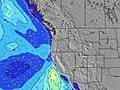 |  |  |  | 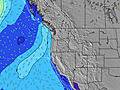 | ||||||||||||||
Wave Height (m) Direction Period (s) | WNW 8 | WNW 8 | SW 14 | WNW 8 | WNW 8 | WNW 8 | WNW 8 | WNW 8 | WNW 8 | WNW 9 | NW 9 | NW 9 | WNW 9 | NNW 7 | NW 8 | NNW 8 | NNW 8 | NW 8 | NNW 7 | NNW 7 | NNW 8 | NW 8 |
Wave Graph | ||||||||||||||||||||||
94 | 85 | 68 | 85 | 170 | 193 | 193 | 236 | 322 | 430 | 540 | 764 | 528 | 568 | 381 | 504 | 403 | 358 | 475 | 675 | 694 | 364 | |
Wind (km/h) | ||||||||||||||||||||||
Wind State on-shore cross-onshore cross-shore cross-offshore off-shore glassy | glassy | on | cross-on | cross-on | cross-on | cross-on | cross-on | cross | cross | cross-on | cross-on | cross-on | cross-on | cross-on | cross-on | cross-on | cross | cross-on | cross-on | cross-on | cross-on | cross-on |
High Tide | 3:13PM2.13m | 2:44AM2.11m | 3:42PM2.19m | 3:31AM1.94m | 4:14PM2.24m | |||||||||||||||||
Low Tide | 8:41AM-0.07m | 8:59PM0.67m | 9:11AM0.06m | 9:45PM0.56m | 9:43AM0.23m | 10:36PM0.45m | ||||||||||||||||
6:05 | — | — | — | — | — | — | 6:07 | — | — | — | — | — | — | — | 6:09 | — | — | — | — | — | — | |
— | — | — | — | 8:38 | — | — | — | — | — | — | — | 8:37 | — | — | — | — | — | — | — | 8:37 | — | |
mm | — | — | — | — | — | — | — | — | — | — | — | — | — | — | — | — | — | — | — | — | — | — |
Temp °C | 17 | 18 | 16 | 16 | 15 | 14 | 13 | 13 | 13 | 16 | 16 | 16 | 15 | 14 | 13 | 12 | 12 | 17 | 17 | 16 | 15 | 14 |
Feels °C | 18 | 17 | 13 | 13 | 12 | 12 | 11 | 11 | 11 | 12 | 10 | 10 | 9 | 9 | 9 | 8 | 8 | 12 | 11 | 10 | 10 | 10 |
Swell 1 Height (m) Direction Period (s) | WNW 8 | WNW 8 | WNW 8 | WNW 8 | WNW 8 | WNW 8 | WNW 8 | WNW 8 | WNW 8 | WNW 9 | SW 14 | SW 13 | WNW 9 | SW 13 | NW 8 | SW 13 | NNW 8 | SW 13 | SW 13 | SW 13 | WSW 16 | NW 8 |
94 | 85 | 68 | 85 | 170 | 193 | 193 | 236 | 322 | 430 | 29 | 28 | 528 | 28 | 381 | 27 | 403 | 7 | 7 | 7 | 25 | 364 | |
Swell 2 Height (m) Direction Period (s) | SW 14 | SW 14 | SW 14 | SW 14 | SW 14 | SW 14 | SW 14 | SW 14 | SW 14 | SW 14 | SW 18 | SW 18 | SW 13 | WSW 18 | SW 13 | WSW 18 | SW 13 | SW 18 | SW 17 | WSW 16 | SW 13 | WSW 16 |
70 | 69 | 67 | 67 | 69 | 70 | 50 | 48 | 29 | 29 | 13 | 12 | 28 | 31 | 28 | 30 | 27 | 12 | 11 | 26 | 7 | 25 | |
Swell 3 Height (m) Direction Period (s) | W 21 | — | W 20 | W 20 | SW 20 | SW 19 | SW 19 | SW 19 | SW 19 | SW 19 | — | — | WSW 18 | — | WSW 18 | — | WSW 18 | — | — | — | — | SW 13 |
9 | — | 8 | 7 | 15 | 15 | 15 | 15 | 15 | 14 | — | — | 31 | — | 31 | — | 30 | — | — | — | — | 7 | |
Wind waves Height (m) Direction Period (s) | — | — | NW 4 | NW 5 | N 4 | — | — | — | — | — | NW 9 | NW 9 | N 6 | NNW 7 | N 6 | NNW 8 | — | NW 8 | NNW 7 | NNW 7 | NNW 8 | N 7 |
— | — | 16 | 60 | 8 | — | — | — | — | — | 540 | 764 | 121 | 568 | 165 | 504 | — | 358 | 475 | 675 | 694 | 260 | |
Nearest Offshore or Glassy | ||||||||||||||||||||||
Distance (km) | 1 | 553 | 636 | 738 | 537 | 156 | 156 | 156 | 156 | 558 | 622 | 1068 | 562 | 394 | 156 | 156 | 156 | 325 | 372 | 371 | 257 | 156 |
Best forecast wave conditions in South Oregon | ||||||||||||||||||||||
Best forecast wave conditions in United States | ||||||||||||||||||||||
Header Global | ||||||||||||||||||||||
- Map Icons:
 Break
Break Live Wave Height (m)
 Live Wind Speed (km/h)
 Surf Rating (10 Max)
 Ocean Swells (m)
- Wind Speed (km/h)
Latest Updates


FREE! Surf-Forecast.com widget for your website
The surf report / weather widget below is available to embed on third party websites free of charge and provides a summary of our Coos Bay-South Jetty surf forecast. Simply grab the html code snippet that we provide and paste it into your own site. You can choose your preferred language and metric/imperial units for the surf forecast feed to suit users of your site. Click here to get the code.
 Nearest