Atacames Surf Forecast and Surf Reports
(Esmeraldas, Ecuador)
- Forecast
- Maps
- Live
- Weather State
- Spot Information

Atacames Surf Guide
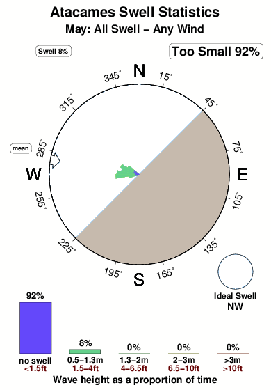
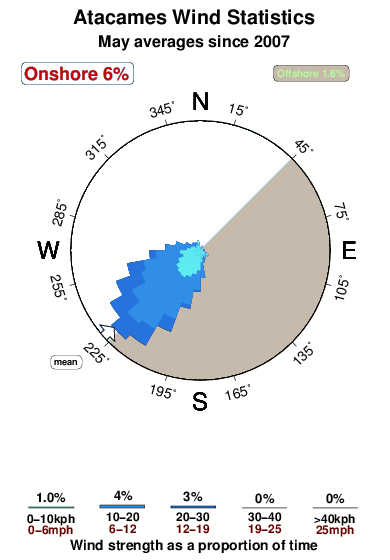
Atacames in Esmiraldas is an exposed beach break that has fairly consistent surf. Winter and spring are the best times of year to visit. Offshore winds are from the southeast. Tends to receive distant groundswells and the ideal swell angle is from the northwest. The beach breaks offer lefts and rights. Good surf at all stages of the tide. Rarely crowded here.
Atacames Spot Info
| Type: | Rating: | Reliability: | Todays Sea Temp*: |
|---|---|---|---|
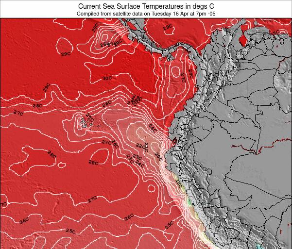
| fairly consistent | 26.9°C*ocean temperature recorded from satellite |
Surfing Atacames:
The best conditions reported for surf at Atacames occur when a Northwest swell combines with an offshore wind direction from the Southeast.
What's the best time of year to surf Atacames (for consistent clean waves)?
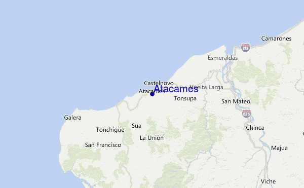
Explore Atacames Location Map
Interactive Atacames surf break location map. View information about nearby surf breaks, their wave consistency and rating compared to other spots in the region. Current swell conditions from local buoys are shown along with live wind speed and direction from nearby weather stations. Click icons on the map for more detail. The nearest passenger airport to Atacames is La Florida (Tumaco) Airport (TCO) in Colombia, which is 162 km (101 miles) away (directly). The second closest airport to Atacames is Mariscal Sucre International (Quito) Airport (UIO) in Ecuador, 188 km (117 miles) away.
- Map Icons:
 Break
Break Live Wave Height (m)
 Live Wind Speed (km/h)
 Surf Rating (10 Max)
 Ocean Swells (m)
- Wind Speed (km/h)
Monday, 4 May 2026, 23:50 Local Time
| Mon | Tuesday 05 | |||
| 10PM | 1AM | 4AM | 7AM | |
| Wave (m) | ||||
| Period (s) | 16 | 15 | 15 | 14 |
| Wind (km/h) | ||||
| Wind State | cross- off |
cross- off |
cross- off |
cross- off |
Tides at Atacames
| NEXT | IS AT (local time) | remaining |
|---|---|---|
| high tide | ||
| low tide |
Swell History at Atacames
Surf stats for Atacames, see the swell variation by month or season on the history page here.

Wind History at Atacames
Wind stats for Atacames, see the variation in direction and stength by month or season on the history page here.
Other Nearby Breaks Closest To:
Discover surf breaks near Atacames. Click below to view there surf guides.
 Nearest