Long Island New York Surf
Detailed Long Island New York surf forecast maps and the latest eyeball surf report from local surfers in the region. Near-shore swell is shown on the map together with the surf forecast rating for spots in Long Island New York. Find the best places to surf in offshore conditions by selecting the wind option on the forecast map. Windsurfers and kite surfers can also use this option to find more favorable cross-shore conditions in Long Island New York. Our local Wavefinder indicates where some of the best conditions are likely to be found in Long Island New York over the next 7 days. Surf photos from Long Island New York and reviews of the best spots and surfing conditions have been provided by local surfers.
Long Island New York Surf Forecast map for predicting the best wave and wind conditions across the region. For surfers, the map shows the most powerful swell tracking across near-shore open water and not the peak waves experienced by boats out at sea. Move your mouse over the ocean swell symbols or the surf breaks on the coastline to see a more detailed surf forecast including wave period and wind conditions. The forecast updates every 6 hours and most live weather reports update every hour. You can animate the Long Island New York Surf map or show live wind and wave conditions as reported from wavebuoys and local weather stations. Surf breaks shown along the Long Island New York coastline are also listed below.
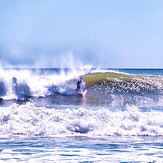
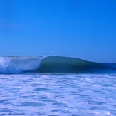
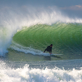
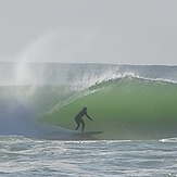
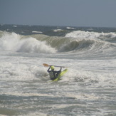
Long Island New York Photos
Long Island New York Wavefinder
Monday 3 | Tuesday 4 | Wednesday 5 | Thursday 6 | Friday 7 | Saturday 8 | Sunday 9 | |||||||||||||||
AM | PM | Night | AM | PM | Night | AM | PM | Night | AM | PM | Night | AM | PM | Night | AM | PM | Night | AM | PM | Night | |
Best forecast wave conditions in Long Island New York | |||||||||||||||||||||
Wave Height (m) Direction Period (s) | S 8 | S 8 | S 8 | SSW 8 | S 8 | S 8 | SSE 8 | S 7 | SSW 6 | S 6 | S 6 | SSW 6 | S 6 | SSW 6 | SSW 6 | S 6 | S 6 | SSW 6 | SSW 6 | SSW 6 | SSW 6 |
829 | 461 | 572 | 192 | 72 | 72 | 232 | 64 | 40 | 89 | 104 | 143 | 62 | 51 | 39 | 24 | 24 | 74 | 53 | 47 | 120 | |
Wind (km/h) | |||||||||||||||||||||
Wind State on-shore cross-onshore cross-shore cross-offshore off-shore glassy | cross | cross-off | off | cross-off | on | off | cross-off | off | cross-off | off | cross | cross | cross-off | cross | cross-off | cross-off | cross | glassy | cross-off | cross | cross |
High Tide | 11:24AM0.86m | 11:36PM0.76m | 12:08PM0.87m | 00:09AM1.22m | 12:59PM0.88m | 1:20AM0.68m | 1:59PM0.89m | 2:26AM0.65m | 3:09PM0.90m | 3:44AM0.66m | 4:31PM0.93m | 4:31AM1.16m | 5:09AM0.69m | 5:47PM0.98m | |||||||
Low Tide | 5:25PM0.20m | 5:36AM0.05m | 6:22PM0.15m | 6:22AM0.07m | 7:27PM0.17m | 7:17AM0.09m | 8:46PM0.17m | 8:21AM0.10m | 10:10PM0.14m | 9:33AM0.09m | 10:39PM0.11m | 10:45AM0.05m | 00:15AM0.02m | ||||||||
mm | 5 | 4 | 4 | — | — | — | — | — | — | — | — | — | — | 1 | — | — | — | 2 | — | — | 1 |
Max °C | 24 | 29 | 25 | 23 | 24 | 24 | 23 | 24 | 25 | 26 | 27 | 25 | 27 | 30 | 28 | 27 | 29 | 28 | 27 | 28 | 26 |
Min °C | 24 | 27 | 20 | 20 | 23 | 22 | 22 | 24 | 24 | 25 | 26 | 24 | 25 | 28 | 27 | 27 | 27 | 27 | 26 | 28 | 25 |
Chill °C | 24 | 29 | 25 | 23 | 24 | 24 | 23 | 24 | 25 | 26 | 27 | 25 | 27 | 30 | 28 | 27 | 29 | 28 | 27 | 28 | 26 |
5:45 | — | — | 5:47 | — | — | 5:46 | — | — | 5:47 | — | — | 5:48 | — | — | 5:50 | — | — | 5:50 | — | — | |
— | 8:07 | — | — | 8:00 | — | — | 7:59 | — | — | 7:58 | — | — | 7:57 | — | — | 7:55 | — | — | 7:54 | — | |
Swell 1 Height (m) Direction Period (s) | — | SSE 8 | S 8 | SSW 8 | S 8 | S 8 | SSE 8 | S 7 | SE 6 | E 10 | SE 8 | SE 8 | S 6 | SE 8 | SE 8 | S 6 | SE 8 | SSW 6 | SSW 6 | SE 7 | SSW 6 |
— | 286 | 572 | 192 | 72 | 72 | 232 | 64 | 19 | 2 | 2 | 2 | 62 | 9 | 10 | 24 | 16 | 52 | 35 | 2 | 66 | |
Swell 2 Height (m) Direction Period (s) | — | — | — | SE 7 | SE 7 | SE 7 | E 10 | SE 6 | — | E 10 | E 11 | — | SE 8 | E 9 | E 9 | SE 8 | E 9 | SE 7 | SE 7 | — | SE 10 |
— | — | — | 47 | 43 | 60 | 2 | 27 | — | 2 | 2 | — | 9 | 2 | 2 | 23 | 2 | 19 | 9 | — | 4 | |
Wind waves Height (m) Direction Period (s) | S 8 | S 8 | NNW 3 | — | — | NNE 2 | N 3 | SW 3 | SSW 6 | S 6 | S 6 | SSW 6 | — | SSW 6 | SSW 6 | — | S 6 | SSW 6 | SSW 6 | SSW 6 | SSW 6 |
829 | 461 | 7 | — | — | 1 | 4 | 3 | 40 | 89 | 104 | 143 | — | 51 | 39 | — | 24 | 74 | 53 | 47 | 120 | |
Sea °C | 21 | 24 | 21 | 21 | 21 | 24 | 21 | 21 | 21 | 21 | 21 | 21 | 21 | 21 | 21 | 21 | 21 | 24 | 21 | 21 | 21 |
Diff °C | |||||||||||||||||||||
Long Island New York Surf Breaks
Because of Long Island's long stretching coast line reaching out eastwards in to the Atlantic, the south facing side has a large swell window especially for hurricane swells. NE winter swells can cause problems for quite a few breaks as they don't pick up. If you fancy a drive then there are a few known decent reefs that can be scored on good swells. The water can get quite cold so you'll need a winter wettie. Barrier islands up the coast catch plenty of swell, so a 4WD is a good idea if you want to go exploring. The further you head along, the more access becomes restricted due to the privately owned gated beaches.
 Nearest