
El Canal (Rio de Bayamon) Surf Guide
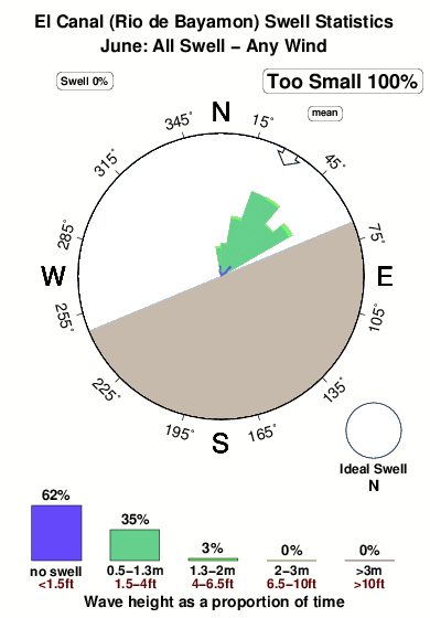
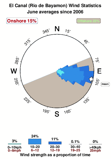
El Canal (Rio de Bayamon) in Puerto Rico is a sheltered river break. The best conditions for surfing are during the hurricane season. Works best in offshore winds from the south southeast and there is no shelter here from cross shore breezes. Windswells and groundswells in equal measure and the best swell direction is from the north. Waves at the river are both lefts and rights. Sometimes crowded. Beware of rips and rocks.
El Canal (Rio de Bayamon) Spot Info
| Type: | Rating: | Reliability: | Todays Sea Temp*: |
|---|---|---|---|
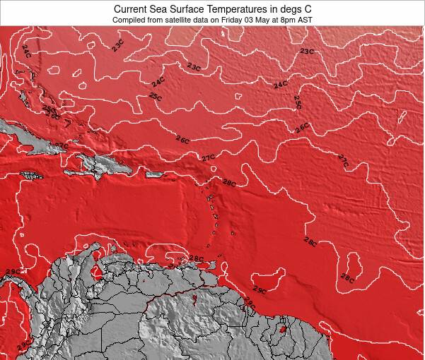
| rarely breaks | 28.2°C*ocean temperature recorded from satellite |
Surfing El Canal (Rio de Bayamon):
The best conditions reported for surf at El Canal (Rio de Bayamon) occur when a North swell combines with an offshore wind direction from the South-southeast.
What's the best time of year to surf El Canal (Rio de Bayamon) (for consistent clean waves)?
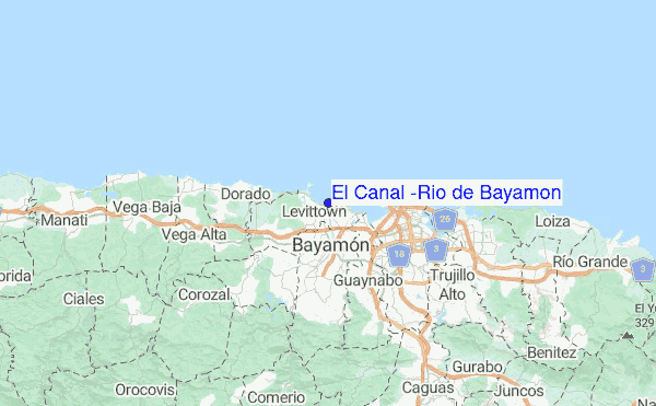
Explore El Canal (Rio de Bayamon) Location Map
Interactive El Canal (Rio de Bayamon) surf break location map. View information about nearby surf breaks, their wave consistency and rating compared to other spots in the region. Current swell conditions from local buoys are shown along with live wind speed and direction from nearby weather stations. Click icons on the map for more detail.
- Map Icons:
 Break
Break Live Wave Height (m)
 Live Wind Speed (km/h)
 Surf Rating (10 Max)
 Ocean Swells (m)
- Wind Speed (km/h)
Friday, 19 June 2026, 21:51 Local Time
| Fri | Saturday 20 | |||
| 11PM | 2AM | 5AM | 8AM | |
| Wave (m) | ||||
| Period (s) | 7 | 6 | 6 | 6 |
| Wind (km/h) | ||||
| Wind State | cross- off |
cross- off |
cross- off |
cross- off |
Tides at El Canal (Rio de Bayamon)
| NEXT | IS AT (local time) | remaining |
|---|---|---|
| high tide | ||
| low tide |
Swell History at El Canal (Rio de Bayamon)
Surf stats for El Canal (Rio de Bayamon), see the swell variation by month or season on the history page here.

Wind History at El Canal (Rio de Bayamon)
Wind stats for El Canal (Rio de Bayamon), see the variation in direction and stength by month or season on the history page here.
El Canal (Rio de Bayamon) Reviews:
Interactive Porthcawl Point location map. View nearby buoy information, live wind conditions and surrounding roads, paths and locations to help find new breaks. Click the buoys or wind icon to view more information.
Other Nearby Breaks Closest To:
Discover surf breaks near El Canal (Rio de Bayamon). Click below to view there surf guides.
- Cochino (Playa de Levittown)
 Beach
Beach
Reliability: rarely breaks2km away - El Escambrón
 Reef
Reef
Reliability: consistent8km away - El Unico
- Beach and reef
Reliability: very consistent8km away - La Ocho (Escambron Beach)
- Reef
Reliability: very consistent8km away - Little Fiji (Escambron Beach)
- Reef
Reliability: very consistent8km away
 Nearest