

Danger Reef Surf Guide
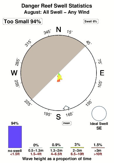
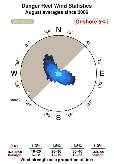
Danger Reef in Cape Peninsula is an exposed reef break that has pretty consitent surf. Winter is the favoured time of year for surfing here. The best wind direction is from the northwest. Groundswells more frequent than windswells and the optimum swell angle is from the southeast. A choice of left and right reefs. Often Crowded. Submerged rocks are a hazard.
Danger Reef Spot Info
| Type: | Rating: | Reliability: | Todays Sea Temp*: |
|---|---|---|---|
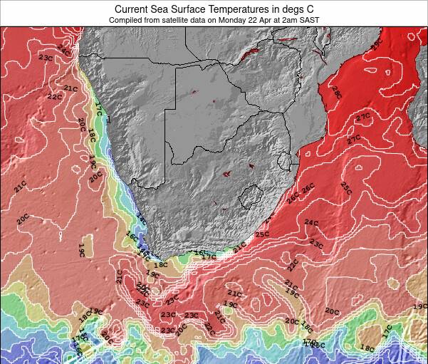
| fairly consistent | 14.8°C*ocean temperature recorded from satellite |
Surfing Danger Reef:
The best conditions reported for surf at Danger Reef occur when a Southeast swell combines with an offshore wind direction from the Northwest.
What's the best time of year to surf Danger Reef (for consistent clean waves)?
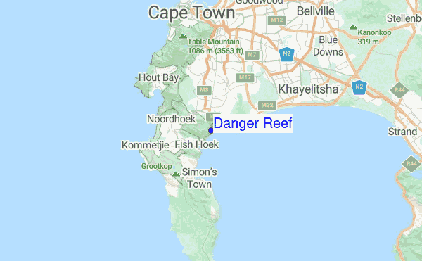
Explore Danger Reef Location Map
Interactive Danger Reef surf break location map. View information about nearby surf breaks, their wave consistency and rating compared to other spots in the region. Current swell conditions from local buoys are shown along with live wind speed and direction from nearby weather stations. Click icons on the map for more detail. The nearest passenger airport to Danger Reef is Cape Town International Airport (CPT) in South Africa, which is 21 km (13 miles) away (directly). The second closest airport to Danger Reef is Oudtshoorn Airport (DUH), also in South Africa, 349 km (217 miles) away.
- Map Icons:
 Break
Break Live Wave Height (m)
 Live Wind Speed (km/h)
 Surf Rating (10 Max)
 Ocean Swells (m)
- Wind Speed (km/h)
Monday, 3 August 2026, 12:14 Local Time
| Monday 03 | ||||
| 11AM | 2PM | 5PM | 8PM | |
| Wave (m) | ||||
| Period (s) | 13 | 12 | 13 | 12 |
| Wind (km/h) | ||||
| Wind State | glass | on | on | on |
Tides at Danger Reef
| NEXT | IS AT (local time) | remaining |
|---|---|---|
| high tide | ||
| low tide |
Swell History at Danger Reef
Surf stats for Danger Reef, see the swell variation by month or season on the history page here.

Wind History at Danger Reef
Wind stats for Danger Reef, see the variation in direction and stength by month or season on the history page here.
Danger Reef Reviews:
Interactive Porthcawl Point location map. View nearby buoy information, live wind conditions and surrounding roads, paths and locations to help find new breaks. Click the buoys or wind icon to view more information.
- Overall:
 2.0
2.0 - Quality on a good day:
 4.2
4.2 - Consistency of Surf:
 3.0
3.0 - Difficulty Level:3.8
- Wind and Kite Surfing:
 1.0
1.0 - Crowds:2.2
Other Nearby Breaks Closest To:
Discover surf breaks near Danger Reef. Click below to view there surf guides.
 Nearest