

Surf Forecasts:

Croyde surf forecast from 5 Jul 2026:
- Best quality surf: Friday 10 Jul, 4AM (local time) - 1.5ft (0.5m), 9s period, W swell with offshore winds.
- Most powerful swell: Saturday 11 Jul, 10PM (local time) - 5.5ft (1.7m), 6s period, NNW swell with 168 kJ wave energy.
- Next surfable swell (1★+): Friday 10 Jul, 4AM (local time) - 1.5ft (0.5m), 9s period with W swell.
Best Forecast Surf Conditions for Croyde this week:
The surf forecast for Croyde over the next 16 days: The first swell (rated 1 star or higher) is forecast to arrive on Friday (Jul 10) at 4AM. The primary swell is predicted to be 0.5m and 9s period with a secondary swell of 0.3m and 4s. The wind is predicted to be offshore as the swell arrives.
The most powerful waves expected at Croyde in the next 16 days are 1.7m 6s and forecast to arrive on Saturday (Jul 11) at 10PM. Winds are predicted to be cross-onshore at the time the swell arrives. The largest open ocean swell (not directed at the beach) is 0.4m 2s period and expected on Thursday (Jul 09) at 4PM.
| Wave Type | Time (BST) & Date | Wave Height & Period |
|---|---|---|
| Next good surf (1 star+) | 4AM (Fri 10th Jul) | 1.5ft (0.5m) 9s |
| Best Surf | 4AM (Fri 10th Jul) | 1.5ft (0.5m) 9s |
| Most Powerful | 10PM (Sat 11th Jul) | 5.5ft (1.7m) 6s |
Table - best surf conditions forecast for Croyde over the next 16 days.
Updates in hr min s Forecast update imminent
Alright folks, Rusty here. Let’s take a good long look at what Croyde’s got lined up for us over the next couple of weeks. I’ll be straight with you – it’s a bit of a mixed bag, and we’re gonna have to wait for the real action.
Overall, the pattern starts off pretty flat and unfriendly, with a long stretch of poor conditions. The water’s sitting at 63°F, which is a solid 4°F warmer than usual for this time of year – that’s noticeably warm, almost like a late summer holdover. But don’t let that fool you; the surf is mostly a no-go for a while.
Right now, from Sunday the 5th through to Thursday the 10th, it’s grim. Tiny waves, onshore or cross-onshore winds, and weak, choppy energy. The combined swell energy is barely cracking 80 (82 at best on Sunday morning), and that’s with a short-period, messy wind swell. Nothing worth paddling out for. The first glimmer comes Friday the 10th morning – offshore wind from the east at 12 mph, and a clean 2-foot swell from the west with a 9-second period. The combined energy is only 57, so it’s small and ordinary, but at least it’s clean. That’s your first real chance for a sneaky session if you’re desperate.
Saturday the 11th gets a bit bigger (3 ft to 4 ft) but cross-onshore winds and short periods (5-7 seconds) make it choppy and messy – not quality surfing.
Sunday the 12th morning has a strong east offshore wind at 16 mph, but the swell drops to 3 ft from the north with a tiny 4-second period, so it’s all chop and no power. Combined energy a pathetic 37.
Things stay poor through Monday and Tuesday the 13th-14th, though on Tuesday the 14th morning we finally see a jump in quality. Offshore east-northeast wind at 16 mph, 2 ft from the west with a solid 11-second period – that’s proper groundswell energy starting to push in. Combined energy hits 128 (moderate) and the waves are surfable, though still ordinary. That’s a real turning point.
Wednesday the 15th morning is similar: east offshore 12 mph, 2 ft west swell at 9 seconds, energy 63. Clean but small.
Now, here’s where it gets interesting. The standout period looks like Sunday the 19th and Monday the 20th. On Sunday the 19th afternoon, we’ve got 7 ft swell from the west at 8 seconds – combined energy 459, which is strong. But the wind is cross-onshore from the west-southwest at 12 mph, so it’s gonna be lumpy and messy. That’s big, but not clean. Then Monday the 20th morning: 6 ft west swell, 9-second period, but a fresh cross-onshore northwest wind at 22 mph – energy 528, very strong, but again, lumpy and rough. By Monday afternoon, 6 ft from the west, 9 seconds, onshore wind at 19 mph from the west-northwest, combined energy 908 – that’s very strong. Honestly, with that much wind and size, Croyde is gonna be a washing machine. This is more of a kitesurfing setup than a clean paddle session. The break is exposed and a beach setup, so for most surfers, that’s a pass unless you’re a masochist.
The single best window? I’d say Tuesday the 14th morning is the pick of the bunch. Offshore wind, moderate energy (128), 2 ft west swell with an 11-second groundswell period – that’ll produce clean, lined-up waves at Croyde. It’s small but quality. And since Croyde is very consistent, you know it’ll be breaking. Crowds can be an issue here (often busy), but with it being a Tuesday morning, you might get lucky.
So wrap-up: a long, flat, rubbish start, then a few clean but small days from the 10th to the 15th, then a messy, windy, powerful end to the forecast. If you want clean waves, aim for the 14th. If you want to get thrashed, the 20th is for chargers only.
Stay safe out there, and don’t force it when it’s crap.
– Rusty
Short Range ForecastMostly dry. Very mild (max 19°C on Mon morning, min 15°C on Sun night). Wind will be generally light. | Days 4-6 Weather SummaryMostly dry. Warm (max 27°C on Fri morning, min 19°C on Wed night). Wind will be generally light. | ||||||||||||||||||||
Sunday 5 | Monday 6 | Tuesday 7 | Wednesday 8 | Thursday 9 | Friday 10 | Saturday 11 | |||||||||||||||
AM | PM | Night | AM | PM | Night | AM | PM | Night | AM | PM | Night | AM | PM | Night | AM | PM | Night | AM | PM | Night | |
Swell Height Map | 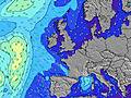 |  |  |  |  |  |  | ||||||||||||||
Wave Height (m) Direction Period (s) | W 6 | W 9 | W 9 | W 9 | W 8 | W 8 | W 9 | W 8 | W 8 | W 9 | W 9 | W 10 | W 9 | W 9 | W 9 | W 9 | W 9 | W 8 | NW 7 | NW 5 | NNW 6 |
Wave Graph | |||||||||||||||||||||
42 | 39 | 76 | 37 | 35 | 35 | 38 | 35 | 21 | 23 | 26 | 29 | 28 | 26 | 27 | 57 | 76 | 49 | 55 | 49 | 141 | |
Wind (km/h) | |||||||||||||||||||||
Wind State on-shore cross-onshore cross-shore cross-offshore off-shore glassy | on | on | cross-on | on | on | cross-on | on | on | on | glassy | cross-on | cross-on | cross-off | cross | off | off | cross-on | glassy | cross-on | cross-on | cross |
High Tide | 10:18AM7.34m | 10:37PM7.57m | 10:59AM7.19m | 11:19PM7.38m | 11:45AM7.01m | 00:09AM7.16m | 12:39PM6.84m | 1:07AM6.95m | 1:43PM6.73m | 2:15AM6.86m | 2:54PM6.80m | 3:29AM6.97m | 4:06PM7.09m | ||||||||
Low Tide | 4:16PM1.47m | 4:43AM1.49m | 4:57PM1.63m | 5:26AM1.64m | 5:45PM1.82m | 6:18AM1.80m | 6:42PM1.99m | 7:19AM1.94m | 7:49PM2.07m | 8:29AM1.96m | 9:03PM1.97m | 9:41AM1.81m | 10:16PM1.67m | ||||||||
5:07 | — | — | 5:09 | — | — | 5:09 | — | — | 5:11 | — | — | 5:11 | — | — | 5:13 | — | — | 5:13 | — | — | |
— | — | 9:32 | — | — | 9:32 | — | — | 9:31 | — | — | 9:31 | — | — | 9:30 | — | — | 9:30 | — | — | 9:30 | |
mm | — | — | — | — | — | — | — | — | — | — | — | — | — | — | — | — | — | — | — | — | — |
Temp °C | 16 | 17 | 15 | 19 | 19 | 17 | 19 | 19 | 17 | 22 | 22 | 20 | 24 | 26 | 23 | 27 | 26 | 22 | 20 | 22 | 18 |
Feels °C | 15 | 16 | 14 | 17 | 17 | 16 | 16 | 16 | 16 | 22 | 21 | 20 | 22 | 24 | 24 | 26 | 26 | 23 | 18 | 20 | 18 |
Swell 1 Height (m) Direction Period (s) | W 6 | W 9 | W 9 | W 9 | W 8 | W 8 | W 9 | W 8 | W 8 | W 9 | W 9 | W 10 | W 9 | W 9 | W 9 | W 9 | W 9 | W 8 | NW 7 | W 8 | W 8 |
42 | 39 | 76 | 37 | 35 | 35 | 38 | 35 | 21 | 23 | 26 | 29 | 28 | 26 | 27 | 57 | 76 | 49 | 55 | 33 | 12 | |
Swell 2 Height (m) Direction Period (s) | W 9 | — | W 15 | W 14 | W 14 | W 4 | W 12 | SW 12 | W 4 | W 4 | W 4 | WNW 4 | — | — | NW 4 | — | W 18 | W 16 | W 8 | W 10 | — |
40 | — | 4 | 4 | 4 | 6 | 3 | 6 | 2 | 1 | 1 | 1 | — | — | 4 | — | 6 | 5 | 33 | 2 | — | |
Swell 3 Height (m) Direction Period (s) | — | — | — | — | W 14 | — | — | — | W 10 | — | — | W 11 | — | — | — | — | — | — | W 17 | W 17 | — |
— | — | — | — | 4 | — | — | — | 8 | — | — | 3 | — | — | — | — | — | — | 6 | 6 | — | |
Wind waves Height (m) Direction Period (s) | — | W 5 | — | W 5 | W 5 | — | W 5 | W 4 | — | — | — | — | — | NE 2 | — | ENE 2 | NNW 3 | NNW 5 | — | NW 5 | NNW 6 |
— | 20 | — | 21 | 18 | — | 7 | 6 | — | — | — | — | — | 2 | — | 1 | 2 | 42 | — | 49 | 141 | |
Nearest Offshore or Glassy | |||||||||||||||||||||
Distance (km) | 48 | 99 | 71 | 134 | 134 | 78 | 141 | 158 | 36 | 25 | 139 | 36 | 25 | 38 | 25 | 0 | 3 | 0 | 217 | 236 | 214 |
Best forecast wave conditions in North Devon | |||||||||||||||||||||
Best forecast wave conditions in United Kingdom | |||||||||||||||||||||
Header Global | |||||||||||||||||||||
- Map Icons:
 Break
Break Live Wave Height (m)
 Live Wind Speed (km/h)
 Surf Rating (10 Max)
 Ocean Swells (m)
- Wind Speed (km/h)


FREE! Surf-Forecast.com widget for your website
The surf report / weather widget below is available to embed on third party websites free of charge and provides a summary of our Croyde surf forecast. Simply grab the html code snippet that we provide and paste it into your own site. You can choose your preferred language and metric/imperial units for the surf forecast feed to suit users of your site. Click here to get the code.
Information about the Croyde Surf forecast
The above surf forecast table for Croyde provides essential information for determining whether the surfing conditions will be good over the next 16 days. A general guide to surfing at Croyde can be found by selecting the local surf guide option on the grey menu. Our Croyde surf forecast is unique since it includes wave energy (power) that defines the real feel of the surf rather than just the height or the period. If you surf the same spot (Croyde) regularly then make a mental note of the wave energy from the surf forecast table each time you go. Very soon you may start to choose your surf days based on the wave energy alone combined with our forecast of favourable offshore wind conditions. Our star ratings will help here and of course you will also find the usual wave height and period predictions on our surf forecasts as well as a full break down of the swell components under our advanced users option (to reveal that, click the little Einstein character under the tide times).
Further information to help with frequently asked questions about our surf forecast for Croyde may be found under the help tab on the top menu and also by moving your mouse over the question marks on the surf forecast table itself. Please always bear in mind that the forecast is for near-shore open water and local factors at each surf break influence the actual breaking wave height, such as the beach / reef profile, water depths offshore and shelter.
Croyde is 9 km (6 miles) from Appledore. If you plan a holiday in North Devon, look for hotels and other accommodation in Appledore. Appledore has rooms for a wide range of budgets as well as car hire and transport links.
 Nearest