

Skull Island Surf Guide
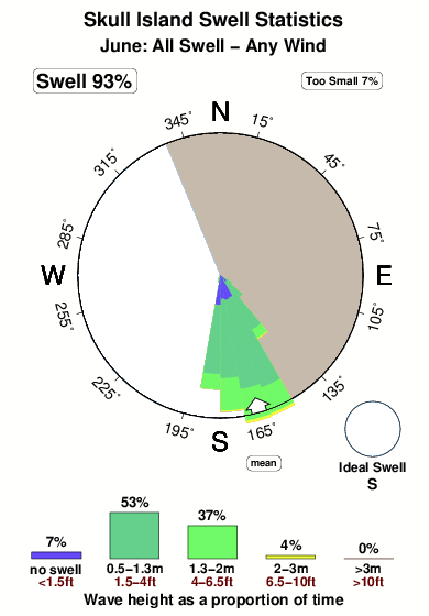
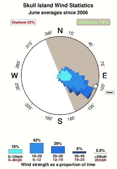
Skull Island in New Georgia is an exposed reef break that has pretty consitent surf. Summer offers the best conditions for surfing. The best wind direction is from the east northeast. Most of the surf here comes from groundswells and the best swell direction is from the south. There is a right breaking reef. Relatively few surfers here, even on good days. Beware of coral.
Skull Island Spot Info
| Type: | Rating: | Reliability: | Todays Sea Temp*: |
|---|---|---|---|
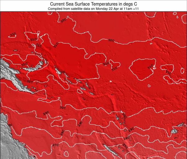
| fairly consistent | 29.0°C*ocean temperature recorded from satellite |
Surfing Skull Island:
The best conditions reported for surf at Skull Island occur when a South swell combines with an offshore wind direction from the East-northeast.
What's the best time of year to surf Skull Island (for consistent clean waves)?
Explore Skull Island Location Map
Interactive Skull Island surf break location map. View information about nearby surf breaks, their wave consistency and rating compared to other spots in the region. Current swell conditions from local buoys are shown along with live wind speed and direction from nearby weather stations. Click icons on the map for more detail. The nearest passenger airport to Skull Island is Port Moresby Jacksons International Airport (POM) in Papua New Guinea, which is 1100 km (683 miles) away (directly). The second closest airport to Skull Island is Nadzab Airport (LAE), also in Papua New Guinea, 1167 km (725 miles) away.
- Map Icons:
 Break
Break Live Wave Height (m)
 Live Wind Speed (km/h)
 Surf Rating (10 Max)
 Ocean Swells (m)
- Wind Speed (km/h)
Thursday, 11 June 2026, 12:52 Local Time
| Thursday 11 | ||||
| 2PM | 5PM | 8PM | 11PM | |
| Wave (m) | ||||
| Period (s) | 10 | 10 | 10 | 10 |
| Wind (km/h) | ||||
| Wind State | cross- off |
cross- off |
cross- off |
cross- off |
Tides at Skull Island
| NEXT | IS AT (local time) | remaining |
|---|---|---|
| high tide | ||
| low tide |
Swell History at Skull Island
Surf stats for Skull Island, see the swell variation by month or season on the history page here.


Wind History at Skull Island
Wind stats for Skull Island, see the variation in direction and stength by month or season on the history page here.
Other Nearby Breaks Closest To:
Discover surf breaks near Skull Island. Click below to view there surf guides.
 Nearest