Salinas River State Beach Surf Guide
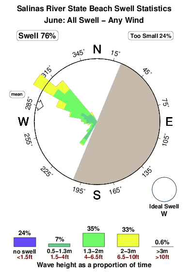
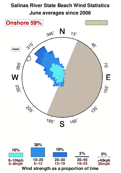
Salinas River State Beach in Monterey is an exposed beach break that usually has waves. Winter is the favoured time of year for surfing here. The best wind direction is from the east southeast. Most of the surf here comes from groundswells and the ideal swell angle is from the west. The beach break provides left and right handers. Best around high tide when the tide is rising. It's sometimes crowded here. Beware of rips, locals and sharks.
Salinas River State Beach Spot Info
| Type: | Rating: | Reliability: | Todays Sea Temp*: |
|---|---|---|---|
| consistent | 12.8°C*ocean temperature recorded from satellite |
Surfing Salinas River State Beach:
The best conditions reported for surf at Salinas River State Beach occur when a West swell combines with an offshore wind direction from the East-southeast.
What's the best time of year to surf Salinas River State Beach (for consistent clean waves)?
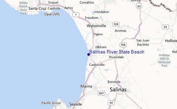
Explore Salinas River State Beach Location Map
Interactive Salinas River State Beach surf break location map. View information about nearby surf breaks, their wave consistency and rating compared to other spots in the region. Current swell conditions from local buoys are shown along with live wind speed and direction from nearby weather stations. Click icons on the map for more detail. The closest passenger airport to Salinas River State Beach is Norman Y Mineta San Jose International Airport (SJC) in USA, 63 km (39 miles) away (directly). The second nearest airport to Salinas River State Beach is Moffett Federal Afld (Mountain View) Airport (NUQ), also in USA, 72 km (45 miles) away.
- Map Icons:
 Break
Break Live Wave Height (m)
 Live Wind Speed (km/h)
 Surf Rating (10 Max)
 Ocean Swells (m)
- Wind Speed (km/h)
Wednesday, 10 June 2026, 11:46 Local Time
| Wednesday 10 | ||||
| 8AM | 11AM | 2PM | 5PM | |
| Wave (m) | ||||
| Period (s) | 18 | 18 | 18 | 17 |
| Wind (km/h) | ||||
| Wind State | glass | on | cross- on |
cross- on |
Tides at Salinas River State Beach
| NEXT | IS AT (local time) | remaining |
|---|---|---|
| high tide | ||
| low tide |
Salinas River State Beach Sea Temperature
Sunny with deceptively warm air temperatures, yet the sea remains quite cold at Salinas River State Beach. Surfers will need a good quality spring wetsuit and optionally a hood, neoprene gloves and boots.

Swell History at Salinas River State Beach
Surf stats for Salinas River State Beach, see the swell variation by month or season on the history page here.

Wind History at Salinas River State Beach
Wind stats for Salinas River State Beach, see the variation in direction and stength by month or season on the history page here.
Other Nearby Breaks Closest To:
Discover surf breaks near Salinas River State Beach. Click below to view there surf guides.
 Nearest