

- Forecast
- Maps
- Live
- Weather State
- Spot Information

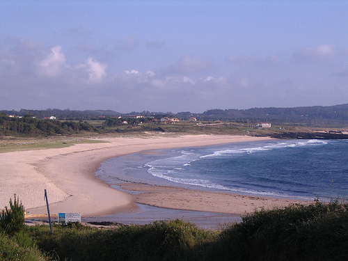
Playa de Rio Sieira / As Furnas surfForecast / Galicia / Spain
How big are the waves at Playa de Rio Sieira / As Furnas today?
The current surf forecast for Playa de Rio Sieira / As Furnas at 4AM is: 0.7m 10s primary swell from a Northwest direction and 0.3m 16s secondary swell from a Northwest direction, 0.6m 4s secondary swell from a Northwest direction (forecast issued at 01:00am May 11). The wind direction is predicted to be onshore.
| Time (CEST) & Date | Wave Height | Wave Period |
|---|---|---|
| Morning (11 May) | 3.5ft (1.1m) | 10s |
| Afternoon (11 May) | 2.5ft (0.8m) | 15s |
| Evening (11 May) | 4ft (1.2m) | 14s |
Table - waves today at Playa de Rio Sieira / As Furnas. (Swell directed towards the surf break)
Sunday 11 | Monday 12 | Tuesday 13 | Wednesday 14 | Thursday 15 | Friday 16 | Saturday 17 | Sunday 18 | |||||||||||||||||||||||||||||||||||||||||||||||||||||
| 11 PM | 2 AM | 5 AM | 8 AM | 11 AM | 2 PM | 5 PM | 8 PM | 11 PM | 2 AM | 5 AM | 8 AM | 11 AM | 2 PM | 5 PM | 8 PM | 11 PM | 2 AM | 5 AM | 8 AM | 11 AM | 2 PM | 5 PM | 8 PM | 11 PM | 2 AM | 5 AM | 8 AM | 11 AM | 2 PM | 5 PM | 8 PM | 11 PM | 2 AM | 5 AM | 8 AM | 11 AM | 2 PM | 5 PM | 8 PM | 11 PM | 2 AM | 5 AM | 8 AM | 11 AM | 2 PM | 5 PM | 8 PM | 11 PM | 2 AM | 5 AM | 8 AM | 11 AM | 2 PM | 5 PM | 8 PM | 11 PM | 2 AM | 5 AM | 8 AM | |
Rating (10 max) | ||||||||||||||||||||||||||||||||||||||||||||||||||||||||||||
Swell Height Map |  |    |    |    |   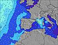 |  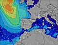 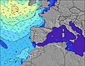 |  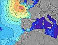 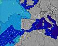 |  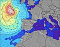 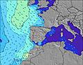 | 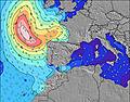   | |||||||||||||||||||||||||||||||||||||||||||||||||||
| Wave Height (m) & direction (?) | ||||||||||||||||||||||||||||||||||||||||||||||||||||||||||||
| Period(s) (?) | 10 | 10 | 10 | 10 | 15 | 15 | 14 | 14 | 14 | 13 | 13 | 13 | 13 | 13 | 13 | 13 | 13 | 12 | 12 | 12 | 12 | 11 | 11 | 11 | 11 | 10 | 10 | 10 | 10 | 10 | 10 | 10 | 9 | 9 | 9 | 9 | 9 | 9 | 9 | 9 | 12 | 12 | 11 | 11 | 11 | 11 | 11 | 10 | 10 | 10 | 11 | 11 | 11 | 11 | 11 | 10 | 10 | 10 | 10 | 10 |
Wave (?)Graph | ||||||||||||||||||||||||||||||||||||||||||||||||||||||||||||
| Energy (?) | 100 | 100 | 98 | 230 | 183 | 335 | 371 | 565 | 595 | 562 | 690 | 545 | 553 | 553 | 488 | 424 | 411 | 367 | 514 | 440 | 425 | 338 | 326 | 287 | 249 | 192 | 157 | 133 | 133 | 133 | 133 | 108 | 193 | 119 | 101 | 81 | 67 | 65 | 95 | 30 | 49 | 72 | 91 | 119 | 156 | 153 | 187 | 204 | 208 | 250 | 345 | 338 | 332 | 326 | 319 | 277 | 312 | 271 | 163 | 307 |
Wind (km/h) | ||||||||||||||||||||||||||||||||||||||||||||||||||||||||||||
| Wind State (?) onshore cross-onshore cross-shore cross-offshore offshore glassy | on | on | on | on | on | on | on | on | cross- on | cross- on | cross | cross- off | cross | cross- on | on | on | cross- on | cross- on | glass | glass | cross | cross- on | cross- on | cross- on | cross- on | glass | off | off | cross- off | cross | cross- on | cross- on | on | cross- off | cross- off | cross- off | glass | cross- on | on | on | cross | cross | cross | cross- off | glass | cross- on | on | on | glass | glass | glass | glass | glass | on | on | on | cross- on | cross- on | cross- on | cross- on |
High Tide / height (m) | 4:01AM 2.79 | 4:19PM 2.85 | 4:34AM 2.81 | 4:50PM 2.90 | 5:08AM 2.80 | 5:22PM 2.91 | 5:41AM 2.75 | 5:55PM 2.88 | 6:15AM 2.66 | 6:30PM 2.81 | 6:51AM 2.56 | 7:07PM 2.72 | 7:31AM 2.44 | 7:50PM 2.62 | ||||||||||||||||||||||||||||||||||||||||||||||
Low Tide / height (m) | 9:52PM 0.48 | 10:07AM 0.41 | 10:25PM 0.41 | 10:38AM 0.39 | 10:59PM 0.37 | 11:09AM 0.42 | 11:32PM 0.39 | 11:42AM 0.47 | 12:07AM 0.44 | 12:15PM 0.54 | 12:43AM 0.53 | 12:50PM 0.63 | 1:23AM 0.64 | 1:30PM 0.73 | 2:08AM 0.74 | |||||||||||||||||||||||||||||||||||||||||||||
Sunday 11 | Monday 12 | Tuesday 13 | Wednesday 14 | Thursday 15 | Friday 16 | Saturday 17 | Sunday 18 | |||||||||||||||||||||||||||||||||||||||||||||||||||||
| Sunrise | - | - | - | 7:18 | - | - | - | - | - | - | - | 7:16 | - | - | - | - | - | - | - | 7:16 | - | - | - | - | - | - | - | 7:15 | - | - | - | - | - | - | - | 7:13 | - | - | - | - | - | - | - | 7:13 | - | - | - | - | - | - | - | 7:11 | - | - | - | - | - | - | - | 7:11 |
| Sunset | - | - | - | - | - | - | - | 9:45 | - | - | - | - | - | - | - | 9:46 | - | - | - | - | - | - | - | 9:47 | - | - | - | - | - | - | - | 9:50 | - | - | - | - | - | - | - | 9:51 | - | - | - | - | - | - | - | 9:52 | - | - | - | - | - | - | - | 9:52 | - | - | - | - |
Rain (mm) | - | 1 | 1 | 2 | 2 | 2 | 1 | - | - | - | - | 2 | 4 | 3 | 2 | 1 | - | - | 1 | - | - | - | - | - | - | - | - | - | - | - | - | - | - | - | - | - | - | - | - | - | - | - | - | - | - | - | - | - | - | - | - | - | - | - | - | - | - | - | - | - |
| Temp. °C | 13 | 13 | 13 | 13 | 13 | 14 | 14 | 14 | 13 | 13 | 13 | 13 | 14 | 15 | 14 | 14 | 13 | 13 | 12 | 12 | 13 | 13 | 14 | 14 | 13 | 12 | 11 | 11 | 13 | 14 | 14 | 14 | 14 | 12 | 11 | 11 | 13 | 14 | 15 | 16 | 16 | 15 | 14 | 14 | 16 | 17 | 18 | 17 | 17 | 17 | 16 | 15 | 17 | 17 | 17 | 16 | 16 | 16 | 15 | 15 |
| Feels °C (?) | 10 | 10 | 10 | 9 | 9 | 10 | 10 | 11 | 11 | 11 | 10 | 9 | 11 | 12 | 11 | 11 | 10 | 11 | 11 | 12 | 11 | 10 | 11 | 12 | 11 | 11 | 9 | 9 | 10 | 12 | 11 | 11 | 13 | 11 | 10 | 9 | 13 | 12 | 11 | 12 | 13 | 12 | 12 | 12 | 15 | 15 | 16 | 15 | 15 | 16 | 15 | 14 | 16 | 15 | 15 | 14 | 14 | 14 | 13 | 13 |
- Map Icons:
 Break
Break Live Wave Height (m)
 Live Wind Speed (km/h)
 Surf Rating (10 Max)
 Ocean Swells (m)
- Wind Speed (km/h)
FREE! Surf-Forecast.com widget for your website
The surf report / weather widget below is available to embed on third party websites free of charge and provides a summary of our Playa de Rio Sieira / As Furnas surf forecast. Simply grab the html code snippet that we provide and paste it into your own site. You can choose your preferred language and metric/imperial units for the surf forecast feed to suit users of your site. Click here to get the code.


 Nearest