

Surf Forecasts:

How big are the waves at Pacific City/Cape Kiwanda today (28 Jun):
- Morning surf: Morning surf (28 Jun, local time) - 5ft (1.5m), 10s period with W swell.
- Afternoon surf: Afternoon surf (28 Jun, local time) - 6ft (1.9m), 8s period with NW swell.
- Evening surf: Evening surf (28 Jun, local time) - 6ft (1.8m), 8s period with NW swell.
The current surf forecast for Pacific City/Cape Kiwanda at 12PM is: 2.1m 9s primary swell from a West-northwest direction and 0.6m 16s secondary swell from a Southwest direction (forecast issued at 04:00am June 28). The wind direction is predicted to be cross-onshore.
| Time (PDT) & Date | Wave Height | Wave Period |
|---|---|---|
| Morning (28 Jun) | 5ft (1.5m) | 10s |
| Afternoon (28 Jun) | 6ft (1.9m) | 8s |
| Evening (28 Jun) | 6ft (1.8m) | 8s |
Table - waves today at Pacific City/Cape Kiwanda. (Swell directed towards the surf break)
Updates in hr min s Forecast update imminent
Short Range ForecastModerate rain (total 10mm), heaviest on Sun morning. Very mild (max 14°C on Sun afternoon, min 12°C on Mon night). Wind will be generally light. | ||||||||||||||||||||||||
Sunday 28 | Monday 29 | Tuesday 30 | ||||||||||||||||||||||
2 AM | 5 AM | 8 AM | 11 AM | 2 PM | 5 PM | 8 PM | 11 PM | 2 AM | 5 AM | 8 AM | 11 AM | 2 PM | 5 PM | 8 PM | 11 PM | 2 AM | 5 AM | 8 AM | 11 AM | 2 PM | 5 PM | 8 PM | 11 PM | |
Swell Height Map |  |  |  |  | 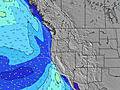 |  |  | 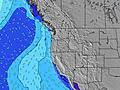 |  | |||||||||||||||
Wave Height (m) Direction Period (s) | W 9 | W 9 | W 10 | WNW 9 | NW 8 | NNW 9 | NW 8 | NW 8 | NW 8 | NW 8 | NW 9 | NW 9 | WNW 9 | NW 9 | NW 9 | NW 10 | NW 10 | NW 10 | NW 10 | NW 10 | NW 10 | NW 10 | NW 10 | NW 9 |
Wave Graph | ||||||||||||||||||||||||
473 | 459 | 423 | 659 | 456 | 252 | 428 | 448 | 437 | 437 | 715 | 904 | 783 | 1137 | 1194 | 1245 | 1271 | 1470 | 1573 | 1569 | 1462 | 1332 | 1147 | 1040 | |
Wind (km/h) | ||||||||||||||||||||||||
Wind State on-shore cross-onshore cross-shore cross-offshore off-shore glassy | cross-on | cross-on | cross-on | cross-on | cross-on | cross-on | cross-on | cross-on | cross-on | cross-on | cross-on | cross-on | cross-on | cross-on | cross-on | cross-on | cross | cross-on | cross-on | cross-on | cross-on | cross-on | cross-on | cross-on |
High Tide | 11:21PM2.30m | 1:40PM1.71m | 00:00AM2.31m | 2:15PM1.74m | 00:38AM2.32m | 2:49PM1.76m | ||||||||||||||||||
Low Tide | 7:02AM-0.18m | 6:27PM0.98m | 7:38AM-0.22m | 7:07PM0.96m | 8:13AM-0.24m | 7:46PM0.93m | ||||||||||||||||||
— | 5:30 | — | — | — | — | — | — | — | 5:31 | — | — | — | — | — | — | — | 5:31 | — | — | — | — | — | — | |
— | — | — | — | — | — | 9:07 | — | — | — | — | — | — | — | 9:07 | — | — | — | — | — | — | — | 9:07 | — | |
mm | 1 | 1 | 1 | 1 | 1 | — | 1 | 1 | 1 | 1 | 1 | 1 | 1 | — | — | — | — | — | — | — | — | — | — | — |
Temp °C | 13 | 13 | 13 | 13 | 14 | 14 | 14 | 13 | 13 | 13 | 13 | 14 | 14 | 14 | 13 | 13 | 12 | 12 | 13 | 14 | 14 | 14 | 13 | 13 |
Feels °C | 11 | 11 | 11 | 11 | 11 | 10 | 11 | 11 | 11 | 11 | 12 | 13 | 12 | 11 | 11 | 11 | 10 | 10 | 11 | 12 | 11 | 10 | 10 | 11 |
Swell 1 Height (m) Direction Period (s) | W 9 | W 9 | W 10 | WNW 9 | WNW 10 | WNW 8 | WNW 10 | WNW 10 | WNW 10 | WNW 10 | NW 9 | NW 9 | NNW 10 | NW 9 | SW 14 | NW 10 | NW 10 | NW 10 | NW 10 | NW 10 | NW 10 | NW 10 | NW 10 | SW 16 |
473 | 459 | 423 | 659 | 169 | 192 | 131 | 102 | 125 | 125 | 715 | 904 | 290 | 1137 | 103 | 1245 | 1271 | 1470 | 1573 | 1569 | 1462 | 1332 | 1147 | 62 | |
Swell 2 Height (m) Direction Period (s) | SW 18 | SW 17 | SW 17 | SW 16 | SW 16 | WNW 10 | SW 16 | SW 16 | SW 16 | SW 16 | SW 16 | SW 16 | SW 15 | SW 15 | SW 18 | SW 14 | SW 14 | SW 15 | SW 15 | SW 15 | SW 15 | SW 15 | SW 15 | SSW 20 |
150 | 243 | 232 | 198 | 201 | 169 | 203 | 203 | 203 | 124 | 124 | 122 | 109 | 104 | 49 | 103 | 103 | 104 | 75 | 75 | 75 | 54 | 55 | 37 | |
Swell 3 Height (m) Direction Period (s) | SW 13 | W 15 | W 15 | — | WNW 13 | SW 16 | — | WNW 12 | WNW 12 | WNW 12 | — | SW 22 | SW 21 | SW 21 | SW 21 | WSW 18 | WSW 18 | SW 21 | SW 19 | SW 19 | SW 19 | SW 19 | SW 19 | W 18 |
45 | 4 | 4 | — | 35 | 203 | — | 58 | 57 | 29 | — | 19 | 18 | 18 | 18 | 31 | 31 | 18 | 59 | 96 | 133 | 59 | 59 | 6 | |
Wind waves Height (m) Direction Period (s) | NW 9 | NW 9 | NW 9 | — | NW 8 | NNW 9 | NW 8 | NW 8 | NW 8 | NW 8 | — | — | WNW 9 | — | NW 9 | — | — | — | — | — | — | — | — | NW 9 |
321 | 314 | 314 | — | 456 | 252 | 428 | 448 | 437 | 437 | — | — | 783 | — | 1194 | — | — | — | — | — | — | — | — | 1040 | |
Nearest Offshore or Glassy | ||||||||||||||||||||||||
Distance (km) | 205 | 51 | 205 | 335 | 330 | 330 | 335 | 330 | 237 | 237 | 63 | 191 | 191 | 330 | 350 | 335 | 335 | 322 | 305 | 330 | 330 | 330 | 931 | 335 |
Best forecast wave conditions in North Oregon | ||||||||||||||||||||||||
Best forecast wave conditions in United States | ||||||||||||||||||||||||
Header Global | ||||||||||||||||||||||||
- Map Icons:
 Break
Break Live Wave Height (m)
 Live Wind Speed (km/h)
 Surf Rating (10 Max)
 Ocean Swells (m)
- Wind Speed (km/h)


FREE! Surf-Forecast.com widget for your website
The surf report / weather widget below is available to embed on third party websites free of charge and provides a summary of our Pacific City/Cape Kiwanda surf forecast. Simply grab the html code snippet that we provide and paste it into your own site. You can choose your preferred language and metric/imperial units for the surf forecast feed to suit users of your site. Click here to get the code.
 Nearest