
Marmols Left Point Surf Guide
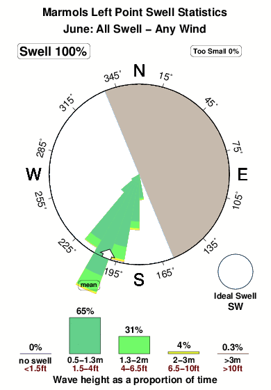
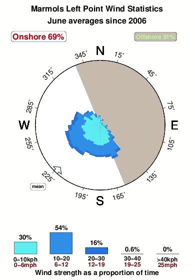
Marmols Left Point in Sinaloa is an exposed point break that is often working and works all around the year. Offshore winds blow from the east northeast. Most of the surf here comes from groundswells and the optimum swell angle is from the southwest.There is a left breaking point here. Unlikely to be too crowded, even when the surf is up. Take care of rocks in the line up.
Marmols Left Point Spot Info
| Type: | Rating: | Reliability: | Todays Sea Temp*: |
|---|---|---|---|
| very consistent | 29.4°C*ocean temperature recorded from satellite |
Surfing Marmols Left Point:
The best conditions reported for surf at Marmols Left Point occur when a Southwest swell combines with an offshore wind direction from the East-northeast.
What's the best time of year to surf Marmols Left Point (for consistent clean waves)?
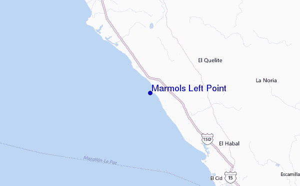
Explore Marmols Left Point Location Map
Interactive Marmols Left Point surf break location map. View information about nearby surf breaks, their wave consistency and rating compared to other spots in the region. Current swell conditions from local buoys are shown along with live wind speed and direction from nearby weather stations. Click icons on the map for more detail. The nearest passenger airport to Marmols Left Point is General Rafael Buelna International (Mazatlan) Airport (MZT) in Mexico, which is 52 km (32 miles) away (directly). The second closest airport to Marmols Left Point is Culiacan International Airport (CUL), also in Mexico, 167 km (104 miles) away.
- Map Icons:
 Break
Break Live Wave Height (m)
 Live Wind Speed (km/h)
 Surf Rating (10 Max)
 Ocean Swells (m)
- Wind Speed (km/h)
Wednesday, 10 June 2026, 06:16 Local Time
| Wednesday 10 | ||||
| 2AM | 5AM | 8AM | 11AM | |
| Wave (m) | ||||
| Period (s) | 16 | 16 | 16 | 16 |
| Wind (km/h) | ||||
| Wind State | glass | cross- on |
on | on |
Tides at Marmols Left Point
| NEXT | IS AT (local time) | remaining |
|---|---|---|
| high tide | ||
| low tide |
Swell History at Marmols Left Point
Surf stats for Marmols Left Point, see the swell variation by month or season on the history page here.

Wind History at Marmols Left Point
Wind stats for Marmols Left Point, see the variation in direction and stength by month or season on the history page here.
Other Nearby Breaks Closest To:
Discover surf breaks near Marmols Left Point. Click below to view there surf guides.
 Nearest